LITTLE ROCK — A U.S. Forest Service district ranger at the Albert Pike Recreation Area disregarded advice from scientists, relied on flawed information and ignored a documented history of flooding when he oversaw construction of Loop D, which bore the bruntof a deadly flood in June, according to a federal report released Friday.
And even though Loop D was within a 100-year flood plain, Ouachita National Forest employees never posted flood warning signs, which violates agency guidelines.
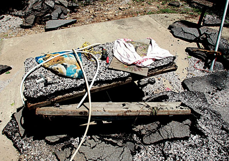
Most of the 20 people killed in the flood were camping at Loop D when the Little Missouri River overran its banks in southwest Arkansas in the hours just before dawn.
The report, compiled by a U.S. Department of Agriculture-appointed review team, criticizes forest personnel for several lapses in policy and protocol.
In its findings, the reviewteam noted:

Ouachita National Forest employees failed to repair a broken radio repeater that resulted in an inability to communicate via radio and the loss of 24-hour dispatch services. It also prevented park employees from receiving reports on weather watches and warnings.
Volunteer hosts at the camp weren’t trained or prepared for emergency situations.
Ouachita National Forest employees don’t have adequate knowledge of Forest Service polices regarding flood hazards.
The Forest Service failed to develop a contingency plan to deal with a flooding disaster.
Given the magnitude of the June 11 flood, it’s unclear whether adhering to agency policies would have prevented deaths. A U.S. Geological Survey hydrologist concluded that the June 11 disaster was “greater than a 500-year flood event.”
The Forest Service’s response to the flood was “valiant and effective,” especially given the treacherous conditions.
Liz Agpaoa, the Forest Service’s forester for the southern United States, said she would not respond to questions Friday about the report but she did speak to the families who lost loved ones in the flood.
“What I’ve heard from the families is they want their efforts to result in better public safety,” Agpaoa said. “They don’t want this to ever happen again, and I would say that is our sincere desire, too.”
The flood at Albert Pike prompted a review of potential hazards and solutions to them at Forest Service recreational sites nationwide.
The Forest Service will issue recommendations to address the concerns outlined in the report by Nov. 30. The agency has not decided whether it will ever reopen Albert Pike for overnight camping.
Agpaoa said the agency already has made many changes in response to the flood, including posting flood warning signs at the campground, posting links to the weather watch/warning system on a visitor safety website and enhancing the radio system for rangers.
She also said the Forest Service is “very close” to making a decision on a warning system for Albert Pike, which could include sirens that sound when the Little Missouri River reaches a certain water level.
In a separate report released Friday, the Forest Service responded in writing to some of the Department of Agriculture findings. That report concluded by acknowledging that all hazards can’t be eliminated.
“All recreational activities on National Forest System lands ... have inherent risks due to the natural setting in which they occur and, in many cases the nature of the activity.”
But the review team’s report went into great detail when describing now-retired district ranger James Watson’s determination to develop Loop D at a cost of about $600,000 in October 2000.
On Nov. 28, 2001, a soil scientist named Ken Luckow sent a letter to Watson telling him that the proposed construction was in the 100-year flood plain and subject to frequent flooding. Luckow expressed concerns, adding that flood warning signs would be a necessity.
In his conclusion, he wrote: “It would be advisable to plan these proposed campsites only as primitive camping areas and minimize any soil and flood plain disturbance.”
The next month, Watson met with hydrologist James Clingenpeel to determine the 100-year flood plain. The hydrologist was shown the proposed construction site, but there weren’t any building markers, strings or flags to indicate the location of buildings or proposed elevations.
According to the report, Clingenpeel used an unauthorized and less-accurate method for determining the 100-year flood plain elevation, which led to eventual confusion over where the flood line was.
As the hydrologist used an instrument to establish the flood-plain elevation, Watson walked to a point between the scientist and another employee and declared that he could see where the flood plain line was and that the proposed construction would be above the level he thought the hydrologist had established.
Clingenpeel said that if campsites were built above where he sighted, there wouldn’t be any flooding problems. He added that Watson “just took the project and ran.”
Watson was well aware of the area’s tendency to flood, the report states. He recalled for the review team the washing away of a camper’s vehicle and possessions in 2000 or 2001. Watson estimated that there were on average two flooding incidents a year during his time working there.
He also described flooding in 2006 or 2007, when he was acting as a camp host at Loop D.
Another issue cited in the report was Watson’s dual role as the primary author of the project’s environmental assessment and as the “deciding official,” the person who makes the call on whether to follow through with a proposed project.
Forest Service guidelines don’t prohibit that but imply that the two positions should be held by different people to avoid conflict.
The review team was puzzled by a discrepancy in Watson’s assessment - whether Loop D was in a flood plain.
The “soils” part of the assessment read: “Most of the area where the new campsites are proposed just south of road 914 should be considered as being within the 100-year flood plain.”
But on another page of the assessment, in the “water section,” Watson had written: “None of the new camp sites proposed for Loop D are in the flood plain.”
Watson said he cut and pasted excerpts from the scientists’ documents.
The review team determined that the soils section came from Luckow’s written findings.
The second part, which said campsites weren’t in the flood plain, was written by Watson.
There was no supporting documentation for Watson’s assertion, the review team said.
The review team also accused Watson of intentionally leaving out the soil scientist’s recommendation that Loop D be used only for primitive camping.
“[Watson] wanted the sites to be developed rather than primitive in nature so as to meet perceived public expectations and fully utilize the money appropriated for the project,” the report states.
Watson circumvented the scientist’s recommendation by requesting and making use of the hydrologist’s single-site elevation reading, “which he used to unilaterally decide that the proposed campsite construction would be above, and thus, outside the 100-year flood plain.”
The review team also interviewed architects and engineers involved in the construction. They said Watson didn’t tell them about any flooding concerns at Loop D and that they never saw the environmental assessment. They saw only Watson’s decision notice, they said. The workers also were under the impression that once a project decision is made, no one can question or contradict the district ranger. “If the ranger says build it, it gets built no matter the recommendations,” said landscape architect Ron Krupa.
Three days after Loop D opened in the summer of 2004, Forest Service employees had to rescue campers when the area flooded. A review of Forest Service law enforcement incident reports showed that from 2000 to 2008, employees responded to nine flooding incidents there. Additional documents referred to significant flooding in 1961, 1975, 1982 and 1987.
Watson said he was aware of the flooding, according to the report.
The Democrat-Gazette attempted to contact Watson for comment but was unable to locate him. Messages left at a number believed to be Watson’s weren’t returned.
Though Agpaoa declined to answer questions about specific Agriculture Department findings regarding Watson, the Forest Service did respond in writing to them in the second report released Friday.
Forest Service officials said in that report that there is no policy prohibiting district rangers from writing environmental assessments and that there “are indications” that Watkins did consider the area’s previous flooding history
As for the “unauthorized method” used to determine the 100-year flood plain, the Forest Service’s written responses note that there are several “acceptable methods” that could have been used.
Asked if the method used provided accurate information, agency spokesman Stephanie Neal Johnson said it did.
In its written responses, the Forest Service acknowledged that it failed to post flood warning signs when it should have, failed to train volunteer camp hosts and did not have adequate knowledge of agency policies related to flood hazards.
Asked to explain “why” those failures existed, Johnson said that would have to be answered by officials in the Washington, D.C., office of the Agriculture Department, which is over the Forest Service. No one from that office had responded by Friday evening.
In response to the report, U.S. Sen. Blanche Lincoln, DArk., said she planned to introduce legislation to require the Forest Service to keep Congress updated on the steps it is taking to improve visitor safety at Albert Pike and all other developed recreation sites in the country.
“I’m concerned that USDA’s review showed that there were several steps which could have been taken to reduce the risks those campers faced,” Lincoln said in a statement issued Friday.
Todd Sultz, whose brother Eric Sultz died in the flood, said Friday that no one had told him about the Agriculture Department report or the problems that it highlights. But he agreed that more should have been done to warn his brother and other campers staying in Loop D.
“Because there was no warning system, I don’t have my brother,” Sultz said. “Some may have survived had they been warned.”
Front Section, Pages 1 on 10/23/2010