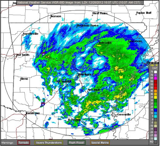
Temperatures are forecast to creep up a few degrees throughout the morning, switching any freezing drizzle in central Arkansas to light rain, the National Weather Service said early Friday.
John Robinson, warning coordination meteorologist for the National Weather Service in North Little Rock, said that as precipitation ends in the late afternoon or early evening, a rain/snow mix or flurries could take over.
In the far northeast corner of the state, Robinson said, temperatures may not top the freezing mark today, threatening freezing rain or drizzle all day. A switch to a sleet and snow mix or snow is likely there, and an inch could accumulate, he added.
The precipitation in all areas will be followed by breezy conditions, helping to dry the roads, Robinson said, adding that as temperatures again dip below freezing Friday night, any remaining moisture will freeze.
Meanwhile, Entergy Arkansas said at 11:15 a.m. that more than 108,000 customers still lacked power. More than 62,000 of those were in Pulaski County and more than 20,000 in Garland County.
First Electric Cooperative said that more than 12,000 members were without power, adding that because crews found additional damage in Saline County and because of treacherous conditions, the remaining outages are expected to be fixed over the following 48 hours.
North Little Rock Electric said about 8 a.m. that about 500 customers remained without power.
