5:45 p.m. UPDATE:
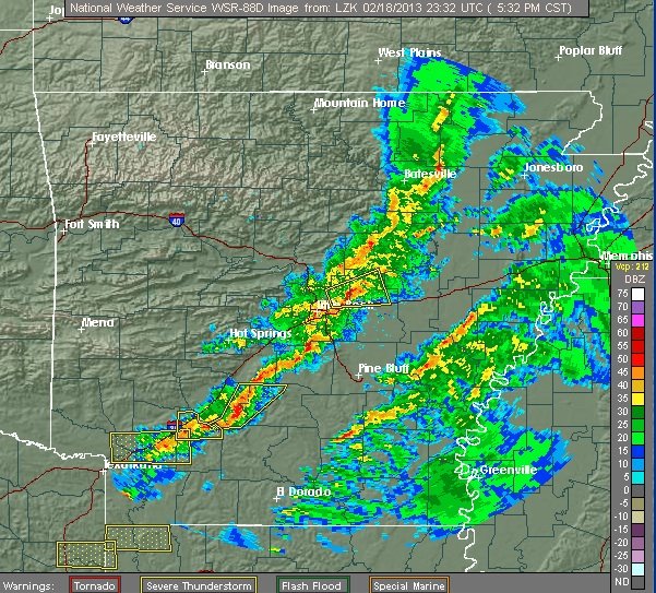
Lines of storms moving across Arkansas prompted several tornado warnings and knocked out power to about 3,000 electric customers.
The National Weather Service issued several tornado warnings in south Arkansas but there were no immediate damage reports or indications of touchdowns.
Entergy Arkansas reported many scattered outages, with about 1,000 out in Conway County and an equal number in Columbia County. About 600 were out in Hot Spring County.
A cold front is sweeping through Arkansas, bringing widespread rain and thunderstorms. Forecasters said southern Arkansas was at the greatest risk of severe weather.
The storms should leave the state by early Tuesday. Another storm system is expected to move in late Wednesday, bringing the chance of freezing rain in parts of the state into Thursday.
The National Weather Service said Monday that severe weather is possible Monday afternoon and evening, with damaging winds constituting the main threat.
Between 3 p.m. and 9 p.m., an area south of a line from Ashdown to Sheridan and DeWitt should see rain totals between 1/4 inch and 3/4 inch, with damaging winds composing the main threat, Warning Coordination Meteorologist John Robinson said in an e-mailed statement.
Large hail and an isolated tornado are also possible, he said.
On Wednesday, freezing rain is possible in northern Arkansas. During the day, there’s a “small chance” that part of Northwest Arkansas and the Ouachita Mountains will see freezing rain, Robinson wrote.
“Note that I said ‘small chance,’ because odds are that temperatures will rise a little above freezing,” Robinson added.
Freezing rain is more likely to develop later Wednesday night and Thursday morning, especially in the northwest and north-central parts of the state.
Showers and thunderstorms are expected to move across the state Thursday, with severe weather most expected in the state’s southeast.
Rainfall should average 1/4-inch to 1/2-inch across the northwest half of the state, with 1/2-inch to 1 1/4 inches expected elsewhere.
Update courtesy of The Associated Press.