4:25 p.m. UPDATE
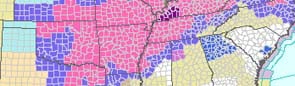
A rash of thunderstorms Tuesday afternoon is responsible for several thousand power failures across central and southwest Arkansas.
According to Entergy Arkansas, around 15,000 customers are without power after the storms. Pockets of rain, thunder and lightning hit the area around 1 p.m. and lasted through the early afternoon.
Early numbers indicate there are 87 outages in and around west Little Rock, affecting 9, 226 customers. An additional 81 outages affected the Garland County area, leaving 4,531 customers without power.
There is no immediately time frame for when power will be restored to the areas.
1:30 p.m. UPDATE
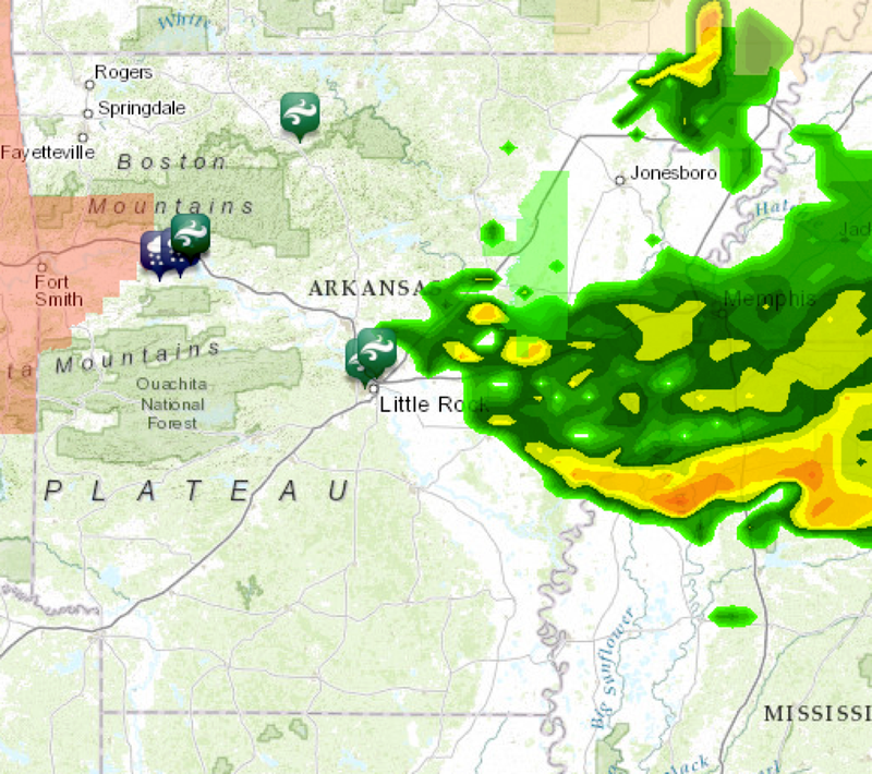
A severe thunderstorm warning was issued for part of central Arkansas on Tuesday, as storms delivered heavy rains and knocked out power in some areas.
The warning was in effect for northeast Grant County, southern Pulaski County and east-central Saline County until 2 p.m., according to the National Weather Service.
Doppler radar showed a thunderstorm carrying winds of 60 mph capable of producing quarter-size hail. The storm was in west Little Rock about 12:30 p.m. and moving southeast at 15 mph.
According to Entergy Arkansas, 14,088 customers were without power as of 1:25 p.m. That included 11,523 in Pulaski County.
Entergy said on Twitter that three circuits at the company's West Markham substation have tripped, affecting 5,000 customers, and that crews are on site investigating.
Meanwhile, the weather service put in a place an urban and small-stream flood advisory for central Pulaski County until 3 p.m. Runoff from the heavy rainfall could create minor flooding in places such as downtown Little Rock, southwest Little Rock, North Little Rock and Prothro Junction, the advisory said.
Most of the state can expect chances for rain in the coming days, the National Weather Service in Little Rock said Tuesday.
Areas across Arkansas will fall under the threat of severe thunderstorms Tuesday, with the lightest threat occurring to the southwest, National Weather Service Warning Coordination Meteorologist John Robinson wrote in an email message.
After a few storms push out of eastern Arkansas, others could redevelop Tuesday afternoon and evening, bringing damaging winds as the biggest threat. Large hail is not as likely, Robinson said.
The threat of severe weather will hang around into the afternoon and evening Wednesday, although the threat of severe thunderstorms will diminish.
Some areas will see anywhere from 1/2 inch to 1 1/2 inches of rain in a line extending north from Fort Smith to Sheridan and Dumas, and flash flood warnings will be possible. Rainfall south of that line should fall off considerably, Robinson said.