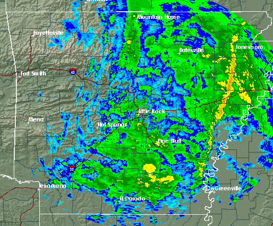
Thunderstorms and high winds are expected throughout the day, the National Weather Service said Sunday.
John Robinson, warning coordination meteorologist for the weather service, said a line of storms from north central Arkansas to south central Arkansas will to eastern Arkansas throughout the day, with winds gusting from 35 to 50 mph.
Wind damage is possible in the eastern part of the state. The line of storms is expected to leave the state late Sunday afternoon, although Robinson said some rainfall will linger throughout the state into late Sunday night.
Robinson said western Arkansas should see additional rainfall around 1/2 inch, while other areas should see 3/4 to 1 3/4 inches.
Snow flurries could be seen in northwest Arkansas late tonight and into Monday morning, but Robinson said the chance is small.