The Arkansas Geological Survey plans to do more observing of seismic activity in the Greers Ferry area in the next couple of weeks.
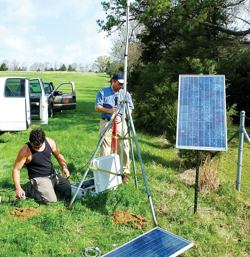
David Johnston, an earthquake geologist with the Arkansas Geological Survey, said this new temporary seismic monitoring station in the Greers Ferry area will give the survey a more accurate idea of seismic activity in the area.
“In the last two years, we’ve seen about 60 [small] earthquakes in the west to southwest area of Greers Ferry,” Johnston said.
He said most of the earthquakes have been relatively small and have ranged from magnitudes of 1.6 to 2.6 on the Richter Scale.
The Richter Scale is not used to express damage, according to the U.S. Geological Survey’s website.
“[The magnitude] usually has to be around 2.5 to 3.0 to feel an earthquake,” Johnston said. Therefore, most of the earthquakes were not felt by residents, Johnston said.
The temporary station in Greers Ferry will work with permanent monitoring stations in the state to solidify a location of seismic activity.
The U.S. Geological Survey’s website states that an earthquake in a densely populated area that results in a considerable amount of damage could have the same magnitude as a quake in a remote area that might only frighten wildlife.
There are currently two permanent monitoring stations in the state: one at Woolly Hollow State Park in Greenbrier, and one near Ozark Folk Center State Park in Mountain View.
Johnston said the Greers Ferry station will be placed in a location far from traffic in order to be as uninterrupted as possible. In such a rural area, Johnston said, the station will transmit data via a 900-megahertz antenna to the earthquake center in Memphis.
The temporary station is powered by a 12-volt battery, which has solar panels attached to keep the battery charged.
Seismic activity has varied throughout the years, but Johnston said it’s difficult to say what is causing the activity. More information on the Arkansas Geological Survey is available at www.geology.ar.gov.
Staff Writer Lisa Burnett can be reached at (501)244-4307 or lburnett@arkansasonline.com.