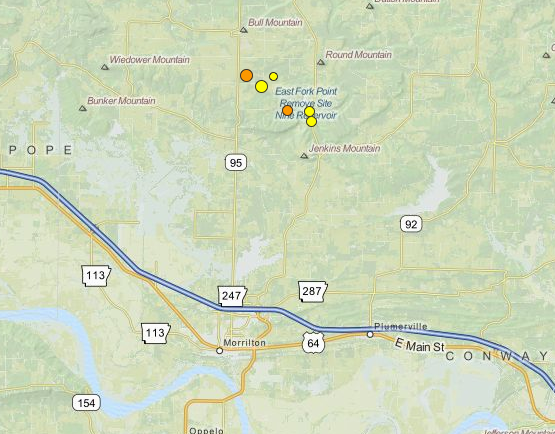
A 3.5-magnitude earthquake rattled the ground north of Morrilton early Friday, the latest and largest of seven tremors to shake that region in recent days and one of dozens across the state this month.
The earthquake, which was recorded by the U.S. Geological Survey just before 12:45 a.m., followed tremors measuring 2.0, 2.5 and 1.7 on Thursday. Quakes of 2.5, 3.4 and 2.3 magnitudes occurred Wednesday.
The quakes have all been centered roughly 10 miles north of Morrilton.
Officials with the Arkansas Geological Survey say all of the quakes in Arkansas this month fall beneath the threshold where damage typically becomes a concern. Quakes below 2.5-magnitude generally aren't felt and damage doesn't usually crop up until they approach or exceed the 4.0 mark.
Seismic activity has been occurring in other parts of Arkansas this month, too, including 25 small quakes south-southeast of Clinton and seven minor quakes east of Cave City.
Geologists with the Survey have said they will send temporary recording instruments to the Clinton area to get better data about the activity and what may be causing it.
Scott Ausbrooks, the geohazards supervisor for the agency, said those earthquakes may be occurring naturally, spurred by the changing water levels of nearby Greers Ferry Lake or caused by natural gas injection wells active in the area.