EASTERN END LAKE OUACHITA VISTA TRAIL
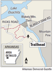
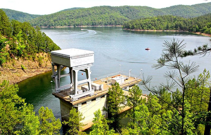
Location: Park at Avery Recreation Area below Blakely Mountain Dam just west of Mountain Pine.
GPS: 34.567580, -93.193137
Length: Explore the Avery Loop Trail at the rec area, then head through the LOViT trailhead sign up Blakely Mountain to the dam overlook. Continue to the crossing of Ricks Road at the top and return for a moderate to difficult 2.7 miles.
Main attractions: The scenic, well-designed LOViT Trail (total length, about 45 miles counting spurs) is an outstanding commune with nature — on foot or mountain bike — along the south shore of Arkansas’ largest man-made lake.
Hazards: None.
Dog, bike, tyke friendly? Dogs and bikers will love it; the small fry will prefer the recreation area.
Video: ArkansasOnline.com/happytrails
Rating (out of five): .....
— Michael Storey
Know a good trail for a hike? Email
mstorey@arkansasonline.com