Arkansas National Guard officials are burning several hundred acres of land in North Little Rock on Thursday to minimize the risk of wildfires in the area, according to a statement from the bureau's environmental office.
The prescribed burn began about 10 a.m. and will cover 820 acres of the Camp Robinson Maneuver Training Center at a post northwest of the North Little Rock airport, 8200 Remount Road, according to Arkansas National Guard spokesman Lt. Col. Keith Moore. The burn is expected to last until about 4 p.m., Moore said.
"Due to the current fire hazard across the state, Camp Robinson received a special permit authorizing the controlled burn from Pulaski County Judge Buddy Villines and the Pulaski County Director of Emergency Management," Moore said in the release.
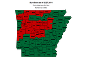
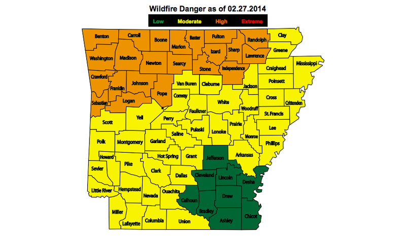
More than three-quarters of the state is listed under a moderate-to-high risk of wildfire danger, according to the Arkansas Forestry Commission's website.
Twenty-four counties in central and Northwest Arkansas, including Pulaski County, are currently under burn bans.
Wind conditions are expected to keep most of the smoke contained over Camp Robinson, the release states.