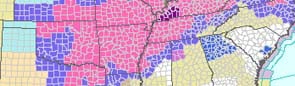
Severe storms capable of producing large hail, damaging wind, heavy rainfall and tornadoes are possible Thursday across Arkansas, the National Weather Service said Tuesday.
Brian Smith, a meteorologist with the agency in North Little Rock, said storms are expected to develop as a cold front moves across the state.
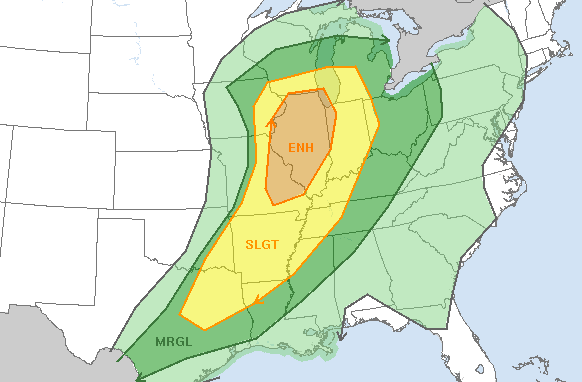
The Storm Prediction Center lists virtually the entire state under a slight risk for severe weather. It's most likely to occur in the afternoon and evening.
Smith said in an email that damaging winds and large hail will be the "primary threat," though tornadoes are also possible.
"A tornado threat will also be present given the amount of low level wind shear," Smith said. "The scope of the tornado threat will depend on if winds back around to the southeast ahead of the front."
The storms are expected to drop 1/2 inch to an inch of rain in most places with some areas seeing up to 2 inches or more, Smith said.
Far Northwest Arkansas is also under a slight risk of severe weather Wednesday and Wednesday night, Smith said, noting that it's possible part of the state could see a "strong storm or two."
And while the cold front will move out of the state Friday, another round of "strong storms and heavy rainfall" is possible Sunday and Monday, the weather service said in a statement.