Most of the state could see more rain and showers Wednesday through Friday before clear weather arrives Saturday, meteorologists say.
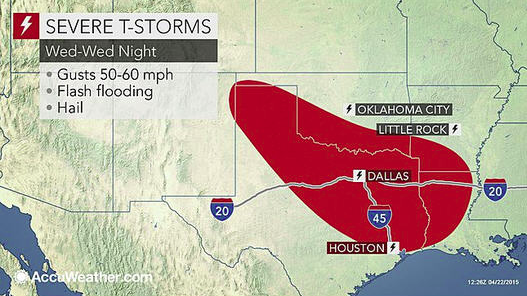
By 2 p.m., showers could move through most of Arkansas and possibly turn into thunderstorms later Wednesday evening, National Weather Service Senior Meteorologist Brian Smith said.
The highest probability for severe storms and the most accumulation of rainfall is in the southwest half of the state, Smith said. Central and south Arkansas are under a marginal risk of severe weather, with the possibility of damaging winds and hail, Smith said.
More rain and thunderstorms will be possible Thursday, continuing into Friday with a widespread chance of precipitation and storms through the night, Smith said.
By Saturday, precipitation should clear out from the northwest to the southeast as drier air moves into Arkansas, Smith said.
Temperatures that day should be in the low 80s across much of the state and in the mid-80s in the south, Smith said.
Warmer weather won't last long, as a cold front will be moving through the state Saturday night, bringing another chance for rain and thunderstorms Sunday and into next week, Smith said.