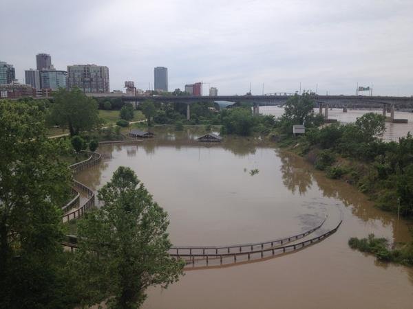
A flood advisory has been issued for the Arkansas River in Little Rock after a storm system dumped over eight inches of rain over the state Sunday night into Monday morning, National Weather Service officials said.
The Arkansas River had risen to over 18 feet by 1 p.m. Tuesday and the National Weather Service of North Little Rock predicts it will rise to nearly 21 feet by Wednesday afternoon, Observation Program Leader Dave Scheive said.
The flood level of the river is 23 feet, but at 21 feet there would be minor flooding at the Clinton Presidential Center, the advisory states.
The William E. "Bill" Clark Presidential Wetlands at the center is currently flooded, as is the island immediately east of the park bridge, Clinton Foundation spokesman Jordan Johnson said. The walkways of the wetlands park were built for flooding, Clinton School of Public Service Dean Skip Rutherford said.
The flooding will not affect center operations, Johnson said. Additional fish and snakes will probably enter the wetlands park because of the flooding, but there should be no additional impact, according to Rutherford.
The National Weather Service expects the Arkansas River levels to crest at 21 feet Wednesday then drop back to 10.5 feet by Friday.
Flooding at the William E. “Bill” Clark Presidential Park Wetlands #arwx pic.twitter.com/EnLcSRpEvw
— Clinton School (@ClintonSchool) May 12, 2015