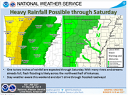
Forecasters added a tornado watch Friday afternoon for several western Arkansas counties as a flash flood watch remains in effect through Saturday night for a large swath of Arkansas.
The tornado watch, effective through 7 p.m., is part of an approaching system bringing more rain chances to an already saturated region. Affected counties include Benton, Carroll, Crawford, Franklin, Hempstead, Howard, Johnson, Little River, Logan, Madison, Montgomery, Pike, Polk, Scott, Sebastian, Sevier, Washington and Yell.
The National Weather Service said Friday that several rounds of precipitation are possible with each capable of dropping up to 2 inches of rain.
"This rainfall combined with saturated ground will likely bring flash flooding to the northwest half of the state," the agency said in a statement, defining that area as roughly north of a line from Arkadelphia to Morrilton to Mountain View to Ash Flat. Southwest Arkansas is also included in the watch area.
The weather service called flash flooding a "very dangerous situation" and said the problems will be made worse by high levels on area rivers and streams.
"Any additional rainfall will not be able to drain into waterways, increasing the threat for flash flooding," the statement said. "This is of greatest concern in the higher terrain areas, including the Ouachita and Ozark Mountain regions."
Gov. Asa Hutchinson on Friday at a news conference announced he has declared five more counties as disaster areas: Miller, Lafayette, Crawford, Faulkner and Logan. Little River County and other portions of southwest Arkansas had already been declared disaster areas, some due to a tornado in the Nashville area a few weeks ago, Hutchinson said.
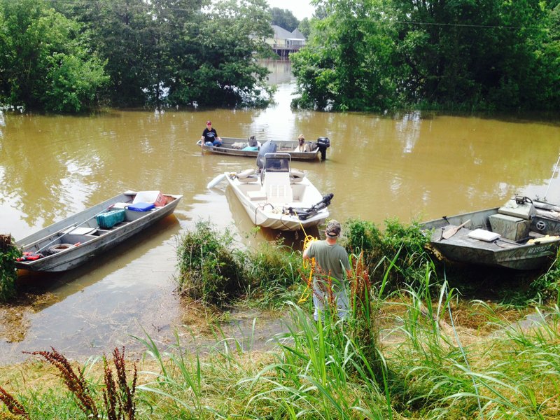
Flood warnings, meanwhile, were in effect along some of those rivers, including the Arkansas River at Dardanelle, Morrilton, Toad Suck Lock and Dam Tailwater, Little Rock and Pine Bluff.
The river at Little Rock was expected to crest at about 23 feet, minor flooding stage, early Saturday morning. Morrilton was said to have reached major flood stage, though the river was falling there. Pine Bluff was in moderate flood stage early Friday and was forecast to rise slightly before falling into minor flood stage Sunday.
A full list of area river forecasts is available here.
Little Rock-area flooding
Recent rain and the increased chance of flooding has led the city of Little Rock on Friday to close a part of the Arkansas River Trail and Rebsamen Golf Course.
The River Trail will be closed from the Two Rivers Park Bridge westward, through the wooded trail and to the restrooms, city officials said.
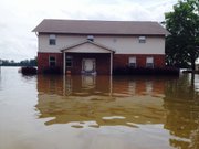
The water is near 3 feet deep across the trail in some spots, city officials said. Water will be "encroaching on homes" near the park as well, the weather service advisory warns. The river is expected to crest later Friday.
The city also said the golf course has been closed proactively to protect the players because the course lies on the banks of the river. Golf course officials will reevaluate the closure Monday, city officials added.
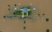
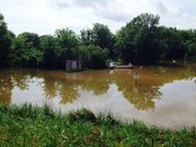
Farmlands downstream of Little Rock are flooded and the Bill Clark Presidential Park Wetlands are "inundated" with flood waters, officials said.
North Little Rock has had to close its sewer-system floodgates to prevent backwater from flooding sewers.