Cooler temperatures and widespread showers and thunderstorms are expected Wednesday across much of the state as a storm system moves through the region, the National Weather Service said.
The system will move slowly across eastern Arkansas Wednesday, bringing with it the chance for locally heavy rain, the weather service said.
In southern Arkansas, a flash flood warning was in effect Wednesday morning for parts of Calhoun, Bradley and Cleveland counties as well as parts of Dallas, Drew and Ouachita counties.
The weather service said up to 3 inches of rain had already fallen in that area and that "flash flooding is likely to occur and may persist for several hours."
[WEATHER UPDATES: Visit the Arkansas Online weather page for your local forecast]
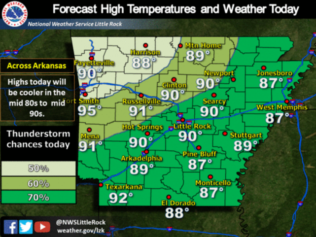
High temperatures across the state, meanwhile, will stay in the upper 80s to low 90s across the state, though the humidity will make it feel as hot as the upper 90s, the weather service said.
In Little Rock, a high of 90 is forecast with a 70 percent chance of thunderstorms during the day and a 50 percent chance this evening.
The weather service said the state could see scattered thunderstorms each day through the rest of the week , including some that could pack gusty winds.
"Given the slow movement of any storms, locally heavy rainfall will be possible, resulting in an isolated flash flood threat," the statement said, adding the threat for severe storms is "isolated and low."