8:38 P.M. UPDATE:
A large swath of Arkansas including the Little Rock metro area was under flash flood warnings Wednesday night as storms packing heavy rain moved through the region.
The National Weather Service said some areas had already received up to 4 inches of rain with additional precipitation expected through the night.
Flash flooding had already caused "numerous" roadways to become impassable, the agency said, including JFK Boulevard in North Little Rock north of Kierre Road. A partial roadway collapse was reported there.
Just under 4 inches of rain had been measured in North Little Rock, the weather service said shortly after 8 p.m. That made it the wettest March day on record.
8 P.M. UPDATE:
Tornado warnings that had been in effect over several counties in south Arkansas have been allowed to expire.
7:52 P.M. UPDATE:
The tornado warning in Lincoln County has been canceled.
7:45 P.M. UPDATE:
The tornado warning covering northwestern Drew County has been cancelled, but a tornado warning is now in effect for southwestern Lincoln County.
The National Weather Service said a storm capable of producing a tornado was near Cane Creek State Park at 7:42 p.m. and moving northeast at 35 mph.
The warning continues through 8 p.m.
7:20 P.M. UPDATE:
A new tornado warning has been issued for northeastern Bradley County, northwestern Drew County, southwestern Lincoln County and southeastern Cleveland County. It runs through 8 p.m.
The National Weather Service said a storm capable of producing a tornado was near Brandon at 7:17 p.m. and moving northeast at 35 mph.
7:19 P.M. UPDATE:
Two tornado warnings have been issued in southern Arkansas.
One tornado warning in eastern Columbia County and northwestern Union County was in effect through 8 p.m. The National Weather Service said a storm capable of producing a tornado was over Emerson at 7:09 p.m. and moving northeast at 35 mph.
A second warning covered southwestern Desha and eastern Drew counties through 7:45 p.m. The weather service said a storm capable of producing a tornado was 7 miles east of Ladelle and moving northeast at 25 mph at 7:13 p.m.
6:30 P.M. UPDATE:
Four counties in southwest Arkansas are under a tornado warning until 7 p.m., according to the National Weather Service.
Those counties are: Columbia, Lafayette, Miller and Nevada.
A storm capable of producing a tornado was located about 6:20 p.m. at Ida, 15 miles east of Atlanta, Texas, moving northeast at 40 mph.
— Brandon Riddle
6:21 P.M. UPDATE:
A tornado warning has been issued for Cleveland and Jefferson counties until 7 p.m., according to the National Weather Service.
About 6:18 p.m., a storm capable of producing a tornado was located at Rison, moving northeast at 40 mph, the weather service said.
— Brandon Riddle
5:57 P.M. UPDATE:
The National Weather Service in North Little Rock has issued a tornado warning for Dallas and Grant counties in south Arkansas until 6:30 p.m.
A storm capable of producing a tornado was located about 5:53 p.m. near Sparkman, about 19 miles southeast of Arkadelphia, moving northeast at 60 mph, according to the weather service.
— Brandon Riddle
5:35 P.M. UPDATE:
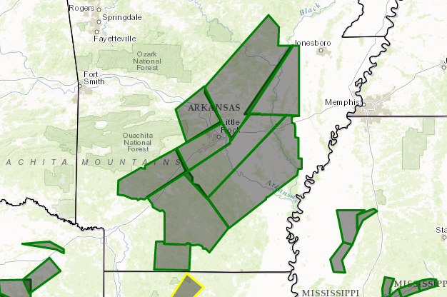
A flash flood warning is now in effect for 18 counties in Arkansas as storms continue to push through the state along a cold front, according to the National Weather Service.
Those counties are: Clark, Cleburne, Conway, Faulkner, Garland, Grant, Hot Spring, Independence, Izard, Jackson, Lonoke, Pike, Pulaski, Saline, Sharp, Stone, Van Buren and White.
— Brandon Riddle
5:15 P.M. UPDATE:
A departing flight from Dallas bound for Memphis was forced to land in Little Rock on Wednesday afternoon, leaving two flight attendants injured.
Records show that the plane, American Eagle Flight 3358, left Dallas/Fort Worth International Airport about 10:26 a.m.
The flight then encountered turbulence and was forced to land about 12:02 p.m. at Bill and Hillary Clinton National Airport, according to a statement from American Airlines, which operates American Eagle as a regional branch.
"The Embraer E175 aircraft landed without incident ... and safely taxied to a gate," the statement reads in part. "Two Envoy [Air] flight attendants were transported to a local hospital, and no passengers reported any injuries.”
American Airlines said a replacement aircraft arrived about 4:44 p.m. at Little Rock's airport. It was expected to depart for Memphis "shortly" as of about 4:55 p.m., according to the airline.
Read Thursday's Arkansas Democrat-Gazette for full details.
— Brandon Riddle
4:25 P.M. UPDATE:
The National Weather Service in North Little Rock has issued a flash flood warning for Faulkner and Pulaski counties, which will remain in effect until 6:45 p.m.
As of about 4:15 p.m., fewer than 1,000 Arkansans were without power as storms continue to move through the state, according to Entergy's outage map. That represents a sharp decrease from the more than 8,000 state residents who were without power earlier Wednesday.
Heavy rain is forecast to continue Wednesday evening and into the late-night hours, according to the weather service. The heaviest amounts of rain are predicted in south and central Arkansas, where up to 3 inches of rain could fall, officials said.
The weather service said some areas of the state could see up to 5 inches of rain before the system move out of the state Thursday morning.
South Arkansas faces the greatest threat for strong to severe thunderstorms with large hail and damaging winds possible. A tornado watch remains in effect for that region.
— Brandon Riddle
3:30 P.M. UPDATE:
The main campus of the University of Arkansas at Little Rock will close at 4 p.m. Wednesday due to flash flooding, according to a university spokesman. Evening classes at the campus are canceled.
— Brandon Riddle
2:30 P.M. UPDATE:
A flash flood warning has been issued for Pulaski and Saline counties, where more than 2 inches of rain has already fallen Wednesday afternoon, according to the National Weather Service in North Little Rock. That warning is in effect until 5:30 p.m.
The weather service on Wednesday afternoon also issued a tornado watch for portions of southwest Arkansas, which is in effect until 10 p.m.
— Brandon Riddle
1:30 P.M. UPDATE:
Entergy reported that 8,316 Arkansas customers were without power as of 1:30 p.m. as storms moved across the state.
Independence County had the most outages, with 4,310 without power.
About 1,200 were without power in Pulaski County, Entergy said.
1 P.M. UPDATE:
The weather service reported that hail was falling at its North Little Rock office just before 1 p.m. Wednesday.
The hail was about 1/2 inch to 3/4 inch big, the office said.
EARLIER:
Storms that could reach severe levels are expected to sweep through much of Arkansas on Wednesday, and forecasters warned southern counties are likely to see the most dangerous hail and winds.
An area south of a line stretching from Hot Springs to Stuttgart could see three-quarter-inch hail and winds topping 60 mph as the storm intensifies in the late afternoon, according to National Weather Service meteorologist Michael Brown.
The weather service in North Little Rock issued a hazardous weather outlook for most of the state early Wednesday, as well as a flash flood warning for southern regions.
According to the outlook, isolated tornadoes are possible throughout the state but are more likely in an "enhanced" area of risk south of Little Rock.
Brown said the storm front moving from the west will first bring rain to Arkansas around 10 a.m. before intensifying later in the afternoon and evening.
Most of the state will see between 1 and 3 inches of rain, though some spots could get up to 5 inches, the weather service outlook said.
"It doesn't appear to be a major outbreak, but we're expecting a little bit" of severe weather, Brown said.
According to the weather service, the storm front will be followed by calm starting Thursday. No additional severe weather is predicted through early next week.
— John Moritz
Received 1/2" to 3/4" #hail here at the @NWSLittleRock office in North Little Rock. Have any hail pics? #ARwx pic.twitter.com/pV3ahzTzUK
— NWS Little Rock (@NWSLittleRock) March 30, 2016