Update 1:30 p.m.
The chance for severe weather in Arkansas will shift to the southeast part of the state Thursday as the tail end of a system continues toward the east, forecasters said.
The National Weather Service's Storm Prediction Center in Norman, Okla. included southeast Arkansas in a long band of area stretching to the Great Lakes that will be under a "slight" risk for severe thunderstorms early Thursday.
The system will likely move east of the state by noon Thursday, said Joe Goudsward, a meteorologist with the weather service's North Little Rock office.
Severe weather was also said to be possible Wednesday night over parts of Northwest Arkansas.
Earlier
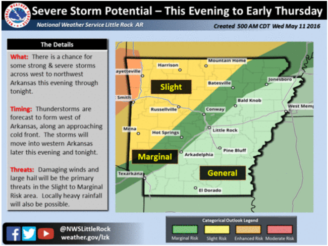
Severe storms are possible in parts of Arkansas Wednesday as a cold front moves into the region, the National Weather Service said.
The agency said in a statement that showers and thunderstorms are expected across parts of Northwest Arkansas Wednesday afternoon into night.
"Some severe storms could be seen with damaging winds and large hail the main threats possible with the strongest storms," the statement said.
Storms are also possible further south and east, "but the severe weather threat will be more isolated," forecasters added.
Isolated severe storms will again be possible over the rest of Arkansas Thursday as the cold front "progresses slowly southeast," the weather service said, though it said the threat for organized severe weather is low.
Strong storms moved through the state earlier this week, with a tornado touching down in Saline County and straight-line winds causing damage in northern Arkansas Monday night.