9 p.m. UPDATE:
The severe thunderstorm warning has been canceled. No warnings are currently in effect in the state.
8:30 p.m. UPDATE:
The tornado warning was allowed to expire at 8:30 p.m.
The National Weather Service said shortly before that the storm structure was weakening.
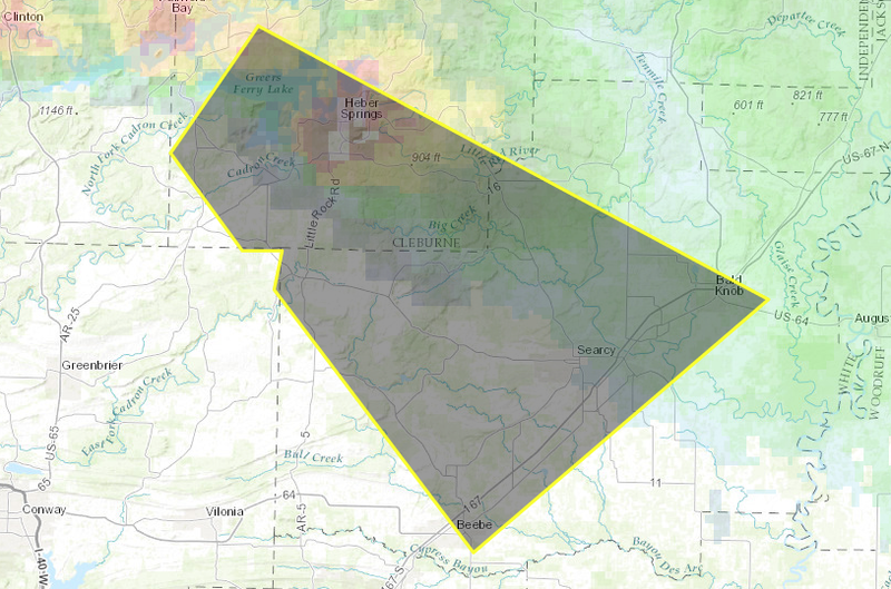
A severe thunderstorm warning remained in effect through 9 p.m. for central White County and southern Cleburne County.
That storm was said to be capable of producing 70 mph wind gusts and baseball-sized hail.
EARLIER:
The National Weather Service has issued a tornado warning for northwestern White and southeastern Cleburne counties.
The agency said at 8:18 p.m. that a severe storm capable of producing a tornado was over Heber Springs and moving southeast at 25 mph. The radar indicated rotation, the weather service added.
The warned area includes Heber Springs, Letona, Pangburn and several other locations.
"Tornadoes are extremely difficult to see and confirm at night," forecasters said in a statement. "Do not wait to see or hear the tornado. Take cover now!"
The weather service said shortly before the tornado warning was issued that the storm could produce baseball-sized hail.
"This could be a life threatening situation if outside," the agency posted on Twitter at 7:55 p.m.
The tornado warning extends through 8:30 p.m.
A severe thunderstorm warning was also in effect for part of the same area under the tornado warning as well as some points to the south and east, including Searcy. Winds up to 70 mph and hail up to 2.75 inches in diameter was said to be possible.