A series of fronts will bring large hail, damaging winds and possibly a tornado or two to Arkansas between Wednesday and Sunday, forecasters predict.
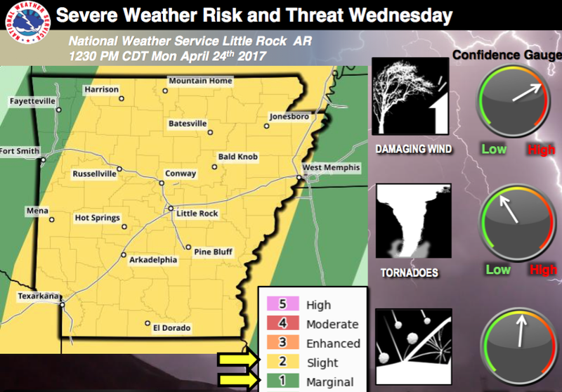
Thunderstorms will descend on the state Wednesday, with most of Arkansas at slight risk for severe weather, according to a Monday news release from the National Weather Service. Only a sliver of the state in the northwest corner is at marginal risk for severe weather.
The cold front expected to sweep across the state will be accompanied by a "line of storms" that will bring damaging winds and large hail, forecasters said. An isolated tornado ahead of that line "cannot be ruled out" in Wednesday's weather, the release noted.
On Friday, a warm front will pass over Arkansas and bring the same conditions — large hail and damaging winds — but this time the threat of tornadoes is higher, the release said. The portion of the state that encompasses most of the western border and stretches east to the outskirts of Little Rock will be the most affected, officials said.
Severe thunderstorms are also a possibility for western Arkansas on Saturday, forecasters said. Sunday, eastern Arkansas could experience its share of hail and damaging winds.
The eastern half of the state should also be on watch for flash flooding from Wednesday through Sunday, the release said.