Parts of Arkansas are at risk for severe weather Monday night and Tuesday morning, according to the weather service.
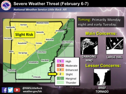
A graphic from the National Weather Service's office in North Little Rock shows that the threat stretches across the state, with everything north of a line from Clay County in the northeast to Sevier County in the southwest at a slight risk.
Chris Buonanno, National Weather Service science and operations officer, said there is potential for strong thunderstorms.
These thunderstorms might bring large hail and damaging winds to northwest Arkansas, he said.
According to the National Weather Service, most of Arkansas' severe storms will probably occur after 10 p.m. Monday. The forecaster expects the storms to continue east after sunrise Tuesday and during the morning until they have left Arkansas by noon.
Buonanno said the storms probably won’t bring much precipitation, so he doesn’t anticipate flash floods arising as a result of the weather.
He predicted that weather after Tuesday would be dry, with a cold front coming in later this week.