"Rain is forecast for the end of the week, a lot of it. Yahoo!"
I received the excited text message from Tina Mullin, a hiking friend from Shreveport. Since they don't have many waterfalls there, and I'm always ready to promote the beauty of the Natural State, I had offered to take her on an Ozark waterfall tour the next time there was heavy rain.
As forecast, on the weekend of April 22, the rain did fall.
On that weekend we did not yet know that it would continue to fall, and fall, swelling the state's rivers and streams beyond the point of causing anyone joy. What looked to us like a wonderful opportunity soon became a disaster that caused terrible property damage and claimed lives.
But none of that had happened nor seemed likely to happen as Mullin and I set out on our driving tour. We were privileged to witness the other awesome power of heavy rain: beauty.
ON THE ROAD
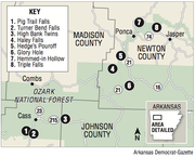
With Tim Ernst's guidebook Arkansas Waterfalls (Cloudland Publishing, 2014) in hand, steering our vehicle north on Arkansas 23, "The Pig Trail," we quickly bagged our first waterfall, appropriately named Pig Trail Falls. This waterfall may be viewed from the comfort of your vehicle; but we chose to leave the car for the complete experience.
Normally a gentle thread of water seeping over the rock ledge, the falls was a gushing 15-foot-wide curtain of water. There was so much running off the mountainside per second that twin falls had formed 20 feet to the right. We correctly read that as a teaser for scenes to come.
Turner Bend Falls was our next stop, to check out the cascade and pick up a couple of the Turner Bend store's "almost famous sandwiches" piled high with turkey and all the fixins'.
GOING, GOING ...
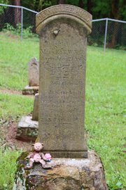
En route to our next waterfall, along Arkansas 215, we paid a visit to the grave of Deny C Lee Hill at Dick Hill Cemetery. The engraving on her headstone tells the sad tale of a 3-year-old murdered to lure her family from their home with the intent of robbery.
A few miles farther down the highway, we stopped near a rock formation. Two slabs of stone jutted 12 feet straight out of the ground, with a 5-foot gap between them. A local told me this place is known as "Hangin' Rock," and it was here that a log positioned across the tops of the stones anchored the ropes used to hang the two men who murdered little Deny.
Just down the highway, mere feet off the road, we reached our next waterfall. Ernst describes this as "one of the most beautiful waterfalls in Arkansas" when the water is running. After the recent drenching, 71-foot High Bank Twins certainly lived up to his billing. Alone, each falls would have been impressive, but combined they were a wonder to behold.
By this time we had caught up with the storm front that was dumping frog-strangler rains feeding the waterfalls. I pulled off the highway just east of the Oark General Store (established in 1890, it's considered the oldest continuously operating store in Arkansas) to allow the storm to pass while we strolled above the turbulent waters of the Mulberry River on the Catalpa Swinging Bridge.
The wood plank and cable arc has washed out several times since its construction in the 1930s, most recently in December 2015. This being the property owner's only link to the outside world during wet seasons, they always find a way to pay for its reconstruction.
We enjoyed the mild terror of crossing "at your own risk," unaware the bridge had only a week left before, once again, it would fall into the swollen river. By April 30 it was a memory.
BOUND FOR GLORY
Shortly after we drove away from the bridge, we exited the paved highway to follow a narrow gravel slip of a path routing us through a hollow bordered by dense lush forest.
The "road" crossed a bridge over the upper headwaters of the Mulberry, just downstream from where State Supreme Court Justice James H. Boomer drowned in 1993 while hiking the Ozark Highlands Trail. Although an experienced hiker, he fell while crossing and was pulled under.
Soon we popped out on Arkansas 21 where, having caught up to the front, we forged ahead through a torrent. Our next destination, Glory Hole.
The rain let up, at least briefly, as we arrived at the trailhead. We grabbed our rain gear and began hiking down the mountain. I couldn't let a little, or in this case a lot, of rain keep Mullin from experiencing one of the state's iconic natural features.
At our first water crossing, she was game for exiting the established trail and scrambling down a bluff so we could walk along the bank of the babbling brook that feeds Glory Hole. We bagged a bonus waterfall and many cascades not visible from the trail.
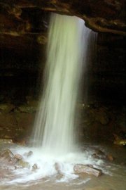
And then there it was, the most interesting falls in the Ozarks. Eons of water pouring off a 6-foot ledge onto the roof of an overhanging bluff has bored a smooth and perfectly round hole through the thick rock. A cascade pours directly into the bluff shelter below.
According to Ernst, the distance from the top of the hole to the floor below is 31 feet.
We used caution as we scrambled to the lip of the hole in search of the perfect angle for our photograph. In 2015, 22-year-old Brandon Jones of Ozark almost died when he slipped through the opening and tumbled to the rock below.
We followed a route to the right of the upper ledge to climb down below the formation to witness the spout shooting through the 5-foot-hole.
After hiking back through a steady downpour, upon reaching our vehicle Mullin turned to me and said, with a wide smile, "This has been a really fun day."
"It's not over yet," I said.
ONE LAST STOP
Shortly after exiting Arkansas 74 onto Kyles Landing Road, I turned right on Camp Orr Road. The road dead ends at the Camp Orr Boy Scout Camp, the only Boy Scout Camp within a national park. The camp was developed in 1953 and covers nearly 600 acres of Buffalo National Wilderness Area. But the camp was not our destination. We were out to bag another waterfall.
I had never approached the falls via the Camp Orr Road. My past visits had been while backpacking the Buffalo River Trail when we would bushwhack down to the falls from the trail. Shortly beyond where the trail crosses the road, I found a place to park, and we began hiking west.
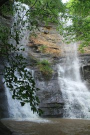
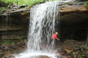
After bushwhacking through wet, dense underbrush, we reached the base of 48-foot Triple Falls.
"Wow!" she said.
The name confuses most visitors, most of the time, because Triple Falls usually has only two columns of water. But on this occasion, we experienced the falls at their best with three dynamic pour-offs tumbling over the ledge.
While snapping many photos, we "discovered" an established trail on the opposite bank of the runoff stream (which Ernst describes in his guidebook and we would have known to expect had we paid closer attention). It gave us a much dryer return hike to the vehicle.
It was a short drive to our home for the night at Kyles Landing Recreational Area, where to our surprise we were able to score a prize campsite just 20 feet from the banks of the swift Buffalo River.
The next morning we discovered the reason behind our good fortune: a fellow camper told us he had been at our campsite the night before -- until the river swelled up to engulf his tent during the night, forcing him to higher ground.
THE ADVENTURE CONTINUES
Only one day remaining. And so much yet to see.
I decided I couldn't bring a visitor to the Buffalo River area without seeing Hawksbill Crag, the most photographed natural feature in Arkansas. Plus, in keeping with the theme of the adventure, we could bag a couple of falls along the way.
A little over 1 mile into our hike we reached Haley Falls, named after Haley Zega. In 2001, when she was 6 years old, she was separated from her family while hiking and spent two nights alone in the Buffalo Wilderness before being rescued.
Haley Falls has two separate falls, an upper and a taller lower, which can be reached via a social trail (an unofficial path) to the left of the upper falls. Both are well worth the required scramble down.
When we reached the Crag, it was engulfed in low clouds that blotted out the mountain backdrop.
On our drive back down Cave Mountain Road, I thought we would search for a waterfall I had heard other hikers talk about but had never visited myself, Hedges Pouroff.
Per the directions I remembered, finding a small turnout just before the road dropped into Boxley Valley, I parked and picked up a faint social trail leading toward the bluff. After a short walk, the trail petered out on the brink of a sheer bluff, and there it was.
A nice stream of water flowed over the edge, ending after what appeared to be a 100-foot free-fall; however, other than having someone hold me by my belt loop as I leaned out, I was unable to get a good look.
THE GRAND FINALE
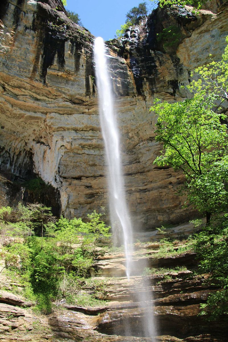
I had saved the best for last. Our final destination was Hemmed-in Hollow Falls, at 209 feet the tallest waterfall between the Appalachians and the Rockies.
After trekking down the long, steep, rocky trail from Compton Trailhead, we were greeted at the base of the falls by a scene that was unmatched by anything we had experienced during our two-day adventure.
At the very summit of the bluff, a massive volume of water was launched into the air as a collective spray. No longer bound by rock or earth, in the gentle breeze, droplets gracefully swayed from side to side as curtains of mist, briefly defying gravity, before plummeting with a splash onto the rock floor. The brief hangtime created a dazzling spectacle of ever changing geometry. We felt that each moment must be unique, never to repeat again.
This would have been a perfect ending to an excellent weekend, but there was one more site I wanted to share. I chose to take the Sneed Creek Trail return route, so my guest could experience Goat Trail.
This is a narrow ledge a quarter of the way down Big Bluff's sheer, 300-foot wall, and it runs almost the length of the bluff.
I was on a recent backpack on the Royal Arch Trail in the Grand Canyon, and Goat Trail is reminiscent of the exposed ledges encountered there, complete with a small hole hikers had to crawl through.
With the open, unobstructed view from Goat Trail across the wide canyon and a full view of the Buffalo River some 200 feet below, this is a must-see for visitors.
Mullin said the adventure had been well worth the six-hour drive from Louisiana.
As for me, I was once again reassured that the Natural State is where I want to be.
Bob Robinson is the author of Bicycling Guide to the Mississippi River Trail, Bicycling Guide to Route 66 and Bicycling Guide to the Lake Michigan Trail (spiritscreek.com).
ActiveStyle on 05/08/2017