ROGERS -- Manors on Blossom Way residents worry a proposed addition to 28th Place will mean greater flooding in the neighborhood, less privacy and security for themselves and their families.
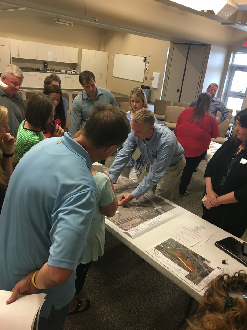
The city held an open meeting at First Baptist Church on Pleasant Grove Thursday night to present the planned changes for the road and hear concerns from those living in the area.
Construction renderings at the meeting showed 28th Place extending from its intersection with Bellview Road in the form of a bridge past Manors homes and connecting with Pauline Whitaker Parkway. The road would be two lanes, each 10 feet wide; a 7-foot median with lamp lighting in the center, a 4½-foot bike lane on either side of the road, followed by 6 feet of green space and a 6-foot-wide sidewalk.
A second portion of 28th Place, north of West Pleasant Grove Road, is planned to be extended and connected north of the Casey's convenience store, widened from two lanes to three and have bike lanes also.
"We're concerned about floodwaters getting closer to and around our homes," said Ruth Dolle, head of Manors' property owners association. "If more construction happens, it will get water in our homes."
Dolle said flooding two weeks ago brought water a half inch from her door and up to the top of her mailbox. That was too close for comfort, she said.
"The city can do something with the creek," Dolle said. Her comments implore city engineers and planners to improve drainage in the neighborhood, especially if the road construction carries through as presented.
Lance Jobe, assistant city engineer, said the route wasn't yet definite and hearing neighbors' comments was a part of the process. Jobe reminded all who attended the Arkansas Highway Transportation Department will get a say in the final route, too.
Construction would begin next spring at the very earliest, Jobe said.
So far only parties with commercial development in mind have expressed interest in the property, said Lori Ericson, assistant planner. The past few have all been condominiums.
Other residents mentioned two 100-year floods within a short amount of time of each other. More roads and businesses would surely make flooding worse, they said as they showed officials videos and photos of their property taken during the most recent rain.
"Our hydraulics aren't perfect, but it's the best model we have," Jobe said. He pointed out the three possible routes for the bridge, one that is relatively straight and two others that are on either side of it. "We'd prefer to keep it as short as possible. That's why the red (straight) route is preferred."
Another resident expressed apprehension their comments would make a difference, since he attended similar meetings in the past that were unfruitful.
Comment forms were provided at the meeting, which give residents a chance to tell the city whether they are for or against the proposed changes, which iteration of the route they are least opposed to, what sites they're hoping to protect and why.
Jobe suggested interested parties complete a comment form. Those most concerned are encouraged to organize their effort and submit letters through the property owner's association to the community development department. The community development department will read and respond to each comment form they receive, he said.
"A lot of the work we do is complaint driven," Jobe said. "Changing based on just one comment is hard to justify, but 20 is more convincing."
NW News on 05/12/2017