South Arkansas faces a severe weather threat going into the weekend, forecasters say, and residents in the state's north could see a brief bout of wintry weather as the system exits.
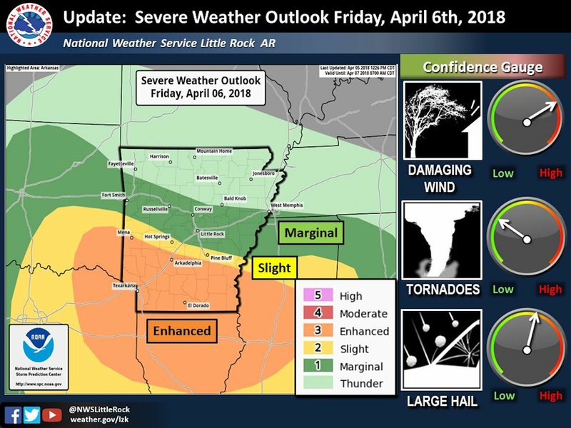
On Thursday, the National Weather Service had already placed much of the state’s south under an enhanced risk for severe weather Friday afternoon and into the evening hours.
Damaging winds wand large hail will be the primary threats in cities like El Dorado, Texarkana, Mena and Arkadelphia, according to the agency’s North Little Rock office.
The enhanced risk means multiple severe storms are possible, resulting in hail up to 2 inches in diameter and wind speeds of 75 mph or greater.
The weather service’s Shreveport office said a threat for isolated tornadoes exists in the risk area, “mainly across north Louisiana.”
Further north, a band encompassing Hot Springs and Pine Bluff is included in a slight risk for storms to turn severe Friday afternoon and into the evening hours.
Much colder air is expected to arrive later Friday and through Saturday morning.
Overnight low temperatures are forecast to be in the upper 20s to mid-30s across Arkansas.
Meteorologists said Thursday afternoon that uncertainty remained “fairly high” regarding whether any wintry precipitation could fall as a result of the temperatures.
“There may be some moisture remaining when this subfreezing air arrives,” the latest forecast discussion reads, meaning a potential “brief wintry mix” in the higher elevations of the Ozarks.