FAYETTEVILLE -- A proposal to downgrade a northeast city road's classification on the overall street plan and keep on the books its connection through a neighborhood to a major thoroughfare will return to the City Council unchanged.
The council's Transportation Committee, consisting of four members representing each ward, unanimously on Tuesday forwarded a proposed street plan change involving Rolling Hills Drive to the full council with a recommendation of approval. The council will take up the item during its next meeting.

On the agenda
The City Council will take up the Rolling Hills proposal during its next meeting:
When: 5:30 p.m. Tuesday
Where: Room 219, City Hall, 113 W. Mountain St.

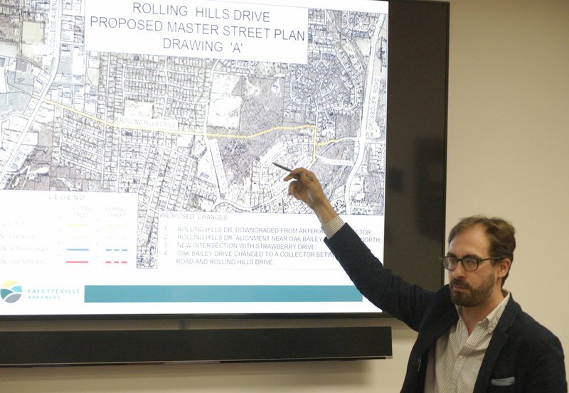
The proposal the committee looked at has two parts. First, it would downgrade the current classification of Rolling Hills on the street plan from an arterial route meant to shuttle cars from one major thoroughfare to another. The new classification would be as a collector street, which are typically two-lane roads with ample room for green space found in neighborhoods.
Secondly, the proposal changes slightly the connection of Rolling Hills Drive between College Avenue and Crossover Road. The original plan adopted two decades ago makes the connection as a straight shot. The new drawing on the map has Rolling Hills extend to Oak Bailey Drive, which could funnel cars south to Old Wire Road and east to the intersection at Crossover.
The full City Council took up the proposal during its April 17 meeting and bounced it to the Transportation Committee for further discussion. City Engineer Chris Brown gave the committee a presentation on the proposal and fielded questions. About a dozen residents attended.
Residents who spoke asked for the connection between College Avenue and Crossover Road to be taken off the street plan map.
Tonya Landrum, who lives on Rolling Hills Drive, said she worried about increased traffic coming from neighborhoods at the city's eastern edge as a result of the connection. Landrum said she liked the wider sidewalks and green space associated with a collector classification. Plus, something needs to separate the bicycle lane on Rolling Hills from the rest of the street, she said.
"I don't think we want to err with this situation," Landrum said.
Committee members said the city would lose any leverage it might have on street design if a development plan comes through. The council also will take up a second item dealing with rezoning the wooded land next to Rolling Hills Drive and Old Missouri Road during the same meeting Tuesday.
Council member Justin Tennant, representing Ward 3, said nothing would stop a future council from putting the connection back on the map if the present council took it off.
"It almost strikes me as a feel-good measure," he said. "I don't think we should do things just to feel good and calm people down for the short term and then pass it off to somebody else. I think it'd be better for us to do it in the most appropriate way."
In other business, the committee reviewed some preliminary implementation measures for the first phase of its updated mobility plan. A proposed timeline will be included at the Transportation Committee's meeting next month.
The draft takes on seven strategies, including increasing walkability, improving pedestrian safety, enhancing access to public transit and developing a capital project plan. The city hired consultant Nelson/Nygaard to update its overall transportation and mobility plan, which it received in March.
The committee also reviewed a measuring tool developed by the consultants to help city officials prioritize transportation projects. The spreadsheet features five major categories of health and safety, economy, environment, equity and deliverability and funding, with associated metrics. Users can assign importance, or weight, to each metric, to align prioritization with goals.
Construction on many of the city's projects associated with the 2006 bond program is almost complete. Rupple Road from Starry Night View to Mount Comfort Road should resume next month after excavators found a number of arrowheads and artifacts at the site.
Also, the next leg of improving Old Wire Road, from Ash Street to Gulley Park, is set to begin May 7. Plans include new curb and gutter, a concrete median, 9 ½-foot-wide bicycle track next to a 5-foot-wide sidewalk and drainage work.
NW News on 04/25/2018