Heavy rains flooded a highway in Miller County on Saturday afternoon, and forecasters say the wintry weather front moving over Arkansas will continue to bring sleet and freezing rain in the north and precipitation in the south throughout the day.
The Arkansas Department of Transportation's iDrive roadway tracker said all lanes of Highway 134 in Miller County just south of Texarkana were closed due to high water Saturday afternoon. The closed portion of the highway extends for one mile near Fouke.
In the south, where forecasters predicted the heaviest precipitation, Joe Goudsward, a meteorologist with the North Little Rock National Weather Service office, said approximately an 1 1/2 to 2 inches of rain had fallen by 2 p.m., but that no cities had reported flash floods.
A flood warning is in affect for a trail of cities from Arkadelphia to Camden to just north of El Dorado, according to the National Weather Service's website.
Goudsward said the rain in central Arkansas could turn into a dusting of snow tonight, but likely no more than an inch. Temperatures are expected to drop tonight and Sunday evening, making for slick, icy roads and bridges.

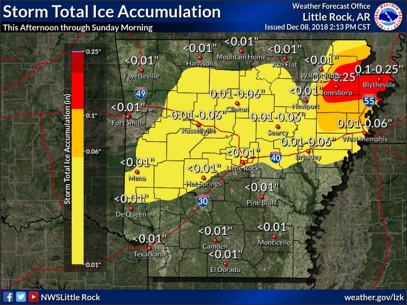
North central Arkansas is getting more sleet and freezing rain than snow, Goudsward said, and that wintry mix should continue throughout the day. The vast majority of the state is still under a winter weather advisory, according to the National Weather Service, but the winter weather warning that was in affect this morning for north central Arkansas has ended.
"We're starting to see some areas 1/10th of an inch of ice or more in the north central Arkanasas, but we haven’t been seeing a lot of travel issues," Goudsward said. Later in the afternoon, the iDrive site showed some snowy and slushy roads around Batesville.
The ice has primarily been collecting in trees and roadsides, but roadways could turn slick later in the day, he said. The area with the highest ice accumulation is Jonesboro and parts of Craighead County.
"Be aware in the northern part of the state, road conditions aren’t showing anything awful, but side roads are probably going to get slick," Goudsward said. "Like always, be careful on bridges and overpasses. There's cold air under and over them, and they freeze up faster."