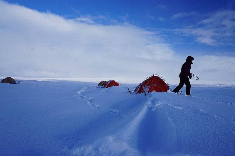
FAYETTEVILLE -- After spending four weeks camping on Greenland ice this past summer, researcher Matt Covington knows there's more work to be done as he studies the movement of vast ice sheets.
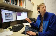
"There's no one else really collecting the type of data we're collecting," said Covington, 37, an assistant professor of geosciences at the University of Arkansas, Fayetteville.
He's helping lead a team of researchers taking close notice of how melted water travels down from the top of an ice sheet roughly 2,000 feet thick.
"Most of that melt water basically flows into caves in the ice," explained Covington, describing more or less vertical shafts that extend to the bottom of the ice.
The Greenland Ice Sheet, like other ice sheets, is a system in motion, with the melted water playing a key role in how portions of the ice end up sliding off the land and into the ocean. This contributes to sea level rise, a global concern that scientists say is occurring at a more rapid rate than in the past.
But "we don't really have a very good way of predicting, how quickly does an ice sheet lose mass? How much of the ice sheet will disappear in certain types of temperature conditions?" Covington said.
A return visit scheduled for August will give Covington another chance to explore nature at its most remote. For fun -- and also for projects relating to environmental research -- the Fayetteville High School graduate has spent more than a week underground as an extreme caver, visiting sites in Mexico, China and Slovenia, among other locations.
A 2014 report in The New Yorker magazine profiled Covington and others attracted to the underground depths, including an anecdote of how Covington once took a bad fall and broke an arm but managed to crawl his way to the surface.
It's a love that dates back to his student days at UA, where in 2002 he earned bachelor's degrees in physics and philosophy. Caving is what inspired his travels, he said.
"After, I guess, my sophomore year, I got on a plane and flew to Indonesia with a bunch of people I didn't know and went caving," Covington said.
As a doctoral student, he studied theoretical astrophysics at the University of California-Santa Cruz before realizing that he could take his skills and apply them as an environmental researcher.
"Once I figured out that I could align my passion for caving with my work, there was no turning back," Covington said. He joined the UA faculty in 2012, and his work has included projects studying how caves form and change over time.
"Most of my research is not really directly on environmental impacts and that sort of thing. But it all relates to that indirectly," Covington said. "Most of the work that I do is really on trying to understand fundamental processes that are going on in nature."
Covington's eagerness to explore goes along with impressive technical skills when designing computer models -- a somewhat rare combination, said Jason Gulley, the principal investigator for the National Science Foundation-funded Greenland project.
"In geoscience, a lot of the modelers tend to be kind of more office-oriented people, so finding somebody who is really good at modeling but also really good in the field is kind of a rare find," said Gulley, an assistant professor at the University of South Florida.
Gully described Covington as a partner in the research project, with their work in Greenland aiming to gather data in hopes of better modeling a natural process. Gulley and Covington are among many scientists working to better understand the melting of ice sheets, Covington said.
After the melted water on top of the ice sheet pours down vertical shafts known as moulins, it spills into rivers far beneath the surface. These rivers can force the thick ice above to float upward and, eventually, out to sea.
"A lot of the ice that's lost is not just by melt directly, but by the ice moving and creating icebergs that come off in the sea," Covington said, describing a process known as "calving."
"The motion of the ice is a big player in how much ice is lost or the rate at which it's lost," he said.
Mathematical models exist for these glacial processes, "but we have very little data on which to really hang the models or test the models," Covington said.
Gary Griggs, a geologist at the University of California-Santa Cruz, co-authored an April report updating the latest findings about sea level rise, described in the report as "the most obvious manifestation of climate change in the ocean." He led a group of scientists working at the request of California officials.
"Models are giving us a whole new way of looking at problems that are very complex," said Griggs, who is not a part of the team of researchers working with Covington and Gulley.
Griggs and other authors in their report described melting ice as a significant factor in sea level rise. They wrote that the Greenland Ice Sheet and Antarctic Ice Sheet have enough ice that, if they both were to melt completely, would cause a sea level rise of more than 200 feet.
"While these ice sheets are not expected to melt completely, even on centennial or millennial timescales, the loss of even a small fraction of either of these huge ice sheets could raise sea level significantly, with devastating consequences for global shorelines," states the report co-authored by Griggs.
This melt will likely play an increasing role in sea level changes, the authors concluded.
Historically, sea level rise has been about half due to "ocean thermal expansion" because water expands with heat, the report states. Griggs and co-authors cited recent scientific findings of "heat gain in the deep ocean" occurring "unabated at least since 2006, with temperature increases extending from the surface to depths exceeding 1500m in all ocean basins."
The authors wrote that science is showing an increasing rate of melt from the Greenland and Antarctic ice sheets, so much that this ice loss will soon be the primary contributor to rising sea levels.
"Right now, there's about 150 million people living within 3 feet of high tide around the planet," said Griggs, describing the importance of climate science and trying to understand factors contributing to sea level rise.
"I think our information is increasing fairly rapidly with more observations, but it's really critical that the work continues to be carried out," Griggs said.
Gulley said modeling is important. But so is field research.
"I would say that there's a big push to replace a lot of field work with models and satellite data because it's cheaper. But there's really no substitute for kind of boots-on-the-ground research," Gulley said.
Covington said going to Greenland allows for observation of key aspects of the glacial system, starting with the melted water on the ice sheet's surface.
"We're measuring the water that's going in, so we have a sort of input, and we see how the system responds and this gives us data that we can really directly compare to the way the models behave," Covington said.
Metro on 01/01/2018