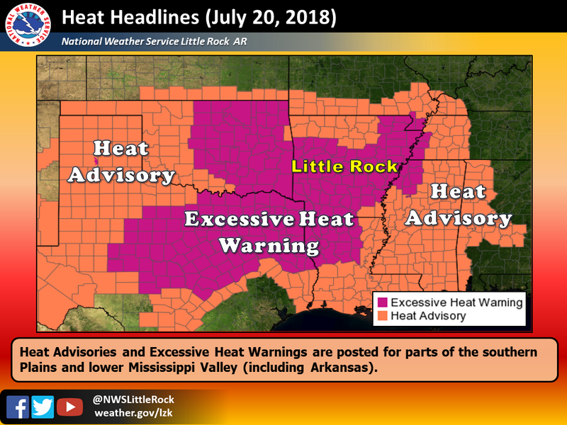
The National Weather Service in North Little Rock says Arkansans can expect “dangerously hot conditions” throughout the state on Friday and a chance for severe thunderstorms in northern and eastern parts of Arkansas later in the day.
All of Arkansas is under at least a heat advisory, with much of the state included in an excessive heat warnings. Meteorologist Heather Cross said the hottest areas will be the western and southern parts of the state, where heat index values are expected between to reach up to 115 degrees. The heat index measures how hot the air feels when the humidity is factored in.
Heat index values in northern Arkansas are projected between 105 and 110 degrees.
Today will “definitely be a contender for one of the hottest days this year,” Cross said, but she doesn’t expect it to break records for July.
Some parts of Arkansas received rain on Friday morning. As a cold front moved south from Missouri, showers and thunderstorms developed in parts of Arkansas around 6 a.m., Cross said. But she said the rain probably won’t make it far enough to cool off the western and southern parts of the state.
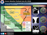
The cold front may bring strong thunderstorms to the northeastern part of the state this afternoon and evening, with chances for damaging wind, tornadoes and hail, the weather service said.
A thunderstorm with pea-size hail and 40 mph winds was reported shortly before noon in southwestern Phillips County in eastern Arkansas, near the White River National Wildlife Refuge, according to the weather service.