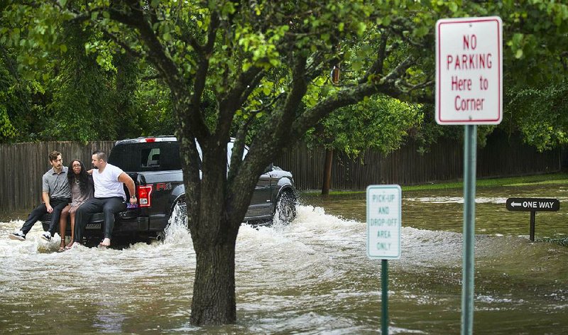
TULSA -- City officials say around 600 Tulsa County homes and business were inundated during last week's historic flooding along the swollen Arkansas River.
The Tulsa World reported that Tulsa Area Emergency Management Agency officials said roughly half of the swamped structures were in the unincorporated Town and Country addition west of Sand Springs, a Tulsa suburb.
Sand Springs was among the first communities flooded when the U.S. Army Corps of Engineers began releasing more water from a dam upriver to control more severe flooding elsewhere.
Storm-weary Oklahomans were gutting waterlogged homes Sunday as the river continued its slow crest rolling hundreds of miles downstream.
Oklahoma officials say six people have died and 118 were injured in the severe weather this spring.
Elsewhere, the amount of water being released into the lower Missouri River from upstream dams will remain at a high level for several months because of recent heavy rain and remaining snowpack.
The Corps said it expects water releases from reservoirs on the Missouri to be above average through the summer and possibly until November.
The Corps said that, for now, it's maintaining the amount of water that's being released from Gavins Point Dam on the Nebraska-South Dakota border at 75,000 cubic feet per second. The Corps' John Remus said that's more than twice the average release of water for this time of year.
That may worsen flooding downstream, where many levees have been damaged by the recent high water.
In Louisiana, a man died Thursday after being rescued from a car on a flooded street as rush-hour flash flooding and possible tornadoes hit the Baton Rouge area. The flooding caused numerous road closures, stalled vehicles and a delay in the start of the final day of Louisiana's 2019 legislative session.
Mayor-President Sharon Weston Broome said some areas of East Baton Rouge Parish received 5 inches of rain early Thursday. And roughly 3.5 inches fell in less than an hour during rush hour.
She opened a morning news conference with a moment of silence for an unidentified victim whose death was attributed to the weather. Fire Chief Ed Smith said emergency medical workers were unable to save the life of the man after he was removed from a flooded car. No other details were immediately available.
News outlets reported that wind damage in the Central community of East Baton Rouge Parish and in the city limits of Baton Rouge was caused by possible tornadoes. Another possible tornado was reported in the Convent area of St. James Parish. And parts of the New Orleans area were under a tornado warning as a possible twister moved over the area shortly after noon.
New Orleans officials said from 2 to 6 inches of rain was expected through today.
Flooded streets made it difficult for state lawmakers to get to the Capitol to put final touches on the state's $30 billion operating budget for 2019-20120. Both the House and Senate convened late. Lawmakers faced a 6 p.m. deadline for ending the 60-day session.
Meanwhile, the Corps said that the Great Lakes Erie and Superior both broke records for average water height in May, and Lake St. Clair on Detroit's eastern edge did as well. Lake Erie also in May reached its highest level on record for any month.
Record or near-record high water levels are forecast to continue in the summer before making the usual downturn into fall.
The effects of this high water have been wide-reaching. Recreational beaches have shrunk, while water has inundated docks and destroyed roads.
Damage to lakeshore property was reported again earlier this week along Lake Ontario in Upstate New York in the town of Henderson.
"There's houses surrounded by water, water going into houses and lake water in the roads," Eric Anderson, an operations coordinator for the Henderson Fire District, told the Watertown Daily Times. "Carp are feeding in people's front lawns."
This kind of flooding has occurred along the shores of the Great Lakes for months, in some places repeatedly, and intensifies during high wind events and storms.
A combination of major winter snowfalls and excessive rainfall are primary drivers for this year's high water.
Information for this article was contributed by staff members of The Associated Press; and by Ian Livingston of The Washington Post.
A Section on 06/07/2019