4:02 p.m.
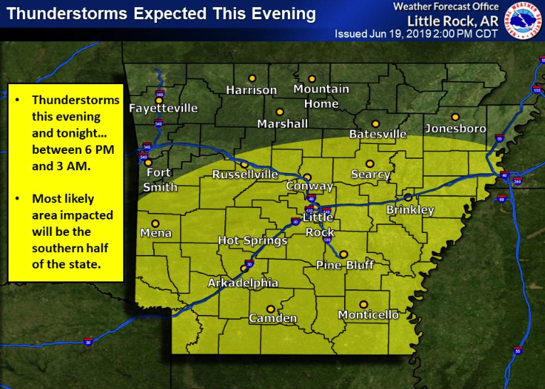
The National Weather Service projected that thunderstorms would form west of Arkansas Tuesday evening, then move east into the state. The storms are expected to move across the southern half of the state between 6 p.m. and 3 a.m., the North Little Rock bureau said.
A weather map showed the potential for thunderstorms stretching from the bottom border of the state up north to around Russellville.
A tornado watch was issued for several counties in southwest Arkansas Tuesday afternoon, including Miller, Union, Dallas, Clark, Howard and neighboring counties. The watch was set to expire at 12 a.m. Wednesday.
— Maggie McNeary
10:29 a.m.
Forecasters expect two rounds of storms to sweep across Arkansas on Wednesday, bringing the possibility of severe weather to the state.
Much of the state is at a slight to enhanced risk for seeing severe weather Wednesday, according to a briefing by the National Weather Service. Forecasters said their primary concerns as the two waves of storms move east over the state are damaging winds and locally heavy rainfall and flooding.
Isolated large hail and tornadoes will also be possible, the briefing states.
Forecasters said they don’t expect much severe weather from the first wave of storms already over west Arkansas on Wednesday morning, with concerns limited to strong wind gusts and small hail.
The second wave of storms, expected to develop over central and southern Arkansas late this afternoon or early evening is more likely to bring severe weather, according to the briefing. The greatest threat is in southwest Arkansas, which the weather service said is at an enhanced risk for severe weather.
The thunderstorms are predicted to last through midnight, forecasters said.
— Josh Snyder
