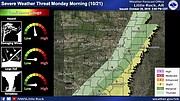
A cold front and upper level storm system passing east across the state Sunday night and into the next morning will bring a threat of damaging wind gusts, hail and the potential for isolated tornadoes, forecasters said.
The National Weather Service predicts a line of showers and thunderstorms will develop in eastern Oklahoma overnight, expanding as it moves into west Arkansas, according to a briefing by the agency. The system is expected to leave the state around midday on Monday or in the early afternoon.
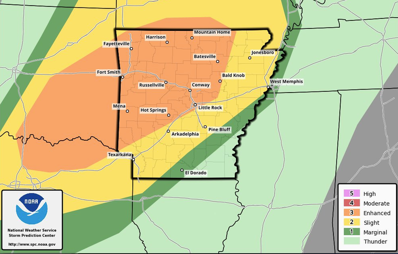
Forecasters said the areas at greatest threat for severe weather are those “west of a line from Texarkana, to Pine Bluff, to Jonesboro.”
The storm is predicted to reach central Arkansas between 4 a.m. and 9 a.m. and could affect morning commutes, the weather service said.
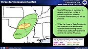
According to the briefing, any severe storms can produce wind gusts in excess of 60 mph and hail the size of a quarter. Localized flash flooding is also possible, particularly over west central and central parts of the state.
Forecasters also said that a few tornadoes are possible, with the greatest threat before sunrise and primarily west of Interstate 30 and U.S. 67.