Fans of bicycle travel away from pavement can test their grit on the gravel of Sugar Camp Scenic Drive in the Mark Twain National Forest.
This meandering back-country road in Barry County of southwest Missouri offers an 8.1-mile gravel grinder bike ride. Or, head out in the family sedan for a windshield tour of this picturesque piece of remote Ozarks.
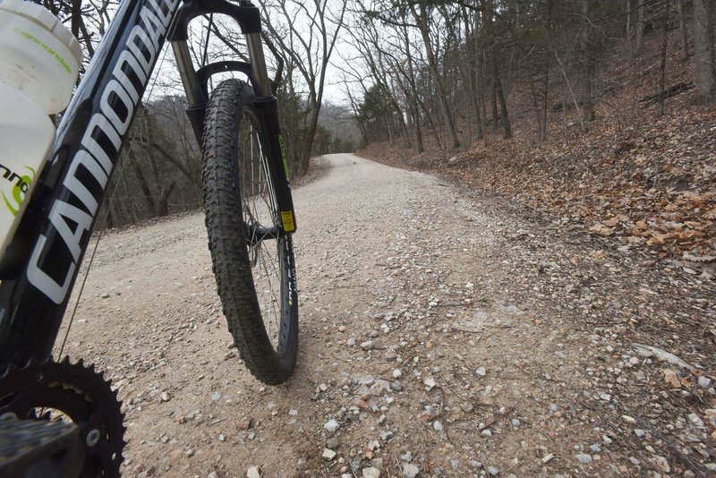
Gravel grinder riding has found favor with legions of cyclists, and it's no wonder. Two things plentiful in the Ozarks are rocks and gravel roads. Bike companies are turning out models specifically designed for gravel riding. Yet nearly any bike will do. A possible exception could be road bikes with skinny tires made for pavement.
Sugar Camp Scenic Drive meanders between Missouri 112 at the west end and Missouri 86 near the east end, close to Roaring River State Park and Table Rock Lake.
[Don't see the gallery above? Click here.]
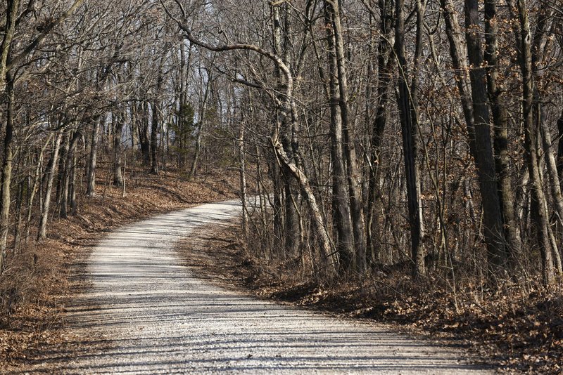
Think of the route as a wide hiking or mountain bike trail. It's well maintained with nice views of the national forest at the start. Vistas high above pastoral private countryside highlight the eastern section. Riders can roll over all or part of the 8.1 miles one way. Ambitious gravel grinders can pedal out and back for a 16.2 mile trip.
To get to the west end of the road, head north on Missouri 37 just over the state line at Seligman, Mo. Turn right on Missouri 112. Go 7 miles to the big sign for Sugar Camp Scenic Drive.
The wide gravel road heads off to the right and drops down a hill. The first vista is a tad less than a mile into the trip, off to the left. The next scenic view unfolds at 3.1 miles, this one off to the right. There's a small picnic area a little farther along with more panorama vistas.
Four miles along, the road climbs high above a picturesque valley, as seen through the leafless trees during winter. At 6.6 miles, gravel turns to pavement the rest of the way.
The trip offers scenery and solitude. Only three vehicles were seen in five hours of biking and car exploring. A bonus for bike riders is that miles of isolated spur trails lead from the main scenic drive for added two-wheeled adventure.

The scenic drive ends at a T intersection. Travelers on an auto tour can extend their trip over a nice loop of several miles. From the T, turn left and drive a short distance to Missouri 86. Turn left and travel north to Missouri Route F. Turn left again and follow this wonderfully hilly highway to Roaring River State Park. At the park, turn left on Missouri 112 and go 2 miles back to the start of Sugar Camp Scenic Drive.
Which begs the question, how did the scenic drive get its name? Some online investigation revealed no clues. A stop at the Barry County Museum in Cassville, Mo. was in order.
Jeremiah Buntin of the museum staff was helpful in gleaning some clues from old newspaper stories. A 1930s article explains how syrup was made from the sap of maple trees in the area of Roaring River State Park and the scenic drive. Other stories mention Sugar Camp Mountain and a Sugar Camp fire tower.
"A sugar camp seems to refer to any place where syrup was made," Buntin said. "There was a Sugar Camp Hollow at Mike's Creek in Powell in McDonald County also. The Sugar Camp mines were located at Mineral Springs east of Cassville."
Whatever the origin, Sugar Camp Scenic Drive is one sweet ride.
Mark Twain National Forest
Mark Twain National Forest encompasses 1.5 million acres of beautiful public land in 29 counties of Missouri. The national forest is a working forest, with some 750 miles of trails for hiking, mountain biking, horseback riding and motorized use. Sections of the Ozark Trail wind through the forest.
About 350 miles of streams run through the forest suitable for canoeing and kayaking. Primitive campgrounds and wilderness camping are available.
Source: Mark Twain National Forest
Sports on 01/28/2020