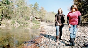
June 10:
11:58 a.m. — Based on what happened with this system in Texas, the National Weather Service issued a flash flood watch. A water level gauge eight miles south of the Albert Pike Recreation Area showed the Little Missouri River to be at 3.14 feet.*
Afternoon — The Basinger and Smith families arrive at Albert Pike.
6 p.m. — State Police Sgt. Brady Gore arrives at a family cabin near Albert Pike. His wife, Gina, already is there.
10:06 p.m. — The National Weather Service updates the flash flood watch, reminding people of the potential dangers.
10:30 p.m. — Gina Gore goes to bed. Brady stays up to finish watching an NBA playoff game.
11 p.m. — Kerri Basinger and Candace Smith go to bed in the RV where their children already are sleeping.
National Weather Service Meteorologist John Lewis begins his shift at the agency’s North Little Rock office.
11:30 p.m. — Brady Gore finally goes to bed, and it is raining hard.
June 11
1:30 a.m. — Water level is at 3.57 feet.
1:45 a.m. — Water rises to 3.67 feet.
1:57 a.m. — Alarmed by the amount of rain falling, Lewis issues a flash flood warning for portions of Pike, Polk, Garland and Montgomery counties saying flash flooding was “likely.” Of most concern were areas near the cities of Glenwood, Caddo Gap and Langley — the latter only about 8 miles uphill from the Albert Pike campgrounds.
2 a.m. — Water rises to 3.81 feet.
2:15 a.m. — 4.65 feet
2:30 a.m. — 5.83 feet
2:38 a.m. — Camp hosts Kathryn Cleveland calls 911 from a land line provided by the U.S. Forest Service. She tells a dispatcher, “we’re all gonna drown!”
2:44 a.m. — Montgomery County dispatchers send a deputy to check on the campground. It would be nearly three hours before he and other rescuers could maneuver around flooded creeks and mudslides to get to stranded campers.
3 a.m. — 9.87 feet
3 a.m. — John Lewis calls sheriff’s offices in the counties he believes are being hit hardest by the thunderstorms. A dispatcher in Montgomery County says there is flooding at Albert Pike but describes it as something that occasionally happens there.
3:15 a.m. — 12.63 feet
3:30 a.m. — 13.91 feet
3:30 a.m. — John Lewis calls the Montgomery County sheriff’s office again. This time, the dispatcher mentions high-water rescues, but again describes what is happening as somewhat routine.
3:30 a.m. — Two men pound on the back door of the Gores’ cabin yelling, “Get up, get out now!”
3:45 a.m. — 15.66 feet
4 a.m. — 17.70 feet
4:15 a.m. — 18.98 feet
4:30 a.m. — 20.57 feet
4:45 a.m. — 21.46 feet
5 a.m. — 22.30 feet
5:04 a.m. — Rescuers finally make it across Little Blocker Creek, which had overflowed and blocked the highway.
5:15 a.m. — 23.09 feet
5:30 a.m. — 23.39 feet
Rescuers make it to the cabins near Albert Pike as well as the campgrounds.
5:45 a.m. — 23.12 feet
6 a.m. — 22.40 feet
6:02 a.m. — sunrise
6:15 a.m. — 21.18 feet
6:30 a.m. — 19.91 feet
6:45 a.m. — 18.55 feet
7 a.m. — 17.18 feet
* The closet water level gauge on the Little Missouri River is about 8 miles south of the Albert Pike Recreation Area in the city of Langley. Hydrologists are trying to determine the water levels at the campgrounds the morning of the flood, but their report won’t be complete until early 2012. It’s likely that the water levels at the campground peaked before they peaked at the Langley gauge.
