LITTLE ROCK — Rain expected to pound pockets of the South over the next several days caused fresh concern Friday about flooding just as many Arkansans were trying to clean up from the previous deluge.
Galleries & Videos:
Recent flood stories & info:
The U.S. Army Corps of Engineers was monitoring already-full lakes in case the rainfall requires a release of water from them into swollen rivers. At the very least, the rainfall is likely to slow thefall of river levels that are at or near flood stage in many communities.
But the rain isn’t expected to cause the kind of flooding problems that Arkansas and neighboring states have seen over the past few weeks, said Tabitha Clarke, a hydrologist with the National Weather Service in North Little Rock. And if the rainfall comes slowly enough, it may cause no serious problems at all.
“It’s really going to depend on where the rain falls,”Clarke said.
Corps officials won’t make any decisions about releasing water from Bull Shoals, Table Rock, Norfork and Beaver lakes until the rain actually falls, she said.
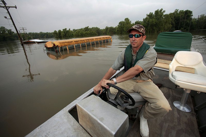
Desha County Judge Mark McElroy said he also will be watching the rain closely.
On Friday, “we had a good day,” McElroy said.
The levees in Arkansas City and surrounding communities were holding, andthe Mississippi River fell about a foot, he said. But this weekend’s forecast of up to 3 inches of rain in some areas has him worried.
“If it rains several inches up north, things could change,” McElroy said. “We’re still not out of the woods. But we’re certainly peeping over the trees.”
Meanwhile, Louisiana and Mississippi residents were watching the Mississippi River as it crests and drains into the Gulf of Mexico.
The river at Natchez, Miss., crested Friday at a level lower than had been forecast, said Jeff Graschel, a hydrologist with the Lower Mississippi River Forecast Center. That’s partly because of the release of water at the Morganza Floodway in Louisiana.
That water release, however, triggered mandatory evacuations in some rural Louisiana communities south of the spillway. Residents of Butte La Rose, La., continued to flee Friday in anticipation of the water flowing through the Morganza spillway to the Atchafalaya Basin.
Authorities went doorto-door Thursday notifying residents to evacuate. Many already had.
Farther downstream on the Atchafalaya River, preparations continued for a crest expected next week. Officials were optimistic that flood walls and sandbags would protect the oil- and seafood-rich area, but there were concerns about flooding from lakes fed by the Atchafalaya River’s overflow.
Also, Friday evening, U.S. Coast Guard investigators were trying to determine whether the river level played a part in a collision near Baton Rouge that caused three barges filled with grain to sink, said Coast Guard Senior Chief Petty Officer Mike O’Berry.
A 5-mile stretch of the river was closed until Coast Guard officials could ensure a safe navigation route for other river traffic.
“Safety is our No. 1 concern,” O’Berry said, adding that restrictions were already in place because of the river level.
MISSISSIPPI
After weeks of anticipation, the Mississippi River finally crested at Natchez and at a level lower than expected.
Graschel said Friday that the river level peaked at 61.8 feet and likely will remain at or near that level for days. Weeks before the crest, forecasters had predicted that it would hit 64 feet - nearly 6 feet above the historic high set in 1937.Forecasters lowered that the prediction at least twice before Friday’s crest.
The lack of rain over the past couple of weeks, along with the release of water at the Morganza spillway, contributed to that lower-than-expected crest, Graschel said.
The river crested in Vicksburg on Thursday at 57.1 feet, beating the 56.2-foot record set in 1927.
Sally Durkin with the Natchez Convention and Visitors Bureau complained Friday that some in the national media have made too much of the river cresting at historic levels in Natchez because “99.9 percent of the city” sits on a bluff 200 feet above the river.
“It’s not turning out as bad as the press made it sound tobe,” Durkin said.
When she saw Shephard Smith of Fox News reporting from her city, she said, she told him to tell people about the bluffs - only a couple of areas downhill from the city are fighting off water, including a U.S Coast Guard station that is now its own island.
“I told him if Natchez is in trouble, the rest of the country is in trouble,” Durkin said. “You’d have to live in the mountains to escape that flood.”
But Jeff Rent, a spokesman for the Mississippi Emergency Management Agency, said the flooding has been major for some parts of the state. About 1,600 homes have been evacuated, but Rent couldn’t say how many actually took on water.
His agency won’t know that until the water goes down and people can get back to their homes. Only 38 people in Mississippi remained in shelters Friday afternoon.
“At the end of the day, we were still at or near historic levels. It was major flooding,” he said, adding that it will be interesting to see how much farm acreage flooded.
“Economically this will be a very large disaster,” he said. “People sort of get lulled into a sense of ‘Maybe it’s not so bad’ because it’s not one that’s very quick and violent.
“But it’s a slow, steady and persistent disaster.”
In the northwest Mississippi community of Cutoff, residents doubt that their town will ever recover.
“We’re just all worried that we’re not going to get our lives back. We were free down there. Nobody bothered us. When you crossed that levee, you left all your worries behind,” Howard Scott, a 47-year-old contractor who is staying at a Red Cross shelter in Tunica, told The Associated Press.
Wearing a flag bandanna around his neck, and a pack of cigarettes rolled up in the sleeve of his YMCA T-shirt, Scott said he fell in love with Cutoff after moving to Mississippi from San Diego years ago.
“Shoot, man. I cry every day. Everybody around here does. We have our moments. We just try not to let anybody see it,” Scott said.
ARKANSAS
As residents return to their homes and begin cleaning up in the Robil Addition in Pocahontas, thieves are also scouring the neighborhood, police said.
Several homeowners reported that refrigerators, ranges and clothes dryers that they had salvaged from their homes and moved outside were stolen, Police Chief Cecil Tackett said.
About 75 homes in the subdivision in southeast Pocahontas were flooded when levees along the Black River and the Running Water Ditch broke April 27.
More than 4 feet of water flooded some houses, Tackett said.
Police ordered a mandatory evacuation only hours before the levee broke.
Returning homeowners began tearing out soaked carpeting and replacing soggy, moldy drywall. They also moved appliances outside the homes, which became fodder for thieves, he said.
“I don’t know if they worked,” Tackett said of the appliances. “Maybe the [owners] thought they could fix them. Somebody picked them up and made off with them.”
He said someone also broke into a home where the owners had not returned and stole a television set, computer and other electronic equipment.
In all, 26 counties in Arkansas have been declared federal disaster areas since President Barack Obama made the initial declaration May 2, according to the Federal Emergency Management Agency.
More than $9.6 million in state and federal assistance - $8.1 million in housing assistance alone - is being distributed to survivors of the tornadoes and floods that have plagued the state for weeks, Arkansas Department of Emergency Management officials said Friday.
“The can-do spirit is alive and well in Arkansas as survivors work to rebuild after the tornadoes and floods,” said David Maxwell, Arkansas’ emergency management director.
“The state and federal grants are a way to support them, and help cover some of their costs, during these difficult times.”
Nancy Casper, a federal coordinating officer for FEMA, said Friday that disaster-affected Arkansans should register with the federal agency quickly.
“More than half a million dollars a day has been flowing to Arkansans since the declaration,” Casper said. “The sooner disaster-affected Arkansans register with FEMA, the sooner we can get help to even more eligible survivors.”
FEMA also has rushed $360,000 to the Arkansas National Guard to help cover costs it has incurred while protecting lives and property during recent disasters.
Information for this article was contributed by Kenneth Heard of the Arkansas Democrat-Gazette.
Road closings The list below shows Arkansas roads closed because of high water or washouts as of Friday afternoon. Up-to-date listings can be found under “fl ood information” at www.arkansashighways.com Road Location ARKANSAS COUNTY Ark. 1 Bridge at the Arkansas/Monroe county line Ark. 17 Mile 9.89 to 14 at Ethel Ark. 44 Mile 5.8 to 6.3 BENTON COUNTY Ark. 264 Section 1 east of Bethel Heights CARROLL COUNTY Ark. 187 Section 0A at Beaver CROSS COUNTY Ark. 163 Two miles south of U.S. 64 at mile 0.15 near Levesque INDEPENDENCE COUNTY Ark. 37 Ark. 122 to Jackson Co.
JACKSON COUNTY Ark. 18 Section 1 from junction of 18 spur to Poinsett Co.
Ark. 37 Mile 5.5 to 6.48 near Grubbs Ark. 37 Ark. 18 to U.S. 67 Ark. 37 Mile 0 to 7.96 near Tuckerman LEE COUNTY Ark. 44 Mile 5.2 south of Marianna Ark. 78 Mile 0 to 4.3 near Aubrey Ark. 121 Mile 7.19 near Holub Ark. 121 Mile 7.5 at Marianna Ark. 243 West of Ark. 121 near Rondo Ark. 259 Mile 0.7 near Moro MISSISSIPPI COUNTY Ark. 118 Mile 0 to 2.75 at Joiner Ark. 120 Between Tuckertown and O’Donnell Bend Ark. 198 From the Mississippi River levee to the end of state maintenance MONROE COUNTY Ark. 1 Bridge at Arkansas/Monroe county line to Marvell Ark. 17 South of Holly Grove Ark. 146 Mile 0 to 9.6 near Lawrenceville Ark. 146 Mile 0 to 9.86 near Holly Grove Ark. 302 Mile 0 to 6.5 near Clarendon PHILLIPS COUNTY Ark. 85 Between U.S. 49 and Ark. 44 Ark. 146 Mile 0 to 5.35 Ark. 318 Between Ark. 85 and Ark. 44 Ark. 318 Ark. 316 to Ark. 20 POINSETT COUNTY Ark. 373 Ark. 14 to Ark. 163 Ark. 373 Ark. 14 to Ark. 214 near Landers PRAIRIE COUNTY Ark. 33 Mile 2.7 to 3.9 at I-40 overpass ST. FRANCIS COUNTY Ark. 50 Mile 0.5 north of Madison Ark. 50 Mile 1.0 WHITE COUNTY Ark. 36 Mile 8.03 east of West Point SOURCE: Arkansas Highway and Transportation Department Arkansas Democrat-Gazette
Front Section, Pages 1 on 05/21/2011