Forecasters say they are increasingly confident that snow will accumulate in northern Arkansas starting Friday and continuing through early Sunday.
As cold air moves into the state from the northeast, rain is expected to turn to freezing rain and then sleet and snow, according to a briefing from the National Weather Service in North Little Rock.
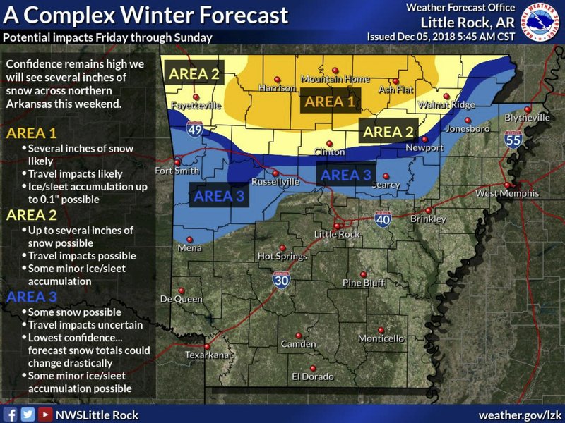
Central parts of northern Arkansas are most likely to see snow, with several inches expected, forecasters said. In the far northeast and northwest corners of the state, up to several inches of snow, along with minor ice and sleet accumulation, is possible, the agency added.
Portions of central and southern Arkansas are expected to see cold rains throughout the weekend, with 3 to 4 inches of rainfall possible. Isolated flash flooding is possible in south Arkansas.
The weather service said drivers in northern Arkansas should expect possible travel difficulties.
Forecasters said the severity of the weather is “heavily dependent” on how quickly rain starts relative to how fast cold air moves into the region from the northeast. If cold air moves in more quickly, freezing rain and snow accumulations will increase, while slower-moving cold air will bring more rain, the weather service said.
“There is a great deal of uncertainty regarding how far south accumulations of wintry weather will make it, because we know for sure that there will be a SHARP cut off from significant accumulations to hardly any at all,” the briefing stated.

EARLIER: Winter storm watch issued for parts of Oklahoma, Texas
OKLAHOMA CITY — A winter storm watch has been issued for parts of Oklahoma and the Texas Panhandle as snow and freezing rain head toward the region.
The winter storm watch is in effect through Saturday night. In Oklahoma, forecasters say 2 to 4 inches of snow is possible along the Interstate 40 corridor. Some areas could see ice accumulations of about three-tenths of an inch, would could cause power outages and tree damage.
In Texas, forecasters say some parts of the Panhandle could see up to 6 inches of snow through Saturday.
The National Weather Service also predicts several inches of snow in northern Arkansas along with heavy rainfall in the southern part of the state during the weekend.