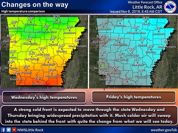
A cold front that will begin moving through Arkansas on Wednesday night is expected to bring rain across much of the state through Thursday, ahead of a second cold front early next week accompanied by a slight chance for rain and snow, forecasters said.
The heaviest rain is predicted in the northwest part of the state, where several inches could fall, according to the National Weather Service.
Forecasters said that widespread severe weather isn’t expected, though isolated thunderstorms are possible across the cold front and some areas will be at risk of flash flooding.
High temperatures are predicted to drop to the 40s for much of Arkansas by Friday before a second cold front moves into the region by early next week, according to the weather service.

Much of Arkansas is forecasted to see below freezing temperatures overnight Monday, with highs reaching the 30s and low 40s by Tuesday. Lows are expected to be in the upper teens to low 30s.
“This will be the coldest air of the season across the state,” said Jeff Hood, a weather service meteorologist.
Hood said forecasters predict a slight chance for rain mixed with snow on Monday. Light rain is expected to fall across most of the state. If snow does fall it’s unlikely to accumulate, according to the weather service.
“Still plenty of uncertainty and we’ll just kind of have to watch as we get closer,” Hood said. “But it will be cold enough.”