4 P.M. UPDATE:
As parts of the state continued under a winter weather advisory set to last until 6 p.m., a state Department of Transportation map showed roads in north and Northwest Arkansas affected by slush and ice patches.
Interstate 49 through Bentonville and Springdale was partly covered in ice patches and light sleet was falling in the area, the map showed. Several highways leading into Harrison were partly covered in slush. South of Fort Smith and west of Clinton, roads appeared clear.
Some schools in the north and northwest part of the state, including University of Arkansas at Fayetteville, ended class early Monday. See a full list of closings at arkansasonline.com/closings/.
The National Weather Service bureau in North Little Rock wrote on Twitter that travel was not expected to be impacted much by the inclement weather, but recommended that drivers be prepared all the same.
Little Rock Mayor Frank Scott Jr. said that the city’s Public Works Department would bring in trucks at 6 p.m. to “address bridges and icy locations overnight as needed.”
The National Weather Service bureau in Memphis said on social media around 3:30 p.m. that northeast Arkansas was seeing sleet.
Check for updates on the Arkansas Democrat-Gazette live traffic map.
— Maggie McNeary
11:52 A.M. UPDATE
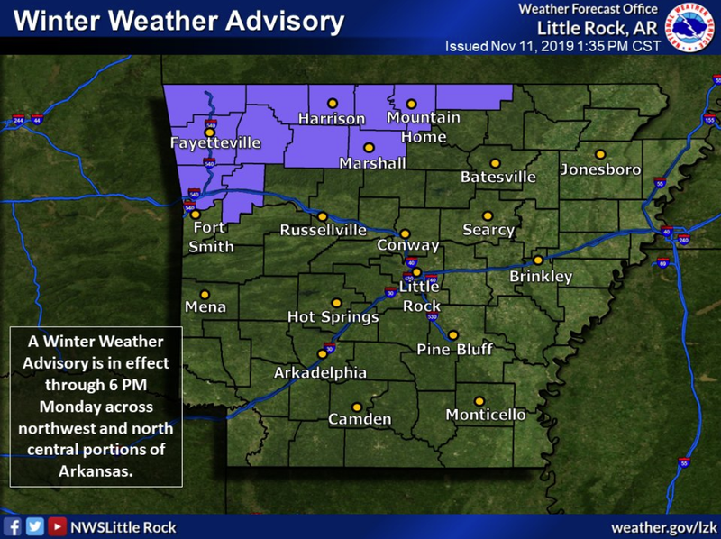
A winter weather advisory is in effect across north and Northwest Arkansas through Monday evening due to light snow accumulations, forecasters said.
Portions of northern Arkansas are predicted to remain near or below freezing from this evening through “at least late Wednesday morning,” a briefing by the National Weather Service states.
EARLIER
A strong cold front moving across Arkansas on Monday is expected to send temperatures plunging by over 30 degrees, bringing with it rain and the possibility of snow, forecasters said.
Forecasters expect sleet to mix into the rain falling near the Missouri border by about noon before the precipitation later transitions into snow, according to the National Weather Service in North Little Rock. The agency predicts up to an inch of snow could accumulate in the northernmost parts of the state.
Across central and southern Arkansas, rain, which could sometimes be heavy, is expected through much of the day, forecasters said. Temperatures will begin falling after noon and then quickly drop during the mid-to-late afternoon.

Rain and snow throughout the state will begin to ease up late this afternoon, the weather service said. Some light snow may fall across parts of central and southern Arkansas at that time, but none is expected to stick.
Forecasters predict strong winds throughout the day and into the evening, with wind gusts reaching over 30 mph.
Tonight and into early Tuesday morning, the weather service expects wind chills will fall into the single digits and teens.
Sunnier weather is predicted for the rest of the week, with highs reaching the 40s and 50s, according to forecasters.
