Extremely cold weather and a wintry mix hit parts of Arkansas late Monday into early Tuesday, breaking records across the state.
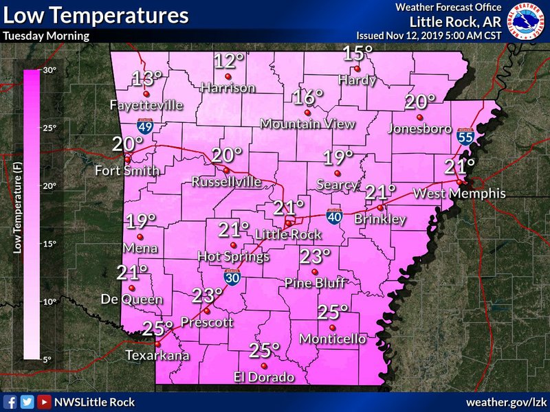
Little Rock broke its daily record low temperature early Tuesday, as the temperature fell to 20 degrees, National Weather Service meteorologist Brian Smith said. The previous record of 22 was set in 1911.
North Little Rock also broke its daily record low, hitting 18 degrees early Tuesday. The previous record of 23 was set in 1976.
Flurries overnight in both cities didn’t leave significant accumulation, Smith said, but even a trace was still enough to set daily records for snowfall.
Colder and snowier weather came Monday and early Tuesday to northern Arkansas.
Smith said Fayetteville broke its daily low record Tuesday by one degree when it hit 9. The last record was set in 1911.
Half an inch of snow fell in Harrison and Corning, he said, and the highest accumulation across the state was recorded in Pocahontas, at 1 inch.
Smith said seeing measurable snow this early in the season is unusual but not unheard of for the region. In Pocahontas, the snowfall was the earliest there at or above one inch since 1993.
Smith said northern Arkansas typically sees its first measurable snowfall in late December.
Smith said many places across Arkansas are likely to get similar or even lower temperatures Wednesday morning.
Smith said it won’t feel as cold, though, because wind chills won’t be as extreme as Tuesday morning.
Highs Wednesday are expected to reach into the 40s, Smith said, much warmer than Tuesday, when most locations are expected to reach only the 30s. Smith said some locations won’t get above freezing.
On Thursday and Friday, temperatures will warm slightly statewide with lows expected in the 20s and 30s and highs in the 40s to mid-50s, Smith said. This is still well below average for this time of year, when daily temperatures usually range from the 40s to the 60s.