Heavy rains moved through the southwest part of the state Wednesday morning and into the afternoon resulted in some evacuations in Texarkana and Dierks, and damaged roads in Sevier and Howard counties, officials said.
Close to 8 inches of rain fell in a few locations before the system moved southward into Louisiana and Texas, officials said.
In Texarkana, 30-40 residents of Sterling Crest Apartments, most of them elderly, had to be evacuated because of high water, said Miller County Office of Emergency Management Director Joe Bennett.
Parts of the city received 7.24 inches of rain Wednesday, said officials with the National Weather Service in Shreveport. The rainfall total broke the former Aug. 12 daily rainfall record of 2.20 inches set in 1966, the weather service reported. It also broke the August daily rainfall record of 4.46 inches set on Aug. 31, 2001.
Firefighters from both sides of the state line, along with Texarkana police and first responders from the Miller County Office of Emergency Management began evacuating residents about 9:30 a.m. Wednesday.
[Video not showing up above? Click here to watch » https://www.youtube.com/watch?v=Qlk-5ASrTZM]
Sterling Crest Apartments is at 915 E. Broad, in a low-lying area near Nix Creek, which officials said is subject to flooding. Bennett said some apartments had as much as 3 feet of water inside.
No injuries were reported.
Fire Chief David Fletcher with the Texarkana Fire Department said a few residents in single-family homes around the city also had to be evacuated because of high water.
"There wasn't any danger, the water didn't get high enough for drowning, but they were stuck and couldn't get out by car," he said. "They either walked out, or we got them out by boat where we could get one on the scene."
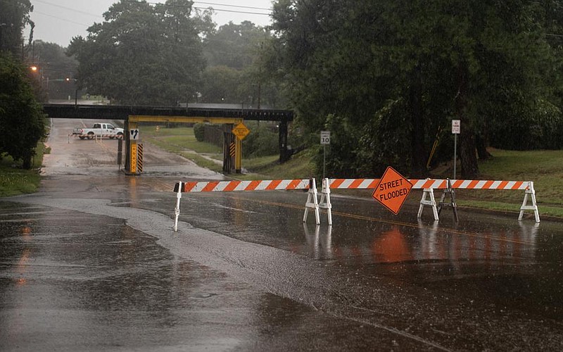
Fletcher said there was also some flooding of underpasses around the city, but it was relatively short-lived.
"The rain came so fast, and it wasn't long after it was over that they were clear," he said of the underpass areas. "They didn't stay flooded very long. We're talking a period of around four to five hours before they were passable again."
Chris Nuttall, a meteorologist with the National Weather Service in Shreveport, said the storm resulted from an upper level disturbance that moved slowly through the area.
"We were expecting some storms to develop, and they kind of congealed into one big complex and didn't move very fast," he said. "As it is we've got a lot of low level moisture and some good southerly winds coming from the Gulf of Mexico so it was able to tap into all of that moisture, and with it not really moving anywhere fast, it just kept pouring a lot of rain onto these few places in a short amount of time."
By Wednesday afternoon, Nuttall said, the system had mostly exited Arkansas and had moved into north Louisiana and east Texas and begun to dissipate.
The highest rainfall total in the area, 7.92 inches, was recorded in Ben Lomand in extreme south Sevier County. County Judge Greg Ray said although the rainfall amount was extreme, he had gotten no reports of evacuations and only minimal damage to roadways.
"I sent my road department out after dinner, and at this time, I've only had reports of a couple of roads with cuts in them, but as far as anything washed out, I haven't heard," Ray told the Arkansas Democrat-Gazette on Wednesday afternoon. "Maybe that one area that got the 8 inches, it may have been an isolated area away from any roads. That's all I can attribute it to."
Ray said the rain began at his house late Tuesday night, and by midnight he had received three-quarters of an inch, which is unusual for this time of year.
"We're usually talking burn bans right now, not flood warnings," he said. "It's crazy. 2020 is going to be a record year, I guess, for everything. I've never seen anything like it."
A few miles to the northeast, the Howard County town of Dierks received more than 7.5 inches of rainfall, Cookie Buice in County Judge Kevin Smith's office said. Water got into a few homes there, but she said there were no injuries and little damage.
"A few people had to get out of their homes but as quickly as the water came up, it went back down again," Buice said. "I think we had some damage to three roads but that was about it."
Other rainfall totals in the area, according to the National Weather Service, were 6.92 inches recorded 2.3 miles south of Ogden, 4.9 inches recorded seven-tenths of a mile south of Nashville, 4.22 inches in Bluff City and 3.53 inches in De Queen.