Two new photo-mapping projects allow viewers to parachute into 19th century downtown Little Rock or walk along a residential section of West Ninth Street around 1960.
On the way, they can see long-gone buildings, from the Marion Hotel to the Duck Quack Inn.
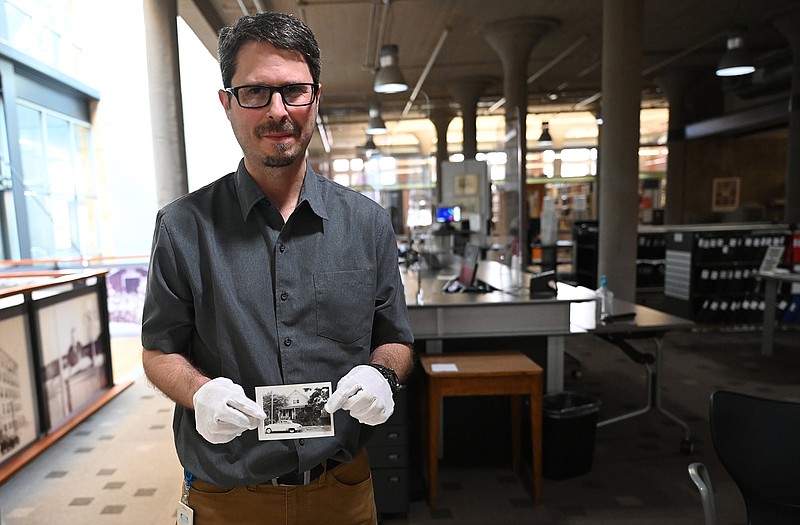
The immersive online projects were done by Brian K. Robertson, manager of the research services division of the Butler Center for Arkansas Studies, which is part of the Central Arkansas Library System.
https://www.arkansasonline.com/125robertslr
“This was kind of an extra side project if you will,” said Robertson. “I thought it was kind of an interesting, cool thing to do, but I’ve just been really overwhelmed with the reactions from people.”
https://www.arkansasonline.com/125roberts9th
Robertson finished the downtown Little Rock project in September and the Lost West Ninth Street earlier this month. He said most of the historic buildings pictured in downtown Little Rock are gone, and all of the old houses along West Ninth Street — from Arch Street to Cross Street — are gone.
The downtown Little Rock project can be viewed at https://robertslibrary.org/mapping-downtown-little-rock/. It includes 130 photographs.
“Images from the Butler Center’s collections are juxtaposed against modern images from Google Earth, resulting in a virtual tour that allows you to see how the downtown landscape has changed over the years,” according to the website.
The online architectural tour focuses on downtown Little Rock’s commercial history, making it clear that the airy landscape of downtown Little Rock was once a dense urban core of buildings. Parking lots occupy many of those spaces today. A recent photo juxtaposed with an aerial view from 1929 shows how much the automobile has affected Arkansas’ capital city.
The earliest images in that mapping project date from near the end of the Civil War, according to the website. The more recent ones document the revitalization and urban renewal that took place in the 1950s and 1960s.
Late 19th century photos in the exhibit show horse-drawn carriages and mule-drawn streetcars on rails in downtown Little Rock. Signs painted on the walls of large buildings advertise the businesses — Dickinson’s Machinery Depot, Gus Blass & Co., Plunkett-Jarrell Grocer Co.
A 1925 photo shows the Mayo Hotel, at the corner of Markham and Cross streets, offering rooms for 50 cents a night.
The Lost West Ninth Street project can be viewed at https://robertslibrary.org/lost-west-ninth-street/.
It includes 50 photographs taken around 1960 along West Ninth Street, from Arch Street to Cross Street.
“For many decades, Little Rock’s West Ninth Street was the heart of the city’s African American community,” according to the website. “’The Line,’ as the street was sometimes known, was home to businesses, churches, fraternal groups and a host of other entities. It also boasted a significant residential population. Unfortunately, by the early 1960s, societal changes, urban renewal and the construction of Interstate 630 were leading to the demise of the once vibrant community.”
The West Ninth Street photographs are arranged sequentially as someone would travel westward along the street, according to the website. None of the structures depicted in the photographs are still standing.
Businesses interspersed with houses along the street include the Duck Quack Inn (a restaurant that specialized in hot dogs and chili), West Ninth Cab Co. and the Glass Front Barber Shop, where haircuts cost 75 cents.
Brian Rodgers, community liaison for the Mosaic Templars Cultural Center, said most retrospectives show the “glitz and glamour” of old Ninth Street — like the Dreamland Ballroom, Gem Theater and Diplomat Club.
“Often when people think about Ninth Street, they think about the business district,” said Rodgers. “What they don’t think about is that people lived on this street.
“That’s the thing about what Brian did that’s so amazing. Showing the houses is the beauty of it. Also, it also shows you what’s gone now.”
Rodgers said it’s interesting to see stores, restaurants and a cab stand interspersed with houses along Ninth Street in the historic photos.
He said many of the buildings on West Ninth Street were demolished to make way for Interstate 630.
“Throughout the South you see the interstates going through these Black business districts,” he said.
Robertson said he hopes to hear from people who have a personal interest in the Ninth Street buildings — perhaps they, a parent or grandparent grew up in one of the houses.
Robertson said he used old city directories and Sanborn fire insurance maps extensively during his research.
Old cars parking along the street also helped him date the images.
“Probably one of my favorite things about my job is doing research on things like that,” he said. “It was a lot of fun. I enjoyed it a lot. One of the things I love about my job is it’s pretty much impossible not to learn something new every day.”