A winter storm that moved into Arkansas on Tuesday night will drop another 6-8 inches of snow on a large area of the state before the precipitation ends Thursday, according to the National Weather Service in North Little Rock.
That's a half-foot of snow on top of almost a foot of snow that fell Monday in some parts of Central Arkansas.
Arctic air pushed temperatures below zero Monday night in some parts of the state, with Fayetteville's Drake Field setting an apparent record of minus-20 degrees, the lowest temperature since weather monitoring began at the airport in 1949.
"What we're seeing in Arkansas is the most severe weather event in my lifetime," Gov. Asa Hutchinson, 70, said Tuesday during his weekly covid-19 media briefing.
"This is plaguing not just our state but also our region, and that makes it even more complicated whenever you have Texas gas shortages, power shortages, Oklahoma as well," Hutchinson said, that affects the supply chain here in Arkansas.
Hutchinson said 18,000 to 20,000 Arkansans were still without electricity early Tuesday afternoon, with Montgomery, Garland and Little River counties being the hardest hit.
"I know the utilities are working hard to get power restored," he said.
Hutchinson said Southwest Power Pool, which controls the supply of energy in part of Arkansas, implemented controlled outages of service at 7 a.m. Tuesday "in order to prevent a larger system failure," but by 10:15 a.m. Tuesday all electric service had been restored and controlled interruptions had ended.
"They will continue to be in an emergency alert status, meaning the system is operating below minimum reserve, and energy conservation remains critical," Hutchinson said.
Hutchinson said there was a regional shortage of natural gas because of cold weather, high demand and some wells being inoperable because of the low temperatures.
"This has impacted both customers at the industrial level as well as some residential levels," he said.
As temperatures rise, the thaw should help alleviate the shortages, Hutchinson said. After high temperatures in the teens Tuesday, across Arkansas highs were forecast to be in the 20s today and the 20s or 30s Thursday. It will get a little warmer Friday, and temperatures are forecast to be around 40 degrees Saturday.
At the peak, Arkansas' 17 local-level electric cooperatives had about 14,000 outages Tuesday morning, said Rob Roedel, a spokesman for the Electric Cooperatives of Arkansas, which has more than 500,000 customers in Arkansas and surrounding states. By 5:30 p.m. Tuesday, the cooperatives had reduced the total number of outages to about 20, he said.
[LIST: School closings » arkansasonline.com/closings/]
About 10,000 of Entergy Arkansas' 715,000 customers were without power at the peak of its outages Tuesday, said Brandi Hinkle, a spokeswoman for the utility. She said only about 250 Entergy Arkansas customers were still without power at 7 p.m. Tuesday.
Hutchinson said 100 guardsmen have been deployed across the state.
"As a result of this weather emergency, I have extended the National Guard deployment through Friday," he said.
In a briefing late Tuesday afternoon, the National Weather Service said the snow likely would occur today north of Interstate 30 from Texarkana to Little Rock and Interstate 40 from Little Rock to Memphis.
The precipitation will be a sleet and snow mix a little farther south, including at Pine Bluff and Stuttgart, according to the forecast. South from there, the rest of Arkansas likely will have a mix today of freezing rain, sleet and snow.
The heaviest snowfall from Tuesday through Thursday -- 6-8 inches -- will be along a diagonal line through the state, from De Queen and Prescott in southwest Arkansas, northeast through Little Rock, Conway, Hot Springs, Searcy, Brinkley, Jonesboro and West Memphis, according to the forecast.
Areas outside that area, including Pine Bluff, Fort Smith, Mena, Russellville, Texarkana and Mountain Home, will receive 4-6 inches of snow, according to the National Weather Service.
Much of Northwest Arkansas, including Harrison, will receive 3-4 inches, but the total could be 4-6 inches in parts of Benton, Washington and Madison counties, according to the forecast.
Southeast Arkansas could get 3-4 inches of precipitation, and that could translate to ice on roads tonight.
It won't be quite as cold as it was earlier this week. Lows tonight are forecast to be in the teens instead of the single digits.
Jeff Hood, a meteorologist with the National Weather Service in North Little Rock, said people seemed to heed the weather warnings last weekend and stayed home. The long weekend included two holidays, Valentine's Day and Washington's Birthday, so many people stocked up on essentials and had Monday off work.
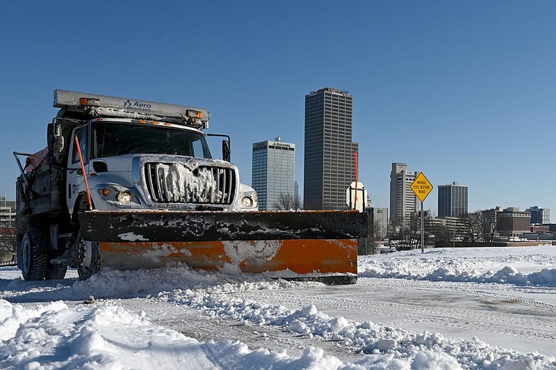
Dave Parker, a spokesman for the Arkansas Department of Transportation, said workers Tuesday were plowing main highways down to 1-2 inches of snow, then applying rock salt or brine to facilitate melting. Then the crews could shift attention to secondary roads, he said.
"That allows us to use our resources wisely," Parker said.
He said the storm that began last night is the third round of winter weather in a week. An ice storm caused problems last Thursday, then a snowstorm hit Monday.
"This may be the biggest punch of all," Parker said early Tuesday afternoon. "To throw everything down at it today just doesn't make sense because we're going to be at it again in 10 hours."
Parker said the powdery snow that fell Monday was easier for motorists to drive in than ice is.
"Ice is just a totally different game," he said. "You can't drive on ice. You can drive in this stuff."
But, he noted, the snow that melts on roads during the day will likely refreeze at night causing more hazardous driving conditions.