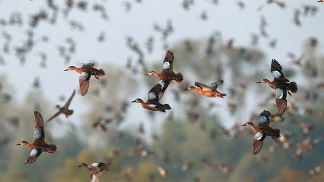
Finding ducks is harder this season than in recent years, but it hasn't slowed the demand for space at Steve N. Wilson Raft Creek Bottoms Wildlife Management Area near Searcy. More hunters are also applying for hunting spots in the Arkansas Waterfowl Rice Incentive Conservation Enhancement program.
Raft Creek Bottoms has an online draw for duck holes and an in-person draw on Saturdays and Sundays. On Tuesdays and Thursdays, users merely show up and grab a permit at a visitor kiosk and return the permit after the hunt. The youth blind, moblitiy-impaired blind and Magellan Tract are drawn online for those days, as well.
Saturday's crowd at the in-person draw greatly exceeded the availability of hunting holes, and while the crowd was smaller Sunday, demand for space still exceeded supply.
Of course, the AGFC manages many other areas that don't require winning a draw to hunt, such as Henry Gray Hurricane Lake WMA and parts of Sheffield Nelson Dagmar WMA. Rex Hancock Black Swamp WMA in the Cache River area also has plenty of water now for good duck habitat and hunting.
Public hunting land in southwest Arkansas, particularly at Ozan WMA, has gotten a boost in habitat thanks to recent rainfall, but there are no ducks on the area.
In the Arkansas River Valley area, AGFC biologist Alex Zachary said that duck use at Ed Gordon Point Remove WMA has been low to moderate, and hunter success has been poor.
On Saturday and Sunday, 23 applicants tried for the Franklin Co. Alix Field in the AGFC's WRICE draw for weekend hunting. That same weekend saw a season high of 273 applicants for the 40-plus WRICE fields available. The Arkansas Waterfowl Rice Incentive Conservation Enhancement program, in which landowners enroll rice acreage that is not tilled over to create waterfowl habitat, allows hunters to apply online for a weekend private rice field hunt. The two most popular fields in terms of applicants this year are near Slovak and Georgetown. Twenty-four applicants sought the Georgetown field and 17 tried for Slovak. To see the total number of applicants for the fields through the season, visit https://www.agfc.com/en/hunting/migratory-birds/waterfowl/special-waterfowl-permit-hunts/ and click on 2020-21 WRICE Weekly Application Numbers.
Applications for the permit draw to the WRICE fields, or weekend hunts at Steve N. Wilson Raft Creek Bottoms WMA, Red Cut Slough in Cypress Bayou WMA or the Conway George Tracts at Dagmar next weekend (Jan. 23-24) are available from noon Thursday to midnight Sunday. WRICE fields, unlike WMA permits, allow for two full days of hunting for the applicant selected for a field, and the hunting party can consist of up to four hunters. Permit winners are notified Monday following the close of the application period. The cost to apply for any permit in the draw is $5.
Arkansas' regular waterfowl season continues uninterrupted to its close at sunset Jan. 31.
*Water levels listed in this report were taken Monday and do not reflect any rainfall Tuesday and Wednesday.
NORTHEAST ARKANSAS
BIG LAKE WMA
North Woods GTR Mast production is good. The Bo Dock gauge currently reads 236.9. Target level is 235.7 with 100% flooded.
South Woods GTR Mast production is fair. The 7-mile gauge is currently at 236.1 feet. Target level is 234.5 feet with 100% flooded.
Simmons Field A good amount of millet and sedge is present. Seed production is very good in the North Unit, Middle and South fields. North field contains 5 acres of millet. 100% flooded.
DAVE DONALDSON BLACK RIVER WMA
Upper Island GTR Moderate mast crop. Water level is 269.55. Target level is 269.5. 100% flooded.
Lower Island GTR Moderate mast crop. Water level is 268.7. Target level is 268.5. 100% flooded.
Upper Reyno GTR Moderate mast crop. Water level is 267.6. Target level is 266.9. 100% flooded.
Lower Reyno GTR Moderate mast crop. Water level is 266.95. Target level is 266.3. 100% flooded.
Winchester GTR Moderate mast crop. Target level is 263.75.
EARL BUSS BAYOU DEVIEW WMA
South Oliver GTR Mast production has been good. The area is 50% flooded with a current gauge reading of 1.75 foot. Water is rising in the GTR.
Thompson Tract GTR Mast production has been good. The area is 100% flooded with a current gauge reading of 1.45 feet.
Lake Hogue WRA Primarily deep open water habitat. Normal pool level.
SHIREY BAY RAINEY BRAKE WMA
Adam Brake GTR Good mast crop. Water level is 240. 100% flooded.
Rainey Brake GTR Good mast crop. 100% flooded.
Eagle Pond GTR Good mast crop. 100% flooded.
Phase III Moist-Soil Unit Good wetland-type vegetation. 85% flooded.
Charles Crisp Moist-Soil Unit Good wetland-type vegetation. 950% flooded.
Ward Field Moist-Soil Unit Good wetland-type vegetation. 100% flooded.
River Field Moist-Soil Unit Good wetland-type vegetation. 100% flooded.
ST. FRANCIS SUNKEN LANDS WMA
Hunt Area Mast production is good. Water levels in the huntable areas are dependent on the St. Francis River. The water level at Oak Donnick is 212.16. The level for huntable timber is 212.
Snowden WRA Mixed grasses are present. 10% flooded.
Payneway WRA Pools A,B, C, and D have mixed smartweed and barnyard grasses, Moderate mast in Pools A,B, and C. Pool A is at 5%. Pool B is at 5%. Pool C is at 5% and Pool D is at 20%.
EAST CENTRAL ARKANSAS
HENRY GRAY HURRICANE LAKE WMA
North GTR Good mast crop. Glaise Creek gauge at 193.43. Full pool.
South GTR Fair mast crop. Glaise Creek gauge at 193.43. Full pool.
REX HANCOCK BLACK SWAMP WMA
Gregory GTR Good mast crop. 100 percent flooded.
Wyeville Unit Good stand of millet and native vegetation. 100% coverage.
SHEFFIELD NELSON DAGMAR WMA
Mud Slough GTR Good mast crop. 50% flooded.
Apple Lake WRA Good mast crop. 70% flooded.
Conway George Waterfowl Unit A Good millet and native vegetation. 100% flooded.
Conway George Waterfowl Unit B Natural slough area with beneficial wetland plants. 100% flooded.
Conway George Waterfowl Unit C Good stand of millet and native vegetation. 100% flooded.
STEVE N. WILSON RAFT CREEK BOTTOMS WMA
NOTE Raft Creek Bottoms WMA is open to waterfowl hunting Tuesday, Thursday, Saturday and Sunday only. Saturday and Sunday hunting has both in-person draws and an online permit draw via www.agfc.com. On Tuesday and Thursday, permits need to be picked up before hunting and returned to the permit box kiosk after the hunt. The Youth blind, Mobility-Impaired blind and the Magellan Tract are available Tuesday, Thursday, Saturday and Sunday by online draw. Online draws for other weekend duck holes are held the Thursday-Sunday before the week of hunt.
Unit A Excellent stand of native vegetation. 100% flooded.
Unit B Excellent stand of millet and native vegetation. 100% flooded.
Unit C Good stand of native vegetation. 100% flooded.
Unit D (Youth Area) Good stand of native vegetation. 100% flooded.
Unit E Excellent stand of millet and native vegetation. 100% flooded.
Unit F Good stand of millet and native vegetation. 100% flooded.
Unit G Fair stand of millet and native vegetation. 100% flooded.
Unit H (Mobility-impaired blind) Excellent stand of native vegetation. 100% flooded.
Unit I Poor stand of native vegetation. 100% flooded.
Unit J (Cypert Tract) Excellent stand of native vegetation. 100% flooded.
Unit K (Cypert Tract) Excellent stand of native vegetation. 90% flooded.
Unit L (Cypert Tract) Fair stand of native vegetation. 50% flooded.
Unit M (Magellan Tract) Fair stand of native vegetation. 100% flooded.
CENTRAL ARKANSAS
CRAIG D. CAMPBELL LAKE CONWAY RESERVOIR
Habitat and water levels are normal on both Pierce and Dix creeks.
BELL SLOUGH WMA
Bell Slough GTR Poor to moderate mast crop. 100% flooded.
Palarm Creek WRA Natural vegetation and planted millet. 85% flooded.
CYPRESS BAYOU WMA
Hunt Area Good mast crop. 100% flooded.
Red Cut Slough Tract Unit 1 Good stand of millet and native vegetation. Water level 75%.
Unit 2 Excellent stand of millet and native vegetation. Water level 100%.
Unit 3 Good stand of millet and native vegetation. Water level 100%.
Unit 4 Good stand of native vegetation. Water level 100%.
Unit 5 Good stand of native vegetation. Water level 40%.
Unit 6 Good stand of native vegetation. Water level 30%.
HARRIS BRAKE WMA
Harris Brake Upper Unit Average mast in the GTR. 100% flooded.
Harris Brake Lower Unit Average mast in the GTR. 95% flooded.
HOLLAND BOTTOMS WMA
WRA Moist Soil Unit (East/West) Excellent conditions. 45% flooded.
Lake Pickthorne WRA Excellent conditions. East cell 100% flooded. West Cell is 100% flooded.
SOUTHWEST ARKANSAS
DR. LESTER SITZES III BOIS D' ARC WMA
Bois d'Arc Lake WRA Closed to hunting. Normal.
Red Slough WRA Closed to hunting. Water level 90%.
GTR Good mast production. Water level 100%.
Little Grassy Habitat is good. Water level 100%.
MILLWOOD LAKE Habitat is good. Water level 261.51.
OZAN WMA
Unit 1 Habitat good. 70% flooded.
Unit 2 Habitat good. 60% flooded.
Unit 3 Habitat good. 60% flooded.
Unit 4 Habitat good. 75% flooded.
Unit 5 Habitat good. 90% flooded.
SULPHUR RIVER WMA
Mercer Bayou Habitat conditions are fair. 100% flooded.
Henry Moore WRA Closed to hunting. 100% flooded.
SOUTHEAST ARKANSAS
BERYL ANTHONY LOWER OUACHITA WMA The WMA has good hard mast production. The only water on the WMA currently is in the sloughs and in the oxbow lakes. Clear Lake Road is closed to all vehicular access, including ATVs.
FREDDIE BLACK CHOCTAW ISLAND WMA DEER RESEARCH AREA Habitat conditions are good. There is variable flooding associated with the Mississippi River. Use extreme caution when boating on the river.
TRUSTEN HOLDER Habitat conditions good. Flooding is river dependent.
SEVEN DEVILS SWAMP WMA Habitat conditions good. 129.8. Fully flooded.
CUT-OFF CREEK WMA
Hunt Area Habitat conditions are good. Gauge is at 128.8 ft. Water is excessively high.
Pigeon Creek WRA Habitat conditions are good. Fully flooded.
BAYOU METO WMA
Upper Vallier GTR Good habitat. Water level 180.46 feet, full pool at 180 feet.
Lower Vallier GTR Good habitat. Water level 179.27 feet, full pool at 179 feet.
Government Cypress GTR Good habitat. Water level 180.25 feet, full pool at 179 feet.
Buckingham Flats GTR Good habitat. 176.73 msl. First phase of pumping completed.
Temple Island GTR Good habitat. Water level 190.
Canon Brake Good habitat.176.93 msl. Full pool at 177 msl.
Halowell WRA Excellent habitat. Staggered flooding of units.
Wrape Plantation WRA Excellent habitat. Staggered flooding of units.
NORTHWEST ARKANSAS
DARDANELLE WMA
McKennon Bottoms 8 acres of native millet. 24 acres of fallow ground. 100% flooded.
Potter's Pothole Hartman Waterfowl Unit Good stand of native vegetation. 100% flooded.
OZARK POOL
Dyer Lake Cells Fair stand of nutsedge and toothcup smartweed, and sprangle top. Units 1 and 2 are 100% flooded. Unit 3 south cell is 75% flooded. West cell 0%.
NIMROD LLOYD MILLWOOD WMA
Nimrod GTR Poor mast crop and desirable native vegetation. 100% flooded.
ED GORDON POINT REMOVE WMA
Little Hole (Unit 1) Natural vegetation. 100% flooded.
Willow Island Natural vegetation. 100% flooded.
Red Gate Native vegetation and Japanese millet. 100% flooded.
Pig Trough (Units 4 and 5) Native vegetation. 95% flooded.
Cedar Ridge (Unit 6) Natural vegetation. 95% flooded.
Unit 7A Japanese millet. 100% flooded.
Unit 7B Natural vegetation. 85% flooded.
Unit 8A Natural vegetation. 100% flooded.
Unit 8B Native vegetation. 100% flooded.
Unit 8C Native vegetation. 100% flooded.
Unit 9 Japanese millet. 100% flooded.
Controversy Corner (Unit 10) Natural vegetation and Japanese millet. 100% flooded.
Remmel Marsh Native vegetation Japanese millet. 100% flooded.
Mud Pond (Unit 12) Natural vegetation. 100% flooded.
Turkey Pond (Unit 13A) Natural vegetation and Japanese millet. 100% flooded.
Turkey Pond (Unit 13B) Natural vegetation. 85% flooded.
Turkey Pond (Unit 13C) Japanese millet. 100% flooded.
Teeny Pond (Unit 14) Natural vegetation and Japanese millet. 90% flooded.
Salt Lick (Unit 15) Japanese millet. Water level 100%.
Bobby's Pond (Unit 16) Japanese millet. 100% flooded.
Race Track (Unit 17) Japanese millet. 100% flooded.
FROG BAYOU WMA
Unit 1 Sprangle top, wild millet, smartweed, nutsedge and Japanese millet. 100% flooded.
Unit 2 Good stand of barnyard grass and nutsedge. 100% flooded.
Unit 3 Smartweed, toothcup, nutsedge, barnyard grass, sprangle top and duck potato. 80% flooded.
Unit 4 Barnyard grass, sprangle top, annual smartweed, nutsedge and crabgrass. 100% flooded.
Unit 5 Sprangle top, wild millet, smartweed, knotgrass, nutsedge and duck potato. 100% flooded.
Unit 6 Barnyard grass, smartweed, crabgrass and sprangle top. 90% flooded and pumping.
Unit 7 Excellent stand of barnyard grass, sprangle top and smartweed. 100% flooded.
GALLA CREEK WMA
Galla Creek GTR Moderate stand of native vegetation and millet, including a mixture of barnyard grass and sprangle top. 100% flooded.
PETIT JEAN RIVER WMA
Santa Fe GTR Poor mast crop. 100% flooded.
Sore-Head Moist Soil Unit Moderate to excellent stands of desirable native vegetation throughout. 100% flooded.
Slaty Crossing Moist-Soil Unit Due to ongoing waterfowl habitat enhancement projects, this unit did not grow a desirable native vegetation crop this year. Only about half of the unit produced a crop of millet, but the areas that did produce look amazing. 100% flooded.
Black Lands Moist-Soil Unit Excellent stand of desirable native vegetation throughout. Poor mast crop in the wooded areas. 100% flooded.
Black Lands Duck Area Poor mast in the wooded sections. Moderate to great stands of desirable native vegetation mixed throughout. 100% flooded.
Pullen Pond Due to ongoing waterfowl habitat enhancement projects, parts of the northeastern sections of this area are bare ground. Other parts of this area have spotted sections of great desirable native vegetation. The desirable native vegetation has started to become more and more prevalent with each year of ongoing management work. Water level 100%.
Pond Creek GTR Poor mast crop with good stands of desirable native vegetation in the open lands. 100% flooded.
Slaty GTR Poor mast crop. 15% flooded.
Blacklands Duck Area Millet, native vegetation. 100% flooded.