A few rounds of thunderstorms are expected to develop Wednesday night into Thursday, with some storms expected to be severe, according to the National Weather Service.
Hazards on Wednesday include hail up to the size of a golf ball, winds reaching up to 60 mph and a “very low” potential for tornados, the briefing states. On Thursday, wind speeds are predicted to reach as high as 80 mph, and the chance for tornadoes is expected to increase to “low.”
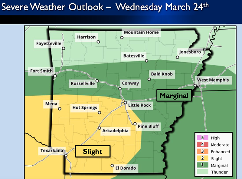
Wednesday night, the greatest potential for strong and severe storms exists over southwestern portions of the state, a briefing provided Wednesday by the National Weather Service shows. Central Arkansas is at a marginal risk of experiencing hazards for much of Wednesday, according to the briefing.
Meteorologist Joe Goudsward said the risk is expected to increase to slight for the Little Rock area Wednesday night.
Thursday, thunderstorm coverage is likely to be greater over Central, eastern and southeastern parts of the state, according to the National Weather Service.
Forecasters said Little Rock is expected to be at a slight risk for experiencing severe weather on Thursday. Eastern Arkansas is listed at an enhanced risk, according to the briefing.
