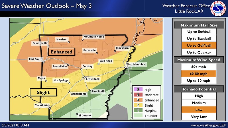
A chance for severe weather exists for most of the state overnight Monday, including winds up to 80 mph, golf-ball sized hail and a chance for tornadoes, according to the National Weather Service.
Severe storms will be most likely in areas north and west of Little Rock beginning around 6 p.m., a Monday morning briefing from the weather service states. Much of northern Arkansas is at an “enhanced” risk for weather hazards, while Central Arkansas is at a ”slight” risk, according to the briefing.
Forecasters said storms will move across the northwest half of the state into Tuesday morning.
[ARKANSAS WEATHER: Hourly forecast + weather radar » arkansasonline.com/radar]
Highs of 80 to 90 degrees are expected, the weather service said, with some heavy rainfall possible through Tuesday.
Little Rock is expected to see up to an inch of rain, while parts of northeast Arkansas are forecast to receive as much as 1.5 inches, according to the weather service.
