Much of Arkansas will have the potential for strong to severe storms Sunday afternoon, with the possibility of flash flooding in southeastern areas of the state, according to the National Weather Service.
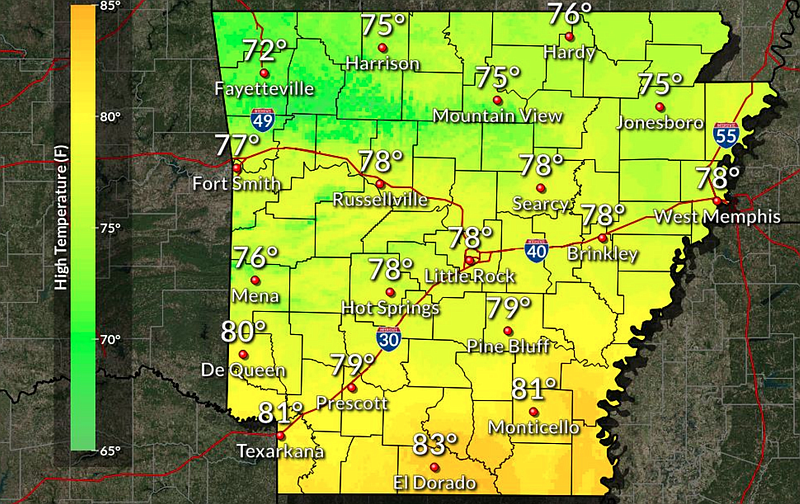
Temperatures Sunday are expected to reach highs in the upper 70s to lower 80s, forecasts show.
Heavy rainfall and additional flash flooding is possible. Weather disturbances will likely bring heavy rain through Wednesday, according to a Friday morning briefing from the weather service.
River flooding is expected to persist throughout the month along portions of the lower White, Black, Cache and Ouachita rivers, the briefing states.
A cold front is expected to move through the state on Sunday, then move south of the state by Monday, forecasters said.
A majority of the state is considered at “slight risk” for severe weather hazards, including hail up to the size of a quarter and winds up to 60 miles per hour, forecasts show. The areas around Harrison and Fort Smith in north and Northwest Arkansas are considered at “marginal risk” for storms, a level below “slight risk.”
North Arkansas can expect to see up to an inch of rain through Thursday, while Central Arkansas may see as much as 3 inches, forecasts show. Southern portions of the state may see anywhere from 3 to 6 inches of rain through Thursday, according to the National Weather Service.