Before the U.S. Army Corps of Engineers built the McClellan-Kerr Navigation System (from 1963-1971), it was sometimes possible to cross the Arkansas River by foot — by dodging the snakes, 15-foot brush and deposits of what Otus the Head Cat called carnivorous sand.
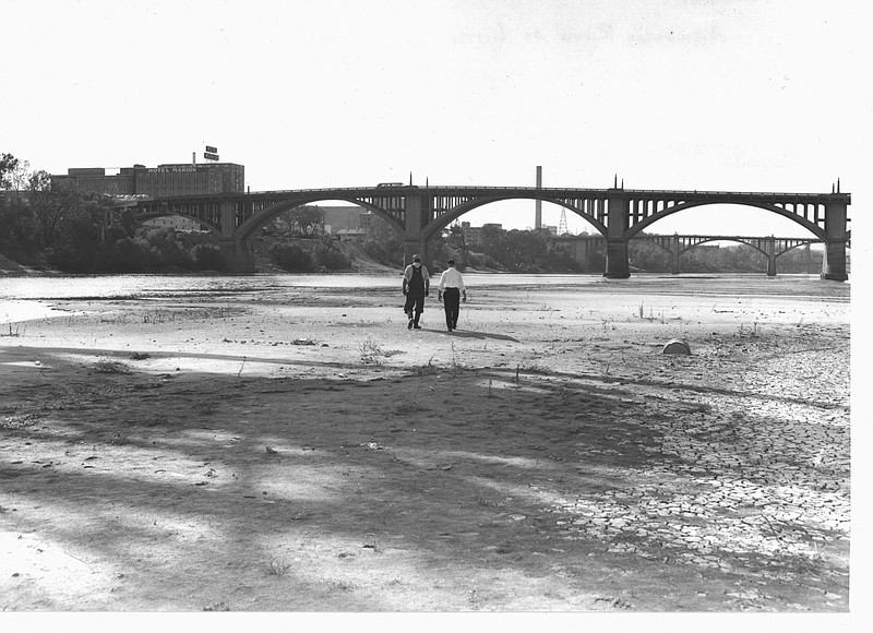
The river shrank often from July 1949 to September 1957. According to the U.S. Drought Monitor, the 1950s drought ranks among the three worst in American history (see arkansasonline.com/822dry). And in September 1956, the Arkansas minimized itself to a historic extent.
On Sept. 12 that year, the Arkansas Gazette reported that at Little Rock the river was "4.5 feet below zero," the lowest since 1872. Later that week it was 4.6 feet below. "The zero figure doesn't indicate the river's actual depth," the newspaper noted. "It's merely an arbitrary figure used to determine river stage readings, and at Little Rock it is 223.61 feet above sea level."
That week, a prisoner escaped from the Cummins Unit by running across the river at Pine Bluff. And Sen. Mike Monroney, D-Okla., joked that instead of building locks and dams it would be cheaper to pave the river.
Because of its shifting bed, depth varied at any given point; on Sept. 16, the river was still considered navigable for light draft boats, but barge traffic was at a standstill.
Our Town columnist Richard Allin wrote that the U.S. Weather Bureau called the Main Street Bridge daily to check the river stage. "There is a special telephone number for a small house down on the river bank," Allin wrote, quoting James F. Rink of the bureau. "When the phone rings there a mechanical apparatus takes over and buzzes signals to the Weather Bureau.
"'Now and then the phone number gets out some way and people use it to play tricks on their friends,' Rink said. 'When the connection is first made it sounds like Inner Sanctum down there. Once people learn the number we have to get a new one.'"
The regional drought broke with a vengeance in 1957, with massive storms in April, May and June.