The soothing sound of nighttime rain on the roof means the first shafts of morning light will shine on waterfalls tumbling loud and proud across the land.
Heavy rain the first week of May created perfect conditions for lacing up the waterproof footwear, packing a picnic lunch and heading out for an Ozarks waterfall safari.
Hiking is a sure fire way to get to dozens, perhaps hundreds, of waterfalls in the region that come to life after a downpour. Yet there are plenty to see without even getting out of the car, or reached via a short walk.
Another name for the Mulberry River Road Scenic Byway after a big rain might be Arkansas Waterfall Avenue. Tall cascades fall in shimmering sheets from cliffs beside the paved, two-lane route, which is Arkansas 215 between Cass and Oark. The byway runs 18 miles between Arkansas 23 near Cass and Arkansas 103 at Oark.
A trio of waterfall hunters May 6 found every tiny stream, creek and waterfall pouring along the byway two days after six or more inches of rain drenched the Ozarks and River Valley.
Teamwork led to discovery of three big waterfalls up to 70 feet tall. It took a designated driver to keep an eye on the road while two passengers served as waterfall lookouts.
The challenge of waterfall hunting in May is that leaves are starting to hide these waterfall gems from view. The best conditions are in winter and early spring when the trees are bare or just starting to bud.
It wasn't the group's first waterfall rodeo along the Mulberry River Road Scenic Byway. They'd traveled it in every season and had a good idea where to find some dandy cascades.
With car windows down, they heard the first waterfall before they saw it. Parking at the nearby High Bank canoe access along the Mulberry River was in order for a short walk to the waterfall.
Through the greenery, a 50-footer spilled down a rock face with steps like rungs of a ladder. The show was stunning enough from the road, but a walk of about 30 yards took the hunters to the base of the waterfall for an up-close view.
High Bank canoe access is close to another waterfall that's the tallest on the byway. That's the High Bank waterfall, with two cascades that fall 70 feet side by side as two silvery, shimmering curtains.
The High Bank twin waterfall takes a bit of hiking to see. From the High Bank canoe access, walk east along the highway about 50 yards. Here there is a small asphalt parking spot that will hold a couple of cars. The trail is across the pavement from this pull-off spot.
It's a rocky ankle-sprainer of hike of about 100 yards along a creek, but the reward is worth the trek. High Bank flowed fast and full this May morning, so much that it created its own misty breeze. The double waterfall splashes down into an oval lagoon. From there the clear water continues its downhill journey.
The two waterfalls already seen would make anyone's waterfall safari, but one of the hunters feared we were missing out on another cascade as stunning as High Bank -- if he could just find it.
As the designated driver steered slowly along, the lookout's keen eyes detected threads of silver through the green leaves. If this waterfall doesn't have a name, it should. It's in the same league as High Bank, but closer to the highway. The safari trio braved a hike through tall grass and a damp forest of rocks and roots for 30 yards.
If they'd wanted a cold shower, they could've basked here in the waterfall's splash. Not only that, a little uphill clamoring gets hikers behind this waterfall for a different perspective.
Most Ozarks waterfalls are rainfall dependent. May usually marks the tail end of waterfall hunting season. Yet anytime a rain gauge fills to the brim, the waterfalls flow.
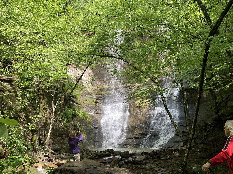
 A multi-tiered waterfall tumbles close to the highway May 6 2022 along the Mulberry River Road Scenic Byway while Tom and Karen Mowry admire the flow. Heavy rain the first week of May got cascades flowing across the region creating ideal conditions for waterfall hikes. Large and small waterfalls flow along the scenic byway, which is Arkansas 215, after ample rainfall. (NWA Democrat-Gazette/Flip Putthoff)
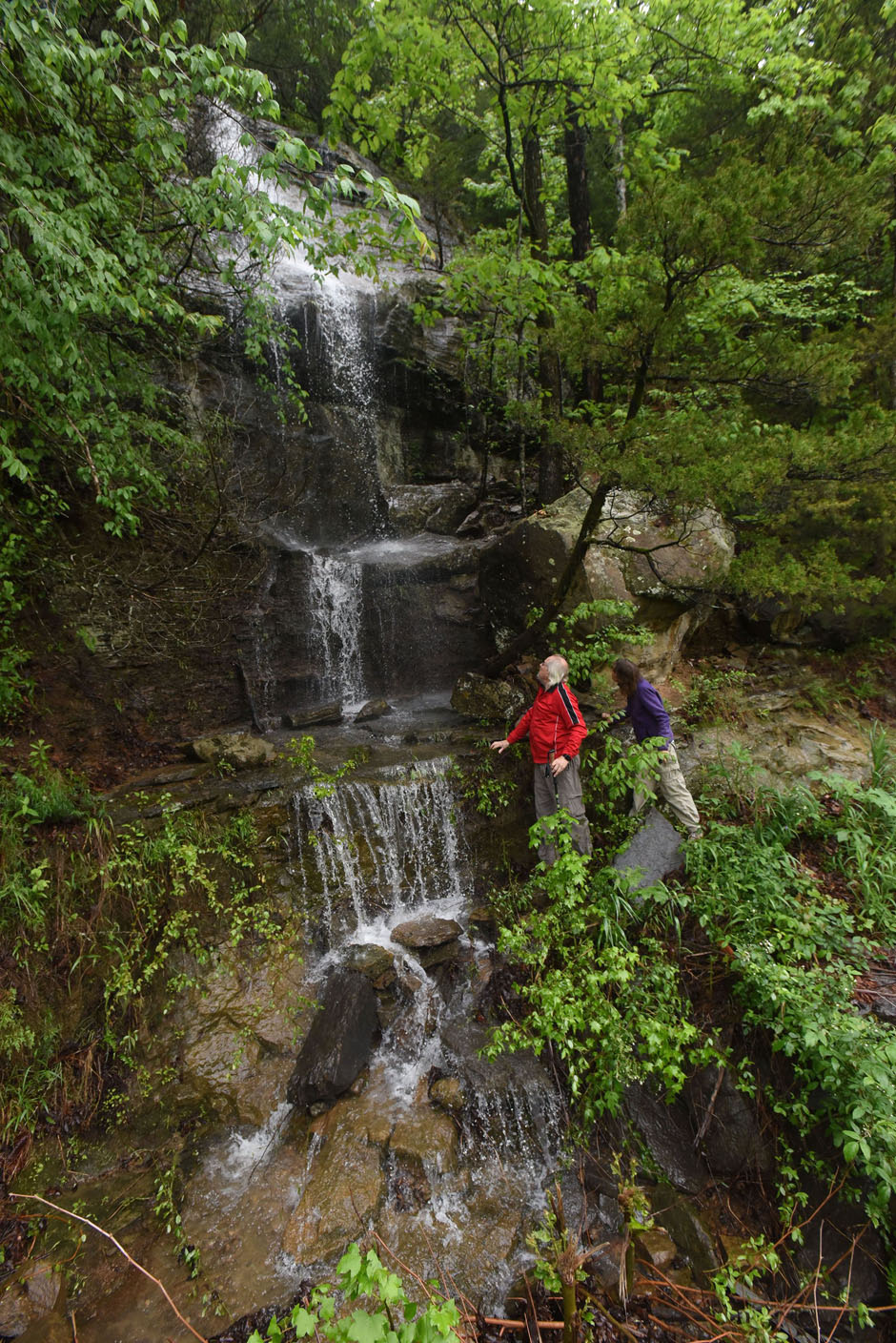
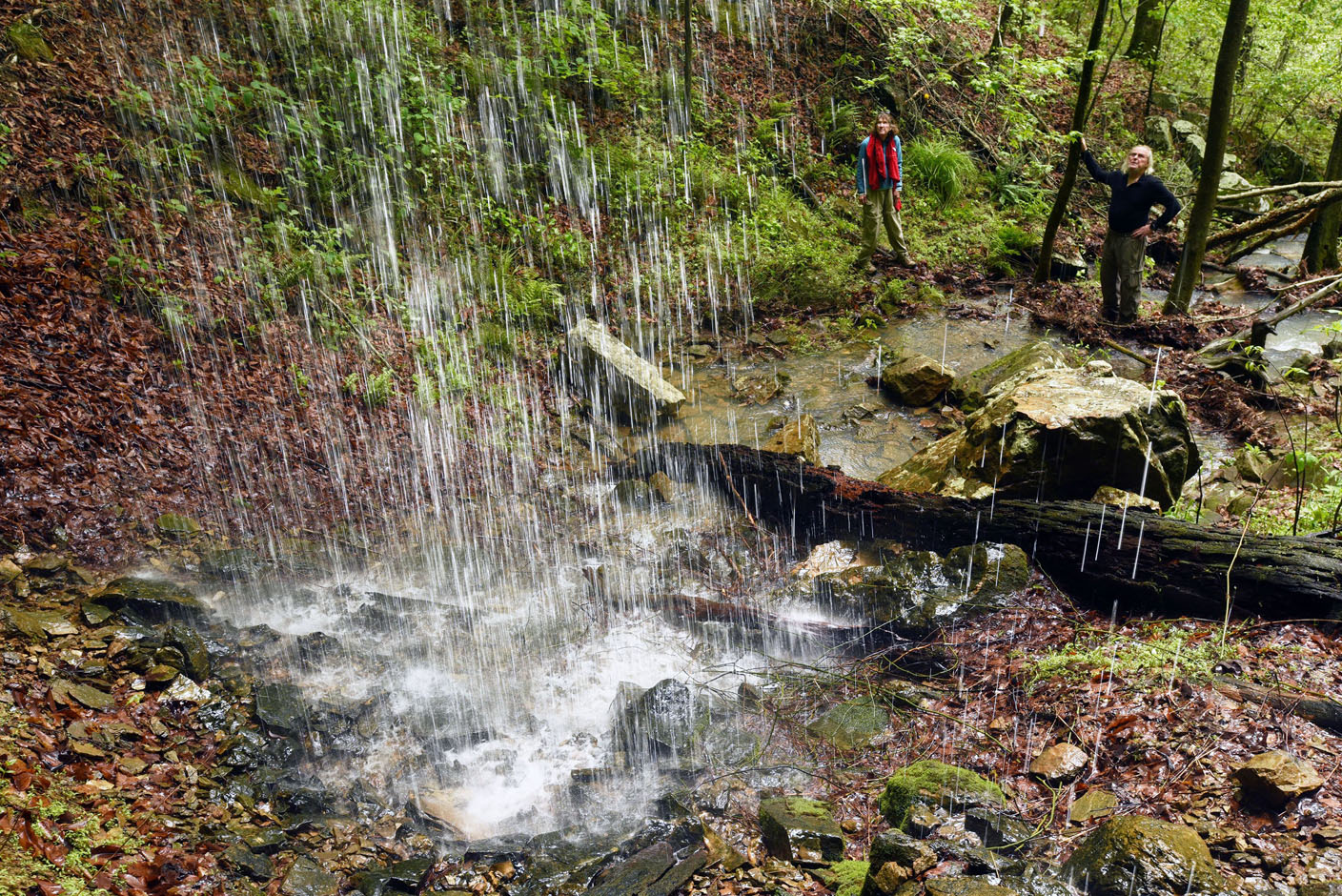 This waterfall is only 30 yards from the highway. It lets waterfall hikers clamor behind the cascade while Karen and Tom Mowry gaze at the base of the cascade. (NWA Democrat-Gazette/Flip Putthoff)
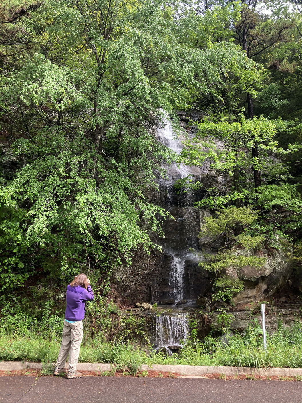 Waterfalls can be seen from the highway along the Mulberry River Road Scenic Byway. The byway is Arkansas 215 in Franklin and Johnson counties. (NWA Democrat-Gazette/Flip Putthoff)
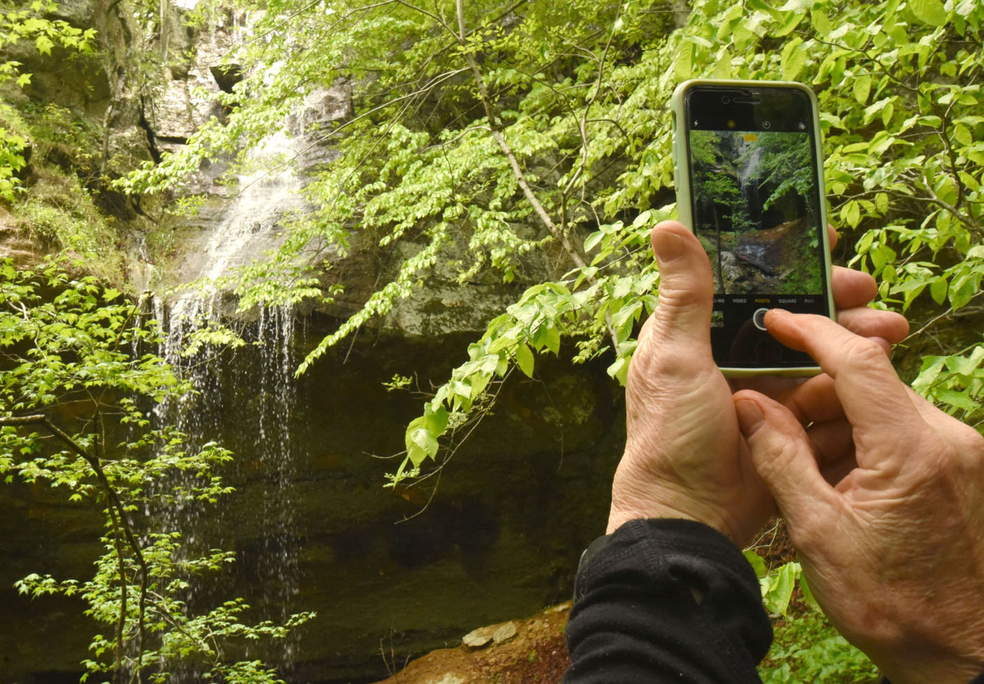 Waterfall wanderers left only foot prints and took only pictures along the Mulberry River Road Scenic Byway. (NWA Democrat-Gazette/Flip Putthoff)
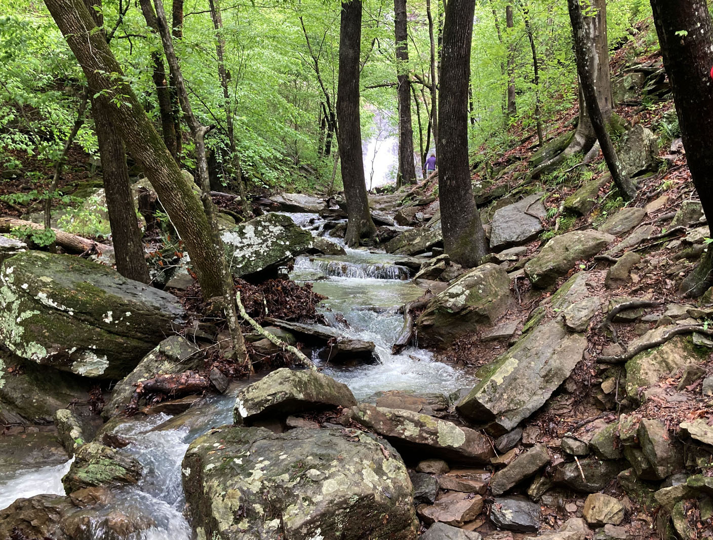 A short but fairly rugged hike along a creekside trail leads to High Bank waterfall. (NWA Democrat-Gazette/Flip Putthoff)
More News
NoneBeauty beyond the byway
The eastern end of the Mulberry River Road Scenic Byway is at its junction with Arkansas 103 near Oark, but there’s more beauty to see. Drive south on Arkansas 103 toward Clarksville to see more waterfalls, lush forest complete with hairpin switchbacks in spots.
Source: Staff report