Northwest Arkansas residents can expect to see snowfall Monday evening, according to the latest forecast from the National Weather Service in Tulsa.
The weather service issued a winter weather advisory for counties along the Arkansas-Oklahoma border from 3 p.m. to midnight. The forecast projects rain showers to transition into snow around 6 p.m. in Fayetteville and continue throughout the night.
The latest information shows the chance for 1/2- 2 inches of possible accumulation. The temperature is expected to remain in the 30-35 degree range during the snow, which will create slushy roadways.
Streets in Northwest Arkansas are not expected to freeze overnight.
In Fort Smith, snow is likely, mainly before 9 p.m. with a low around 35. Snow accumulation of less than a half inch is possible, according to the weather service.
Temperatures will dip into the mid-30s overnight, and roads could be icy on elevated surfaces.
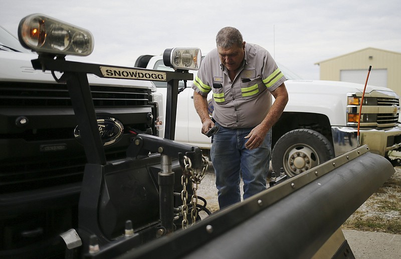
In Benton County, road crews are preparing to treat icy and snow covered roads, said Melody Kwok, a county spokeswoman. Crews have the fast mover trucks loaded with the plows and ready to go as needed, Kwok said.
“We have notified all our crews that they are on standby tonight,” she said. “We will likely have several crews come in early in the morning to load up and head out with the plows and salt and sand mixture.”
Crews will hit the county’s bridges and intersections first to prepare for the morning commute. The salt brine pre-treatment mixture is being prepped, Kwok said.
The machine will be fully loaded with the mixture by Monday afternoon, she said.
Kwok said the rain before the wintry mix switch over will prevent crews from pre-treating the roads.
“If we do get a break in the rain, crews will be sent out tonight to hit the bridges and intersections before the snow comes in,” Kwok said. “With temperatures not expected to hit 32 degrees until early morning, we do not anticipate much of a freeze over.”
The weather service has Benton County at the edge of the system, she said.
“If that shifts more to the west, we will be prepared to see more slick spots and snow,” Kwok said. “We are all hands on deck at the road department.”
Cassi Lapp, a spokeswoman for the city of Bella Vista, said equipment is ready to move if snow flies, and crews will be on alert status for any weather that comes in.
Brian Lester, chief of staff for Washington County Judge Joseph Wood, said Monday the county does not pre-treat roads for winter weather, but will be prepared.
“We have put plows on about three trucks and we will be ready,” Lester said. “We get our information directly from the National Weather Service in Tulsa and we are closely monitoring it. If it’s impactful, we will do whatever we need to do.”
Jay Cantrell, chief deputy with the Washington County Sheriff’s Office, said Monday the Sheriff’s Office is also monitoring the storm and will be prepared.
“We have managed to accumulate a number of four-wheel drive vehicles in our fleet so we will have those ready and we will be able to respond to any emergencies,” Cantrell said. “Otherwise, we’ll be doing what we always do, checking the roads for slick spots and watching out for anyone who might slide off the roadway.”
Cantrell said the timing of any snowfall was critical. If people are able to get home from work before any snow accumulates, he said, they should stay at home and not venture out unless it’s necessary.
“If we can get people home before the roads deteriorate, that’s a good thing,” he said.
The forecast for Tuesday describes the conditions as mostly cloudy with a high of 40 degrees. Tuesday night’s forecast is partly cloudy with a low around 22 degrees, according to the weather service.
EARLIER:
Residents of Northwest Arkansas can expect to see snowfall Monday evening, according to the latest forecast from the National Weather Service in Tulsa.
The NWS issued a Winter Weather Advisory for counties along the Arkansas-Oklahoma border from 3 p.m. to midnight. The forecast projects rain showers to transition into snow around 6 p.m. in Fayetteville and continue throughout the night.
The latest information shows the chance for 1/2- 2 inches of possible accumulation. The temperature is expected to remain in the 30-35 degree range during the snow, which will create slushy roadways.
As of now, streets in Northwest Arkansas are not expected to freeze overnight. The Benton County Road Department will have crews on standby to treat potentially hazardous locations, according to a press release.
In Fort Smith, snow is likely, mainly before 9 p.m. with a low around 35. Snow accumulation of less than a half inch is possible, according to the weather service.
Temperatures will dip into the mid-30s overnight, and roads could be icy on elevated surfaces.