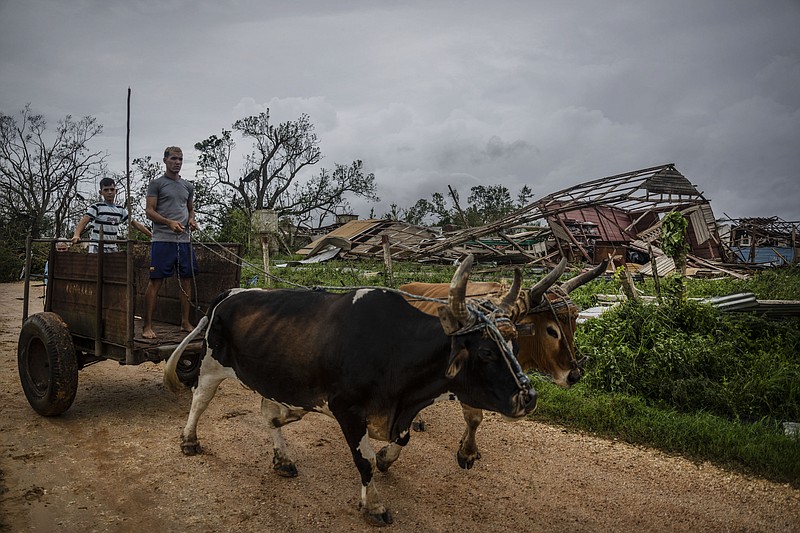
HAVANA -- Hurricane Ian tore into western Cuba as a major hurricane Tuesday, knocking out power to the entire country and leaving 11 million people without electricity, before churning on a collision course with Florida over warm Gulf waters amid expectations it would strengthen into a catastrophic Category 4 storm.
Ian made landfall in Cuba's Pinar del Rio province, where officials set up 55 shelters, evacuated 50,000 people, and took steps to protect crops in the nation's main tobacco-growing region. The U.S. National Hurricane Center said Cuba suffered "significant wind and storm surge impacts" when the hurricane struck with top sustained winds of 125 mph.
Ian was expected to get even stronger over the warm Gulf of Mexico, reaching top winds of 130 mph approaching the southwest coast of Florida, where 2.5 million people were ordered to evacuate.
Tropical storm-force winds were expected to reach hurricane-force today -- when the eye was predicted to make landfall. With tropical storm-force winds extending 140 miles from Ian's center, damage was expected across a wide area of Florida.
It was not yet clear precisely where Ian would crash ashore. Its exact track could determine how severe the storm surge is for Tampa Bay, said University of Miami hurricane researcher Brian McNoldy. Landfall south of the bay could make the impact "much less bad," McNoldy said.
Florida Gov. Ron DeSantis urged people to prepare for extended power failures. He told Floridians in mandatory evacuation zones to heed officials and get out before it's too late to leave.
"It is a big storm, it is going to kick up a lot of water as it comes in," DeSantis told a news conference in Sarasota, a coastal city of 57,000 that could be hit. "You're going to end up with really significant storm surge and you're going to end up with really significant flood events. And this is the kind of storm surge that is life threatening."
He said about 30,000 utility workers have already been positioned around the state but it might take days before they can safely reach some of the downed power lines.
"You don't get a mulligan on this. It's better to take the precaution and not have a significant impact than the reverse," he said.
DeSantis said nearly 100 shelters had been opened by Tuesday afternoon, with more expected. He said most buildings in Florida are strong enough to withstand wind, but the 2.5 million people who have been told to evacuate face the greatest danger from flooding.
As of mid-afternoon Tuesday, Walmart Inc. had closed 89 stores and Sam's Clubs in Florida in anticipation of the storm. The Bentonville-based retailer said its emergency operations center employees are tracking the hurricane and the status of store closures can be followed on an interactive, real-time map on the company's website.
NASA rolled its moon rocket from the launch pad to its Kennedy Space Center hangar, adding weeks of delay to the test flight.
Airports in Tampa, St. Petersburg and Key West closed. Busch Gardens in Tampa closed ahead of the storm, while several Orlando-area theme parks, including Disney World and Sea World, planned to close today and Thursday.
The city of Tampa ran out of sandbags by noon Tuesday after distributing nearly 50,000. Tampa General, a waterfront hospital, had armored itself with an 8-foot storm surge barrier.
Forecasters nudged Tuesday the track south, shifting the worst of the wind and storm surge impacts to the Sarasota area.
However, Jamie Rhome, acting director of the National Hurricane Center, said the drenching rains and still-high storm surge could lead to intense flooding.
"There's been a narrative today that Tampa Bay has dodged a bullet. That is not true," he said. "While the surge threat may have gone down a little as the track shifted ... a band of very heavy rain looks like it's going to set up to the north of where the center cuts through the state."
DeSantis said Tuesday officials are still prepared for that scenario, with food and water packages staged across the state and a helicopter ready to deliver them to the Pinellas County peninsula if the bridges go out.
"Hopefully, it doesn't come to that," he said.
Ian's forward movement was expected to slow over the Gulf, enabling the hurricane to grow wider and stronger. The hurricane warning expanded Tuesday to cover roughly 220 miles of Florida's west coast. The area includes Fort Myers as well as Tampa and St. Petersburg, which could get their first direct hit by a major hurricane since 1921.
Forecasters said the storm surge could reach 12 feet if it peaks at high tide. Rainfall near the area of landfall could top 18 inches. They also reported a threat of isolated tornados being kicked up by the storm's approach across Florida.
GETTING OUT
Hundreds of residents were being evacuated from several nursing homes in the Tampa area, where hospitals were also moving some patients.
Gil Gonzalez boarded up his windows Tuesday and had sandbags ready to protect his Tampa home. He and his wife had stocked up on bottled water and packed flashlights, battery packs for their cellphones and a camp stove before evacuating.
"All the prized possessions, we've put them upstairs in a friend's house and nearby, and we've got the car loaded," Gonzalez said on his way out.
"It's a monster and then there's the confusion of the path," said Renee Correa, who headed inland to Orlando from the Tampa area with her daughter and Chihuahua. "Tampa has been lucky for 100 years, but it's a little scary now."
Kelly Johnson was preparing to hunker down at her home two blocks from the beach in Dunedin, west of Tampa. She said she would escape to the second floor if sea water surges inland, and had a generator if power goes out.
"I'm a Floridian and we know how to deal with hurricanes," Johnson said. "This is part of living in paradise -- knowing that once in a while these storms come at you."
Forecasters warned the hurricane will be felt across a large area as it plows across Florida with an anticipated turn northward.
Flash floods were possible across the whole state, and portions of Florida's east coast faced a potential storm surge threat as Ian's bands approach the Atlantic Ocean. Parts of Georgia and South Carolina also could see flooding rains into the weekend.
Georgia Gov. Brian Kemp preemptively declared a state of emergency Tuesday, ordering 500 National Guard troops on standby to respond as needed.
As the storm's center moved into the Gulf, scenes of destruction emerged from Cuba's world-famous tobacco belt. The owner of the premier Finca Robaina cigar producer posted photos on social media of wood-and-thatch roofs smashed to the ground, greenhouses in rubble and wagons overturned.
"It was apocalyptic, a real disaster," wrote Hirochi Robaina, grandson of the operation's founder.
Local government station TelePinar reported heavy damage at the main hospital in Pinar del Rio city, tweeting photos of collapsed ceilings and toppled trees. No deaths were reported.
At the White House, President Joe Biden said his administration was sending hundreds of Federal Emergency Management Agency employees to Florida and sought to assure mayors in the storm's path that Washington will meet their needs. He urged residents to heed local officials' orders.
"Your safety is more important than anything," he said.
FEMA Administrator Deanne Criswell warned Florida residents Tuesday that Hurricane Ian's expected slow pace of movement will give it more time to wreak havoc across the state, urging people not to become complacent about the danger it poses even if they live in central or southern Florida.
"My message to those who may be watching at home: Get ready," Criswell told reporters, speaking from the White House briefing room. "Don't underestimate the potential that this storm can bring."
"We are going to see impacts across the state of Florida," Criswell said. "Whether it's inland flooding from the large amount of rain that we're going to see, to tornadoes and tornado watches that we may see in the southern parts of the state later today, to the storm surge and hurricane-force winds that may impact the community near landfall."
Florida, she added, "is going to experience the impacts of this storm for a very long time."
Criswell said FEMA is preparing to help restore power to areas that lose electricity, distribute food and water to those who need it, and help save with search-and-rescue teams anyone who becomes trapped.
She warned that residents who think they can ride out the storm are committing "dangerous" thinking, urging them to listen to government officials as the storm approaches.
White House press secretary Karine Jean-Pierre said Biden spoke later Tuesday evening with DeSantis on federal steps to help Florida prepare for the storm and both committed to close coordination.
Information for this article was contributed by Serenah McKay of the Arkansas Democrat-Gazette, by Cristiana Mesquita, Curt Anderson, Cody Jackson, Freida Frisaro, Anthony Izaguirre, Mike Schneider, Seung Min Kim, Seth Borenstein, Bobby Caina Calvan and Julie Walker of The Associated Press and by Alex Harris and Alex Roarty of Miami Herald (TNS).
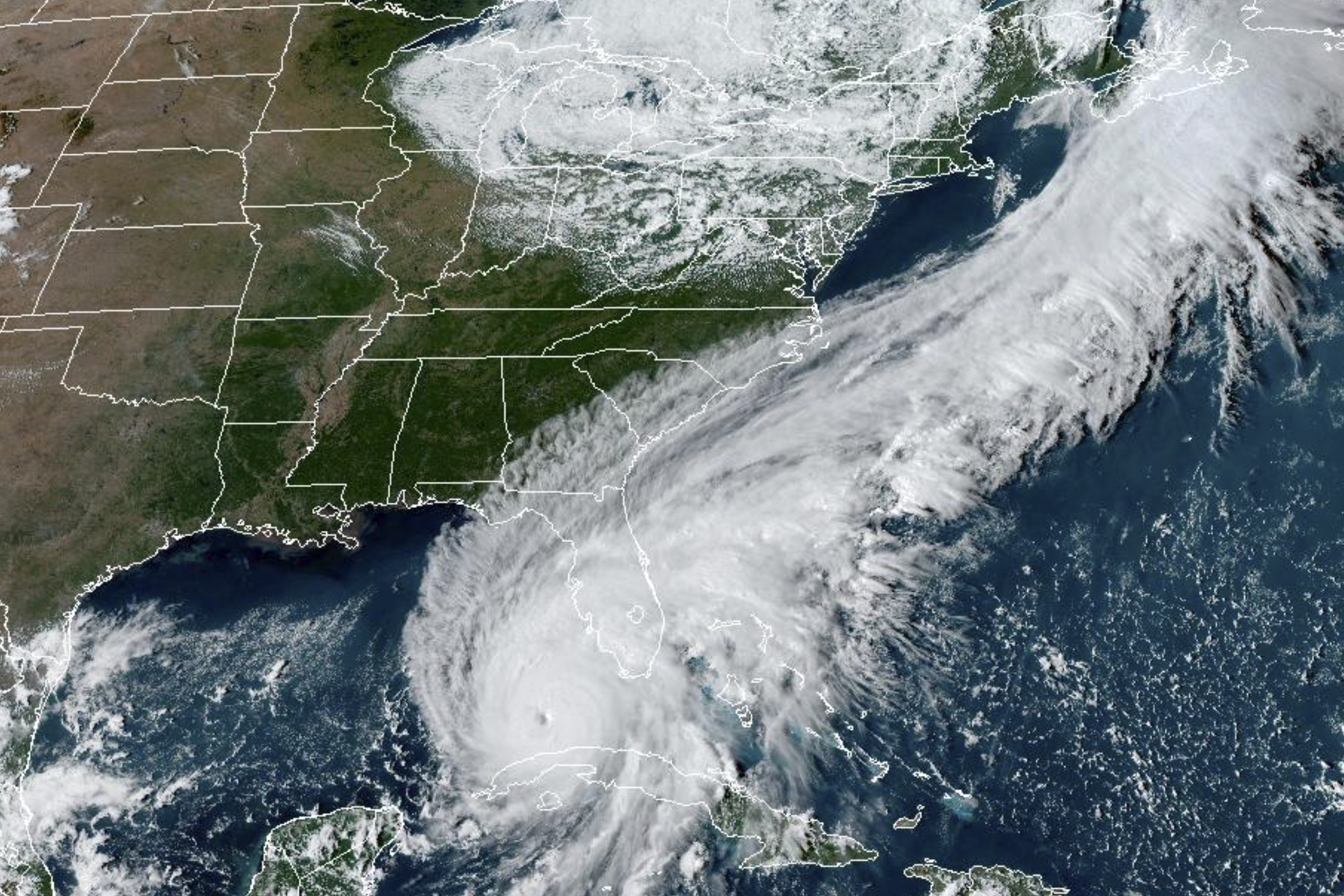 This GOES-East GeoCcolor satellite image taken at 4:26 p.m. EDT on Tuesday, Sept. 27, 2022, and provided by the National Oceanic and Atmospheric Administration (NOAA), shows Hurricane Ian over the Gulf of Mexico. Hurricane Ian tore into western Cuba as a major hurricane Tuesday and left 1 million people without electricity, then churned on a collision course with Florida over warm Gulf waters amid expectations it would strengthen into a catastrophic Category 4 storm. (NOAA via AP )
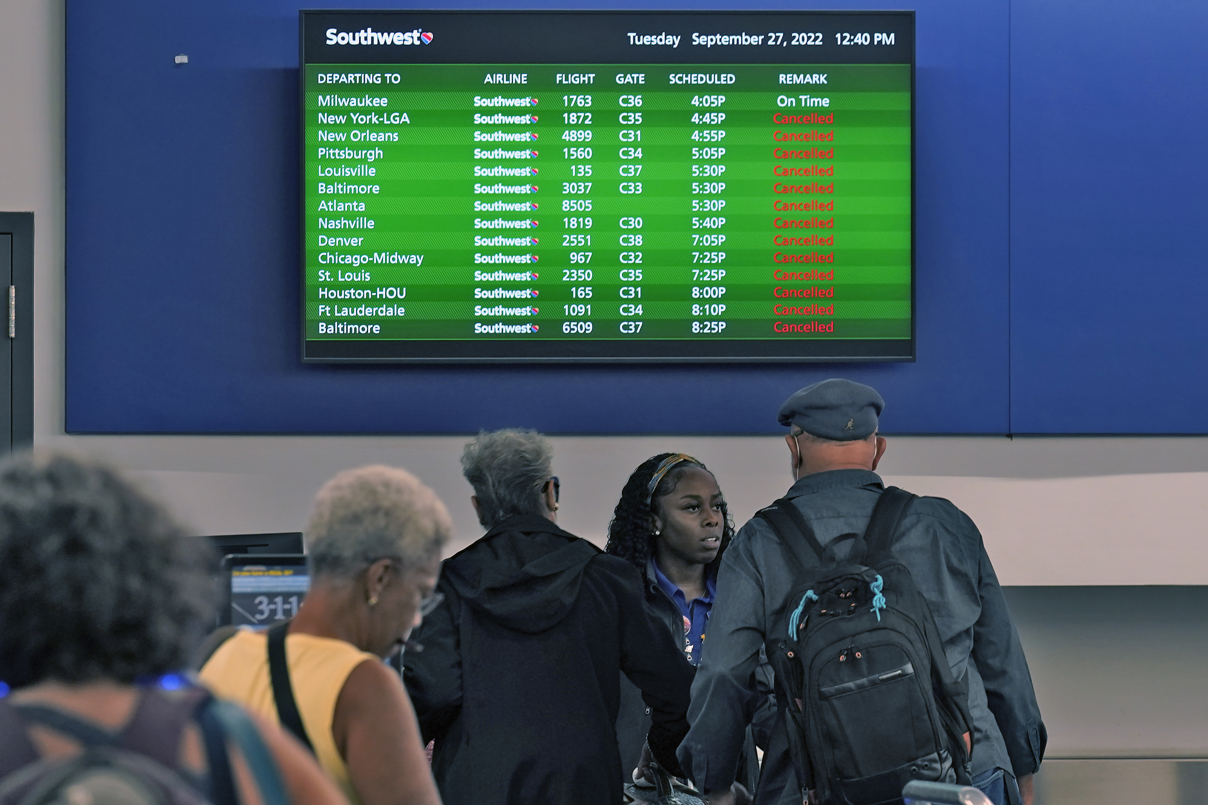 Southwest Airline passengers check into a ticket counter near a sign that shows canceled flights at the Tampa International Airport Tuesday, Sept. 27, 2022, in Tampa, Fla. The airport is closing at 5pm EST today ahead of Hurricane Ian. Ian is predicted to make landfall somewhere along Florida's west coast. (AP Photo/Chris O'Meara)
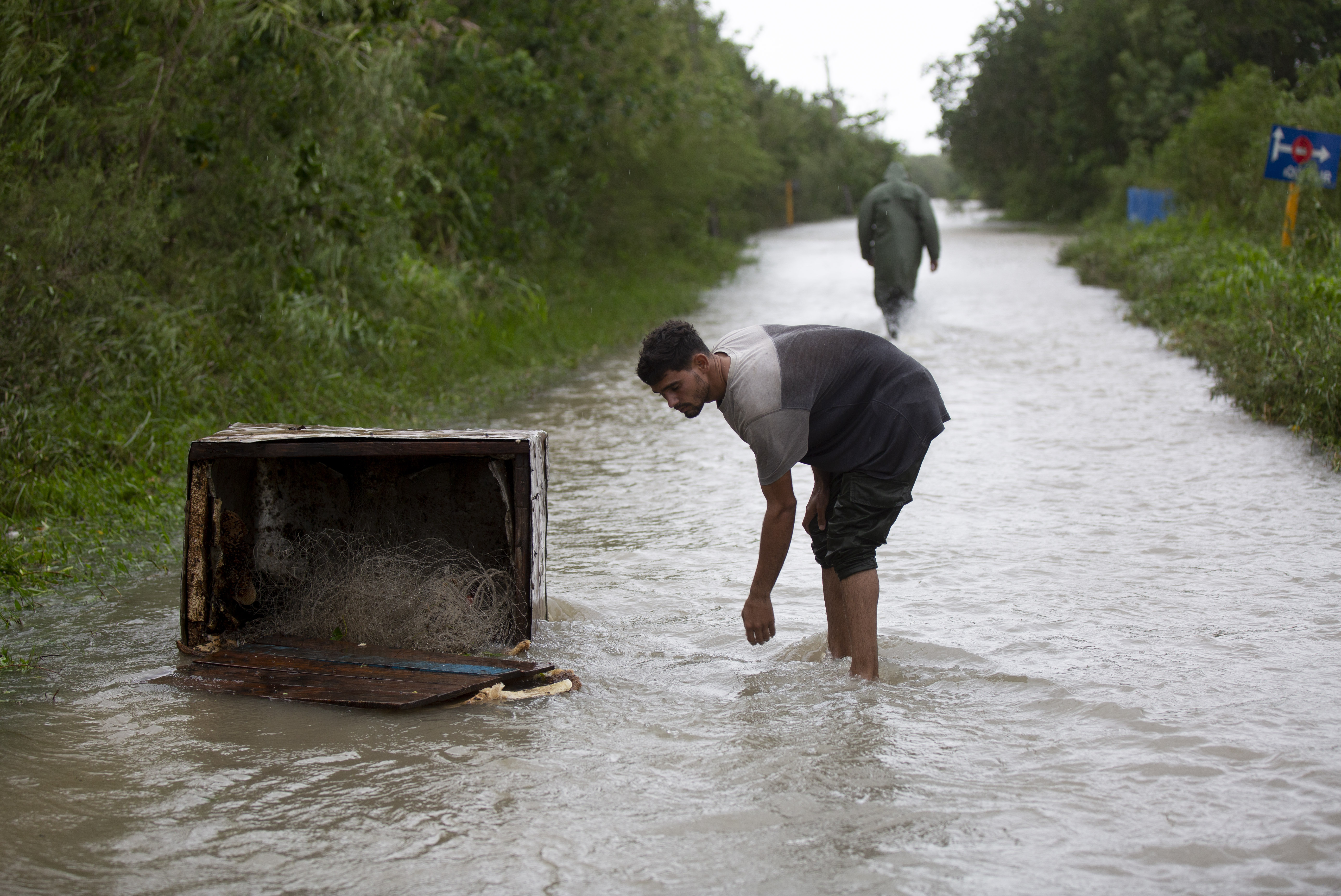 A man leans over next to an oveturned box filled with a fishing line, after Hurricane Ian's storm surge flooded the area in Playa Cajio, Artemisa, Cuba, Tuesday, September 27, 2022. Ian made landfall at 4:30 a.m. EDT Tuesday in Cuba's Pinar del Rio province, where officials set up shelters, evacuated people, rushed in emergency personnel and took steps to protect crops in the nation's main tobacco-growing region. (AP Photo/Ismael Francisco)
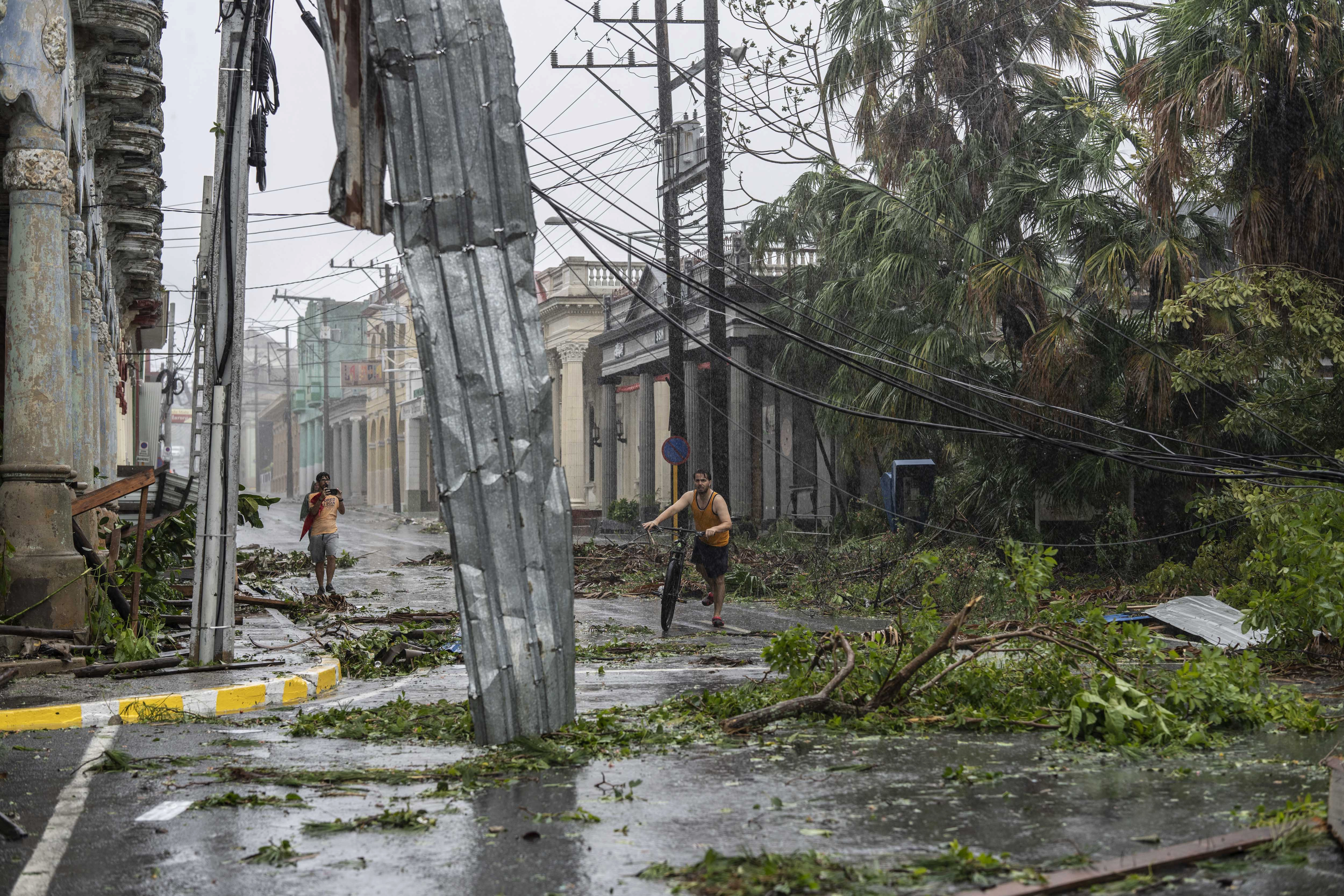 Fallen electricity lines, metal and tree branches litter a street after Hurricane Ian hit Pinar del Rio, Cuba, Tuesday, Sept. 27, 2022. Ian made landfall at 4:30 a.m. EDT Tuesday in Cuba’s Pinar del Rio province, where officials set up shelters, evacuated people, rushed in emergency personnel and took steps to protect crops in the nation’s main tobacco-growing region. (AP Photo/Ramon Espinosa)
 Visitors to the Southernmost Point buoy brave the high waves from Hurricane Ian crash for photos, Tuesday, Sept. 27, 2022, in Key West, Fla. Ian was forecast to strengthen even more over warm Gulf of Mexico waters, reaching top winds of 140 mph (225 kmh) as it approaches the Florida’s southwest coast. (Rob O'Neal/The Key West Citizen via AP)
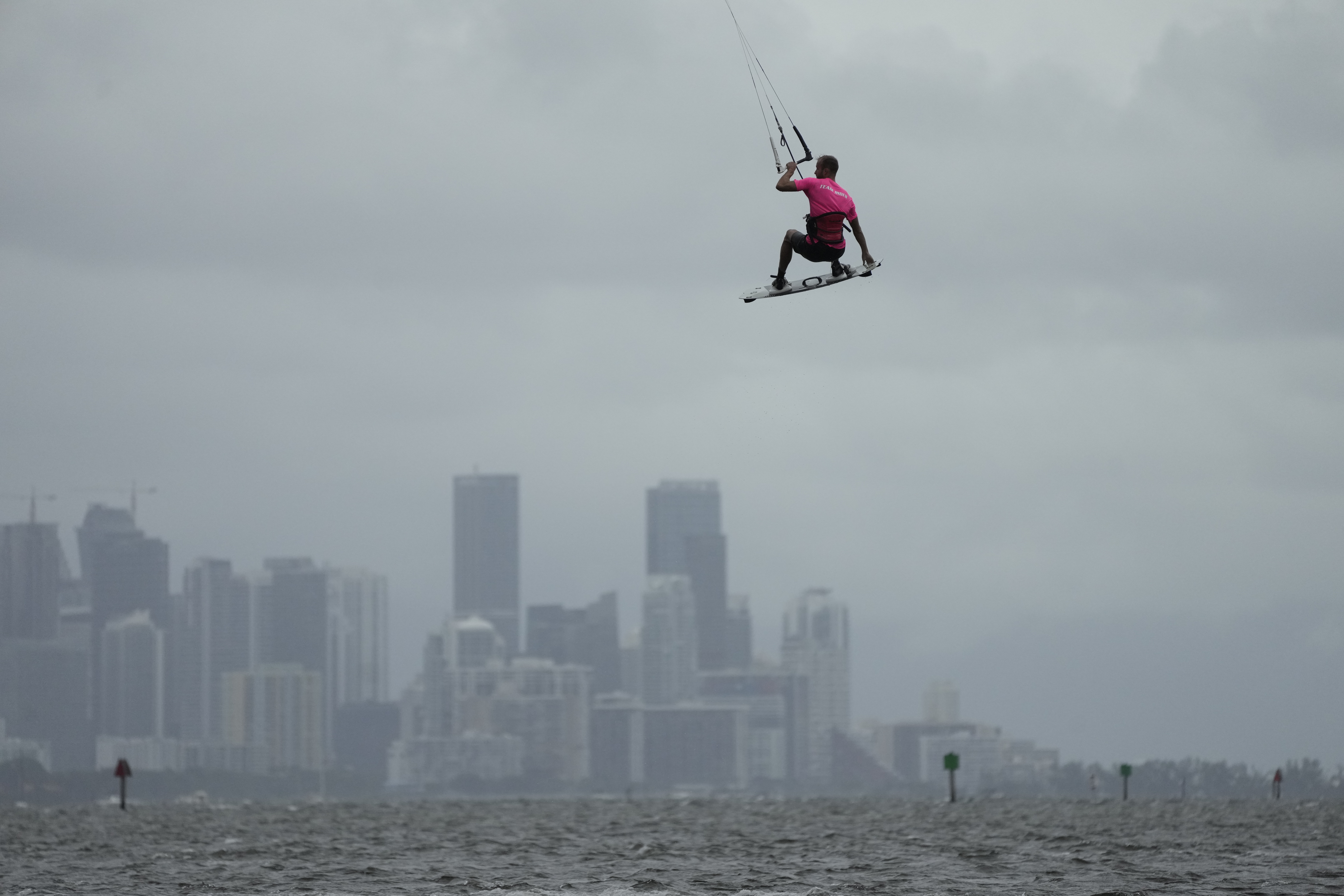 A man flies high with the Miami skyline in the background, as kite surfers take advantage of strong winds caused by distant Hurricane Ian, at Matheson Hammock Park in Coral Gables, Fla., Tuesday, Sept. 27, 2022. (AP Photo/Rebecca Blackwell)
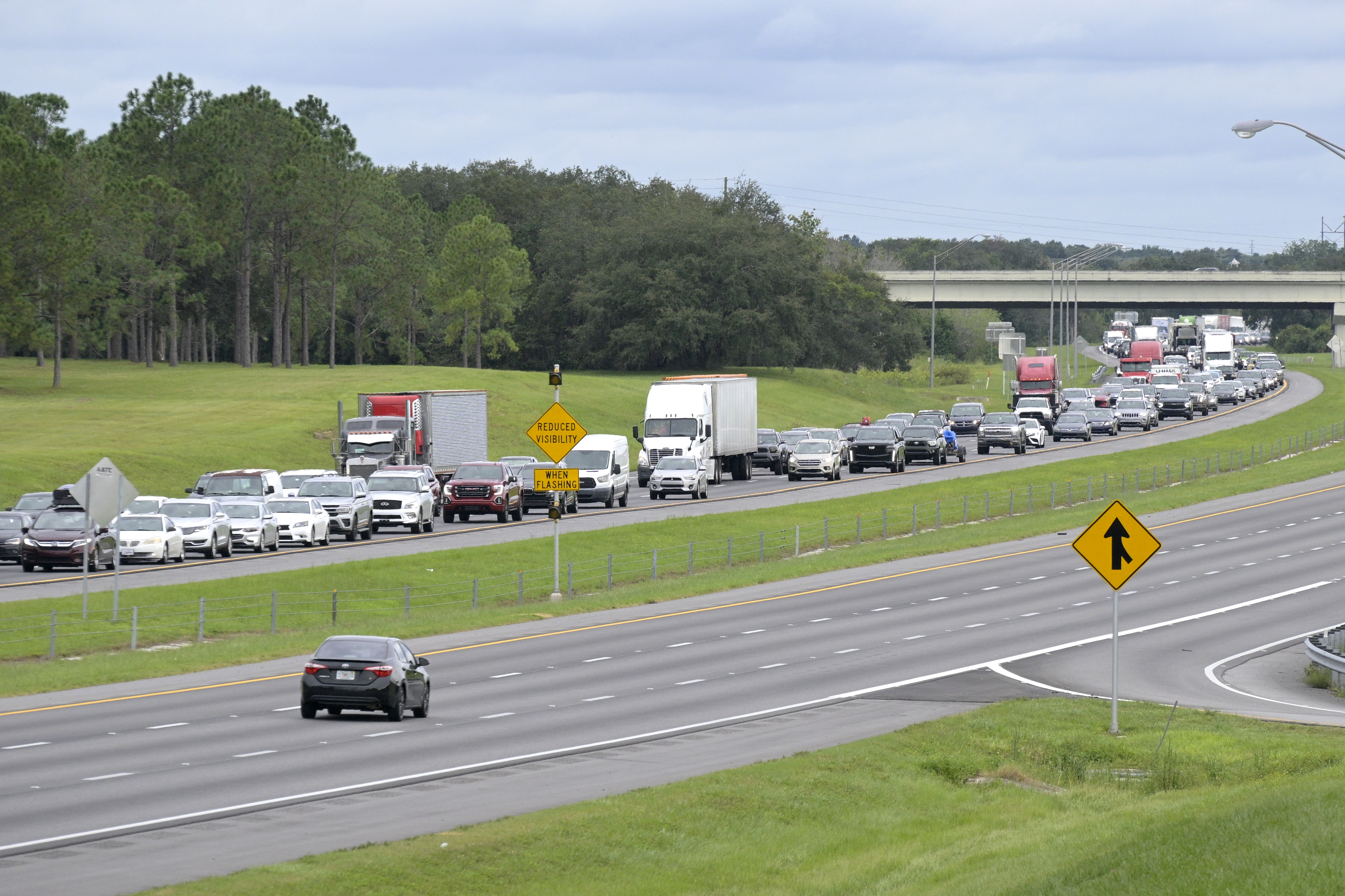 Eastbound traffic crowds Interstate 4 as people evacuate in preparation for Hurricane Ian approaches the western side of the state, Tuesday, Sept. 27, 2022, in Lake Alfred, Fla. (AP Photo/Phelan M. Ebenhack)
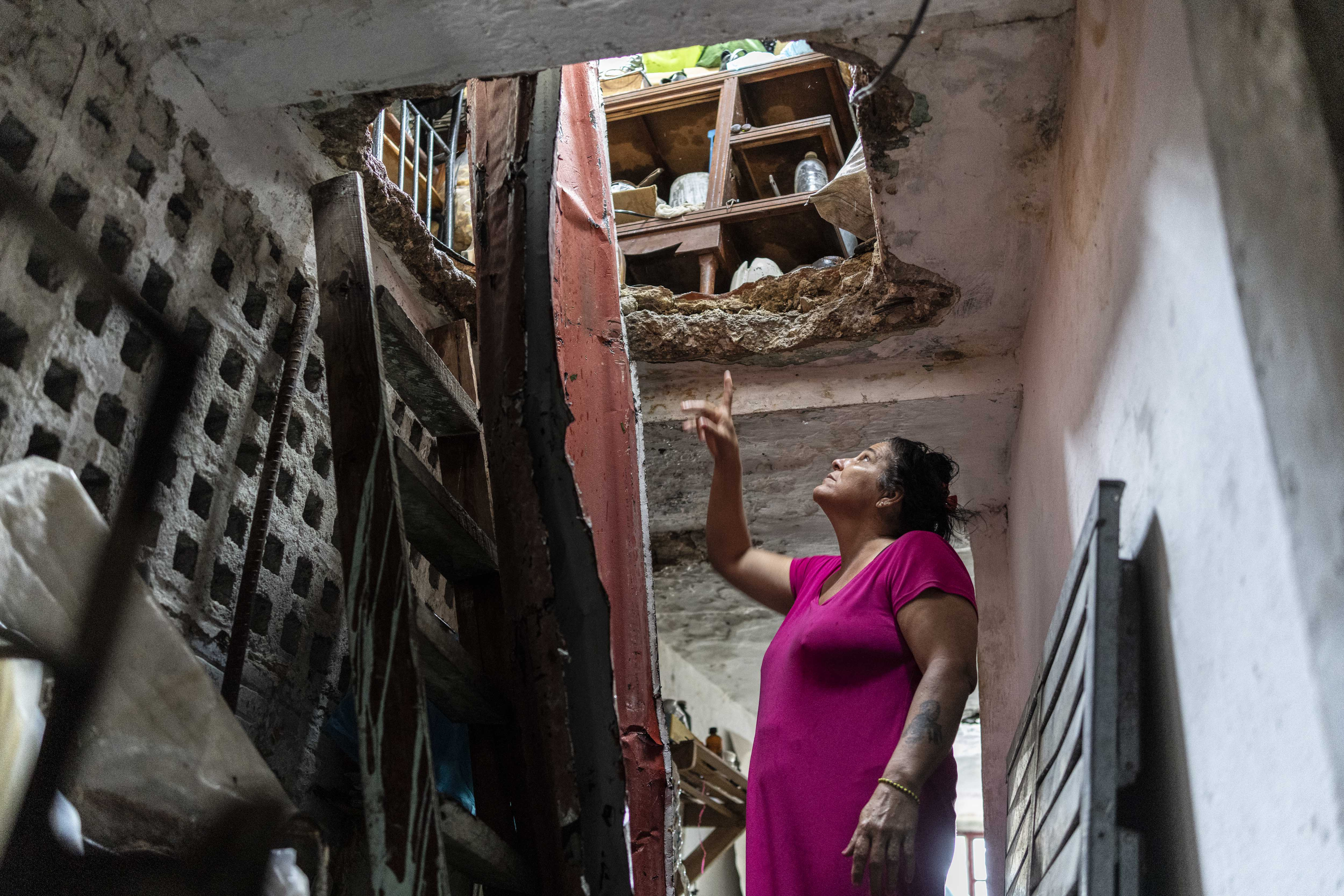 A woman points to damage in her roof, above the second story, caused by Hurricane Ian in Pinar del Rio, Cuba, Tuesday, Sept. 27, 2022. Ian made landfall at 4:30 a.m. EDT Tuesday in Cuba’s Pinar del Rio province, where officials set up shelters, evacuated people, rushed in emergency personnel and took steps to protect crops in the nation’s main tobacco-growing region. (AP Photo/Ramon Espinosa)
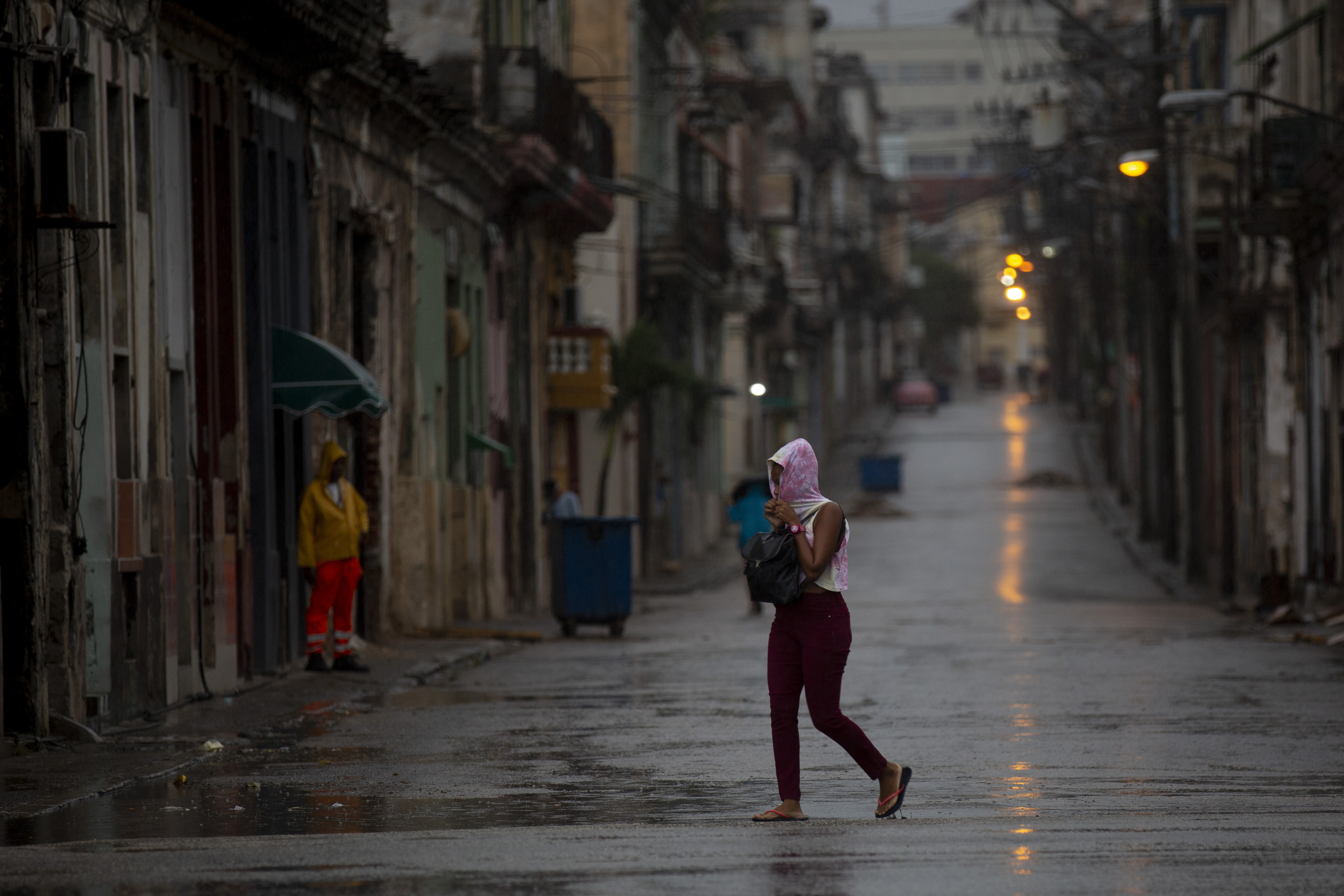 A pedestrian crosses an empty street during the passing of Hurricane Ian in Havana, Cuba, early Thursday, Sept. 27, 2022. (AP Photo/Ismael Francisco)