3:30 P.M. UPDATE: Light snow projected for Little Rock's rush hour, weather service says
The National Weather Service said Friday afternoon that “low-level dry air is causing snow to dissipate” and projected light snow for Little Rock’s afternoon rush hour.
That snow is likely to stick around until Saturday morning, as the National Weather Service predicts that Friday night temperatures in northern and central Arkansas will dip into the single digits.
National Weather Service meteorologist Willie Gilmore said the west-central part of the state saw the most snow, with the area from Russellville over to Conway seeing about 2 to 3 inches. More snow was falling there Friday afternoon, so the numbers could climb a little higher, Gilmore said.
Gilmore said 1/2 to 1 inch of snow was recorded in Little Rock, with about 1/2 of an inch recorded in the northern part of the state.
“We’ve seen bigger storms, but sometimes we don’t need much snow to create travel problems,” he said.
Gilmore said the snow would be gone by next week, when temperatures will reach the 50s and 60s. “It just takes some sunshine” to get rid of the snow, he said.
NOON UPDATE: Second round of snow to bring waves of dustings in central Arkansas
As light flurries swirl over the middle of the state, forecasters predict pockets of heavier snowfall to pick up around noon, and those flakes have staying power, said meteorologist Willie Gilmore with the National Weather Service.
The next round of snow is “not going to be a continuous thing” stretching through the afternoon hours, Gilmore said. Rather, dustings will come and go in waves in central Arkansas starting around noon until 3 p.m., adding to 1 inch or so that has already touched down in Little Rock and the 2 to 3 inches reported in Conway and Russellville, he said.
Little Rock’s count isn’t official, he noted, but a quarter-inch of snowfall had already blanketed the ground by 6 a.m. at the Little Rock International Airport, where the National Weather Service conducts its measurements. So assuming more than 1 inch will fall by the end of the day is a pretty safe bet, he said.
Starting this afternoon, moderate snowfall should fall in most of the state, with heavier bouts of around an inch and a half expected in western and southwest Arkansas, Gilmore said. Flurries should taper off around 3 p.m. in the central region, and not much precipitation is expected anywhere in Arkansas after sundown, he added.
But the current conditions mean the fallen flakes will likely stick around, Gilmore said. Temperatures in the metro area are hovering in the low 20s and are not expected to spike anytime soon, he noted. And in northwest and west Arkansas, folks could see their thermostats drop into the single digits overnight.
“Whatever is actually falling is not really going to go anywhere,” Gilmore said.
The forecast doesn’t warm up much tomorrow, either. Temperatures might push past freezing in central Arkansas, but that’s still a maybe, Gilmore said. The larger warmup will be Sunday and later in the week, he said, but people hoping for change in the weather today will have to wait.
Gilmore, a self-proclaimed fan of flurries, said the weather service isn’t predicting “crazy numbers here,” but it’s “enough to watch the roads.”
“It doesn’t take a lot of snow to cause many problems,” he said.
People should always drive with care, Gilmore said, although today he’s noticed some people might be taking that motto to extremes. He and his colleagues have seen a few drivers go too slow at the incline of a hill only to slide back down the slope well before cresting the top.
“It’s nice to be cautious,” Gilmore said. “But sometimes you need a little momentum.”
When it comes to keeping those roads clear, the state Highway and Transportation Department relied on a single product to do most of the heavy lifting today: salt brine.
Because there was no freezing rain or sleet, crews were able to pour the solution on the blacktop of many state highways starting last night, and they worked into the early hours of the morning until the flakes started to fall, said Arkansas Highway and Transportation Department spokesman Danny Straessle.
In the best conditions, the brine dries and leaves a salt residue on the road in anticipation of winter weather, Straessle said. Then, when the snow starts to fall, the mixture releases heat and warms the flakes and slush from the bottom up. Then trucks dump more salt on top, and the snow is melted away from both directions, he said.
The “beauty” of the entire operation is that after the brine melts the snow, it washes away for good — no extra cleanup needed, Straessle said. And without any ice buildup, “we can just push the snow off the road all day. That’s not a problem,” he said.
But just because the department got a jump on this snowfall does not mean drivers shouldn’t take caution, Straessle added. As the snow melts, water will start running across roadways and will likely refreeze when the sun goes down, he said.
So even though it’s a Friday night and “everybody wants to get out,” people should still drive slow, especially when there’s the possibility of skidding on black ice.
“You won’t know it until you hit it,” Straessle said.
10:30 a.m. UPDATE: Video shows Little Rock/North Little Rock road conditions
Curious about the road conditions in Little Rock and North Little Rock? This video shows several area streets late Friday morning:
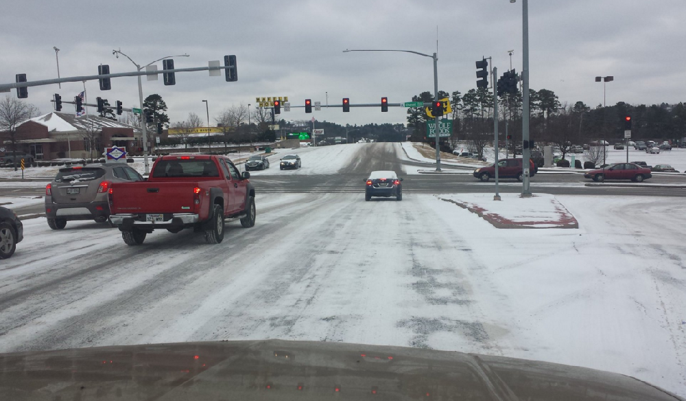
9:30 a.m. UPDATE: Slick conditions reported on highways around state

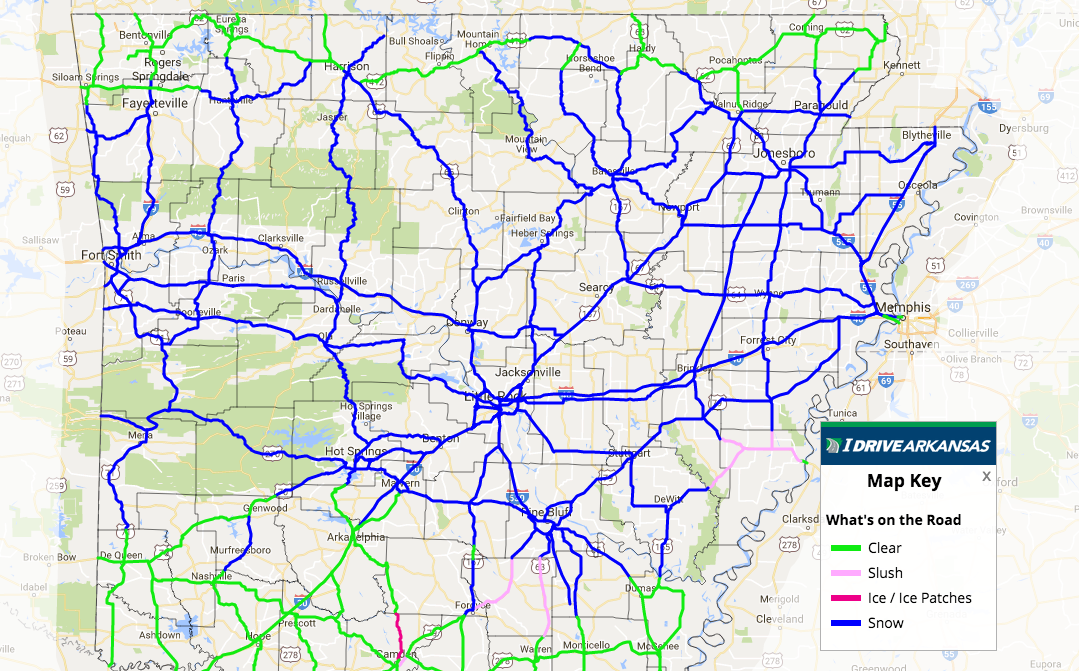
The latest update from the Arkansas Department of Highways and Transportation shows snow-covered roads across much of Arkansas as a wintry system moves through.
A map posted on DriveArkansas.com at 9:30 a.m. showed snow covering at least parts of all of the state's major interstates in central Arkansas, including I-630, I-30 and I-40 in the Little Rock metro area. Slush was reported on I-440.
There were numerous reports of stalled vehicles, slideoffs and wrecks around the state, including an accident on Interstate 30 in Saline County that was reported to involve at least one injury and a car that swerved off a snowy Markham Street in Little Rock before crashing into The Oyster Bar (PHOTOS).
The slick conditions were roughly north of a line from De Queen to Arkadelphia to Fordyce to Dumas all the way through part of the northern-most row of counties in the state.
Forecasters say the slick conditions may stick around for some time because temperatures aren't expected to rise above freezing today and additional snowfall is possible. Crews from the state are working to clear the highways.
8:20 a.m. UPDATE: Snow totals from around state
The National Weather Service has compiled some unofficial reported snow totals from cities around the state:
Photo taken south of Batesville by Dennis Moore
7:45 a.m. UPDATE: Snow photo gallery
Click here to browse photos of the snow from across the state.
6:30 a.m. UPDATE: Snow falls across majority of central Arkansas, expected to continue, forecasters say
Flakes are now falling, sticking and slickening many central and north Arkansas roads, and forecasters say the winter weather won’t stop anytime soon.
A wide swath of the state is now experiencing dustings of snow, covering a region spanning the western to eastern border and from Fayetteville south to Pine Bluff.
Dozens of schools have announced their closure, as well as city and state government offices, after snow began to fall around 4:15 a.m.
The southern third of the state remains mostly clear as of 6:30 a.m., while icy stretches of roads can be found in Hot Springs, Little Rock, Pine Bluff and north of El Dorado, according to a map from the state Highway and Transportation Department.
A hazardous weather warning was issued by the National Weather Service at 5 a.m. for more than half of the state’s counties.
Periods of snowfall will continue across much of Arkansas throughout today, according to the National Weather Service’s most recent update. A break in the flakes will likely happen later this morning as a storm system moves east of the state, the notice said.
Forecasters also predict snowfall will taper off in the northern and western portions of the state later this evening. As for central and southern Arkansas, residents can expect another light to moderate round of snow this afternoon and early evening.
When the snowfall ends for today, experts predict between 1 to 2 inches thick will have fallen across the central portion of the state and lesser amounts in the north and south. The Ouachita and Ozark Mountains have the potential to break that 2-inch barrier, the notice said.
Flurries today could stick around for at least 24 hours, the National Weather Service said. Drivers are urged to use extreme caution if they must get out on the road today.
This weekend will see dry and cold conditions, with single digit and teen temperatures on Saturday and Sunday. A warming trend will likely begin Monday, forecasters said.
Check the full list of school closures here, and check back with Arkansas Online for updates.
5 A.M. UPDATE: Little Rock, North Little Rock, Pulaski County school districts close for day
Several schools across the state, including the Little Rock, North Little Rock and Pulaski County Special school districts, have announced they will be closed Friday because of the wintry weather.
Click here for the full list and check back for updates as they come in.
4:15 A.M. UPDATE: Snow begins in Arkansas
Snow has begun to fall, and accumulate, turning some roads slick across a broad swath of the state.
The Arkansas Department of Highways and Transportation reported snow on many highways, including Interstate 440 and U.S. 67/167 in the Little Rock area. An updated map of conditions is available here.
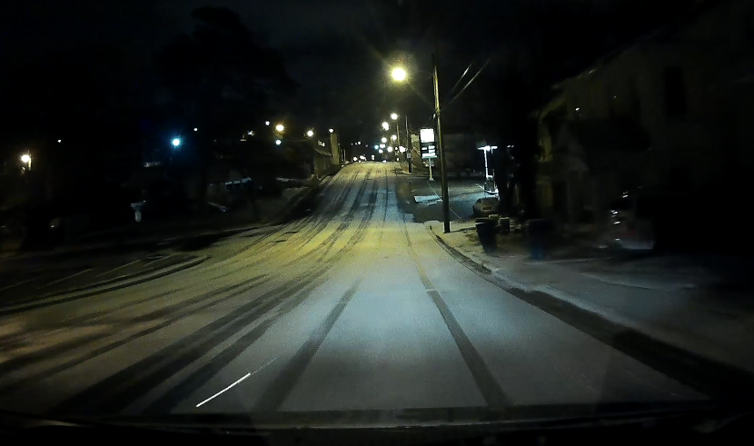
In Little Rock city limits, the first band of wintry weather dropped a thin layer of snow shortly before 3 a.m. Markham Street between Stifft Station (pictured) and downtown was snow-covered in places.
The National Weather Service, which issued a winter weather advisory for much of central and northern Arkansas, said "several more bands" of snow are expected later Friday morning and during the day. The advisory continues through 3 p.m.
"Light snow will start to taper off from west to east during the late morning to early afternoon hours," the agency said in statement. "When the snow does finally end, we are expecting a swath of 1 to 2 inches across central sections of the state with lesser amounts both to the north and south. There could be some locally higher amounts in the Ouachita and Ozark Mountains."
The statement noted that cold conditions will keep the snow "around for at least 24 hours."
"With this being the first accumulating snow of the season, exercise extreme caution if out and about today," the agency said.
— Gavin Lesnick
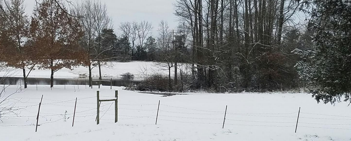
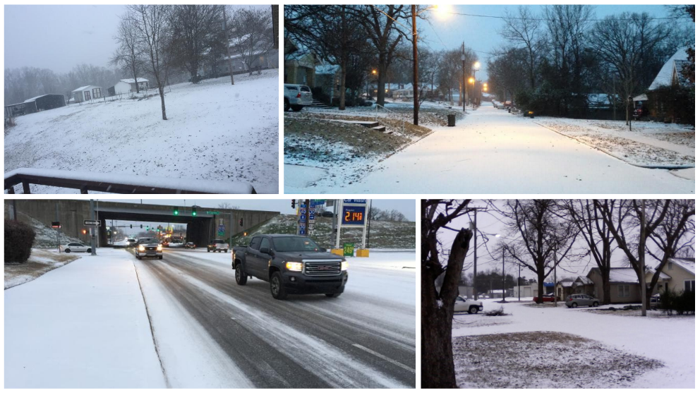
ABOVE: Hattiesville, Ark. Photo by Cait Milloway.