It was hotter Wednesday in Little Rock than any day in 2014. And it's expected to be just as sweltering Thursday.
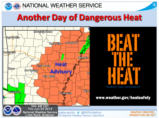
Little Rock and much of central and eastern Arkansas will again go under a heat advisory Thursday afternoon, when temperatures surge into the mid-to-upper 90s and heat indexes — the measure of how hot the air feels when humidity is factored in — crack the triple digits.
Little Rock is forecast to reach 99, matching the high temperature set Wednesday that was the hottest reading in the city since September 2013.
The heat advisory begins at 1 p.m. and continues to 6 p.m. for an area roughly east of a line from Batesville to Conway to Hampton. The heat index will range in that area from 105 to 109.
"With heat indices this high, heat-related illnesses are likely with prolonged exposure to these conditions," the National Weather Service said in a statement, advising people to drink fluids, stay out of the sun and in air conditioning, and check on relatives and neighbors.
Cooler air is expected to arrive Friday into the Saturday, but a front will also bring chances for strong to severe storms. The weather service said damaging winds and large hail will be the primary threats.
The front is expected to move out the state by midday Saturday, the agency said in a statement.
"This sets the stage for cooler and dry air in the forecast for the long term," it added.
Highs in the 80s or low 90s, then, are forecast for the state into the middle of next week.