ST. PETERSBURG, Fla. -- Florida, Alabama and Mississippi got emergency preparations underway Saturday ahead of the arrival of Subtropical Storm Alberto, a slow-moving system expected to cause wet misery across the eastern U.S. Gulf Coast over the holiday weekend.
Cuba was being pounded by rain along its western coast, raising the threat of flash floods and mudslides. The National Hurricane Center in Miami said the island's rain totals could reach 10 to 15 inches -- and even 25 inches in isolated areas.
Heavy downpours were expected to begin lashing parts of Florida, Louisiana, Mississippi and Alabama today. The Florida Keys could see as much as 10 inches of rain, the hurricane center said. A tropical-storm warning has been issued for the Dry Tortugas.
The governors of Florida, Alabama and Mississippi all declared states of emergency Saturday, ahead of the storm.
Some 5 to 10 inches of rain are possible along affected areas in eastern Louisiana, Mississippi, Alabama, western Tennessee and the western Florida Panhandle. Isolated areas could see as much as 15 inches.
Alberto -- the first named storm of the 2018 hurricane season that officially starts Friday -- is expected to strengthen until it reaches the northern Gulf Coast, likely on Monday night.
At a briefing in Tallahassee, Florida authorities urged residents to take the storm seriously and to organize water, food, medicines and other preparations. Gov. Rick Scott declared a state of emergency, which gives him wide latitude to prepare. In Mississippi, Gov. Phil Bryant said on Twitter that he has signed an emergency proclamation to make the National Guard and other resources available.
Watches were issued for storm surges -- life-threatening inundations from rising coastal waters moving inland -- for a stretch of coastline between Crystal River, Fla., and the mouth of the Mississippi River. Authorities were warning of dangerous surf and rip current conditions later Saturday.
"The combination of storm surge and the tide will cause normally dry areas near the coast to be flooded by rising waters moving inland from the shoreline," the hurricane center said. Isolated tornadoes over the Florida Keys or southwestern Florida were a threat late Saturday.
Forecasters at the National Weather Service in Mobile, Ala., warned residents along coastal Alabama and Mississippi as well as the Florida Panhandle to brace for heavy rain and high winds. Isolated tornadoes were also possible. The weather service said a flash-flood watch would be in effect from Saturday evening through Tuesday evening for southeastern Mississippi, much of southern Alabama, and the western Florida Panhandle.
"This system will bring excessive rainfall to the watch area beginning Saturday evening and continuing through Tuesday evening. Rainfall amounts of 5 to 8 inches, and possibly locally up to double these amounts are possible in this area with this event," the National Weather Service said.
The weather service said waves as high as 18 feet could pound the popular Gulf beaches in Baldwin County, Ala., and northwestern Florida on Monday. A high surf warning was in effect through 7 p.m. Tuesday local time.
At 5 p.m. Saturday, the hurricane center said Alberto was about 95 miles north of the western tip of Cuba and moving north at 13 mph. The storm had top sustained winds of 40 mph and was expected to strengthen as it moves over the eastern Gulf of Mexico.
A subtropical storm like Alberto has a less defined and cooler center than a tropical storm, and its strongest winds are found farther from its center. Subtropical storms can develop into tropical storms, which in turn can strengthen into hurricanes.
A tropical storm warning remained in effect for Cuba's western Pinar del Rio province, where heavy rains could trigger flash floods and mudslides, the National Hurricane Center said.
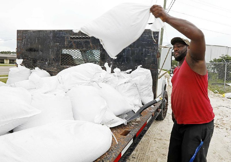
Parts of Florida, Georgia, Alabama, Mississippi and Louisiana had heavy rain last week, and further deluges could leave those areas vulnerable to flash flooding and river flooding. Some beachfront and riverfront communities were already handing out sandbags.
The downpours could dampen Memorial Day, the unofficial start of the summer tourist season along Gulf beaches. Along with heavy rains and high winds come rough seas and a threat of rip currents from Florida to Louisiana that can sweep swimmers out to sea.
A Section on 05/27/2018